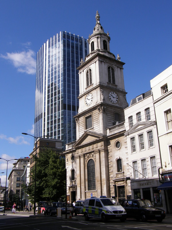
It seems to me that it never rains in east London; every time I've stepped east of Liverpool Street, the sun has come out and stayed out to the point of sunburned noses and tantalising visions of ice cold pints of beer at the end of the day. This might be one reason why I've enjoyed every single day walking through this lesser known part of London, but I think the real reason I've been enjoying east London so much is because I didn't expect to. I'm ashamed to say that I believed the hype and thought that Tower Hamlets, Newham and Waltham Forest would be grim; meanwhile people (mainly from west London) kept advising me to hide my camera when in the east, and not to look as if I was carrying anything too valuable.
But this is my fourth day wandering around these boroughs, and the negative hype is just plain wrong. East London is great, and as far as tubewalking goes, it beats south London hands down (or it does in my book). Gor bless the East End!
Liverpool Street to Bethnal Green
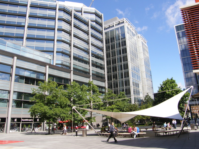
It doesn't take long to get away from Liverpool Street and the bright lights of the City; indeed, it still surprises me just how close the ultra-modern glass skyscrapers of London are to the down-to-earth backstreets of the East End, but from Bishopsgate, the edge of the City is only a short walk down Brushfield Street. On the way you pass Old Spitalfields Market, just after a pleasant plaza called Bishops Square where city shirts exchange loud laughter over coffee; this plaza used to be the western two-thirds of the original market, which was founded in 1682 by Charles II, but it's now home to an impressive Norman Foster-designed office block. The eastern third of the market, which is housed in buildings dating from 1887, is protected with listed status and survived the developers' plans, and it is now a burgeoning market that's particularly popular at the weekend.
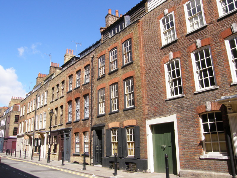
On the other side of Commercial Street looms the bulk of Christ Church, and the instant you pass the church, the offices disappear and turn into East End terraces. I love these terraces; it's just so easy to imagine what it was like 130 years ago, back in Victorian London, when these very same houses stood overlooking a completely different street scene. Back in 1888, Jack the Ripper was doing stuff in this very area: his fifth and final victim, Mary Jane Kelly, was found mutilated in her room at 13 Miller's Court just to the south of Brushfield Street (Miller's Court itself no longer exists as it's now been redeveloped as a multi-storey car park); and his second victim, Annie Chapman, was murdered just off Brick Lane, at 29 Hanbury Street, though this address is now part of the extension to the old Truman Brewery. With a little imagination, it's easy to slip back into those times, even though the skyscrapers of 21st century London are just over your shoulder.
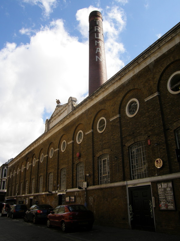
Brick Lane is a short stroll from Christ Church, and even though there is some Victorian architecture still in evidence, it's a little harder to imagine the days of yore round here because Brick Lane is now the curry capital of London. Sometimes referred to as Banglatown, this is the heart of London's Sylheti community (Sylhet is an area in the northeast of Bangladesh, and Sylheti is a very common language among the UK's Bangladeshi community). The street is famous for its many curry houses, though they're not open in the early morning, so everything was rather quiet as I walked through. The street is also famous for its graffiti, though it seems that for every Banksy you get entire streets of people's practice doodles, which aren't worth putting on display; it could do with a clean canvas, if you ask me. Still, it doesn't stop it being an atmospheric street, particularly around the old Truman Brewery building, which has been redeveloped as a shopping and cultural area, with over 250 shops, restaurants, art galleries and offices; Dray Walk, just off Brick Lane, is particularly popular with cappuccino critics.
Just before the end of Brick Lane, check out the remains of the Braithwaite Viaduct on the left. This viaduct, which was recently awarded Grade II listed status, is the second oldest railway structure in London and was built between 1839 and 1842. It was designed by John Braithwaite, chief engineer of the Eastern Counties Railway, and Prince Charles described it as 'an astonishing hidden treasure', which might have helped save it from the developers' axe. From the road the viaduct is fairly well hidden, as all the historical parts are inside the Bishopsgate Goods Yard, but this might change as the area is redeveloped (without knocking down the viaduct, of course).
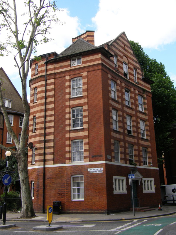
From Brick Lane, it's worth taking a detour up Club Row to Arnold Circus. This is part of the Boundary Estate and the architecture is intriguing. Dating from the end of the 19th century, the buildings round this tranquil circus have a distinctive stripey brick effect that lends the square a sense of decorum that the terraces don't have. The Boundary Estate was the world's first council estate and was one of the earliest social housing schemes, starting in 1890 with the clearance of the Friars Mount slum (also known as the Old Nichol Street Rookery) where the death rate was four times that of London, with one child in four dying before their first birthday. The mound in the middle of Arnold Circus was made out of rubble from the clearance, and the flats are Grade II listed, a status that is richly deserved.
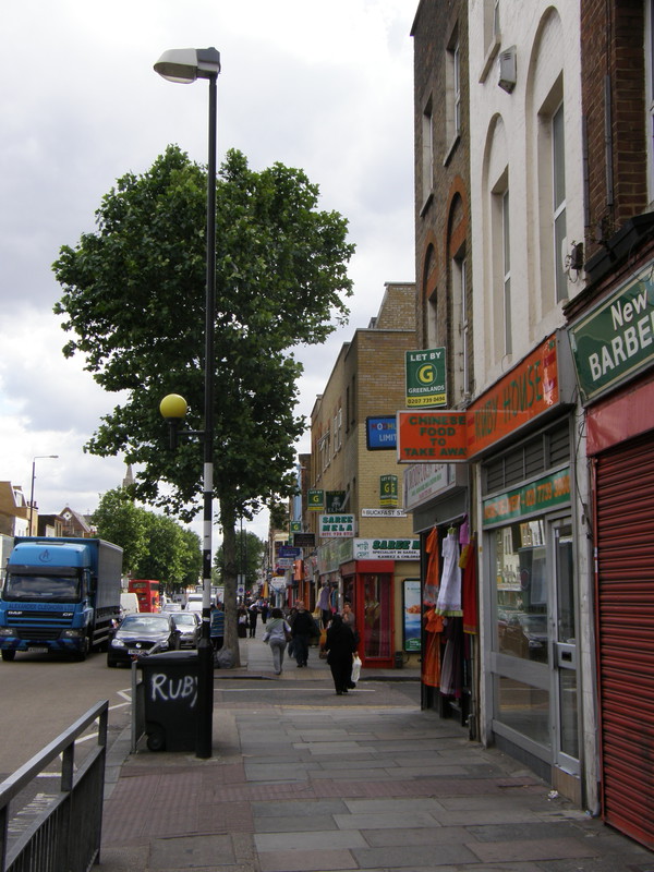
After this peaceful detour, Bethnal Green Road is a lot busier, though it's a wide road with generous pavements, so it's not in the same league as the busy streets back in the centre of town. Shops line the sides, sitting under terraces that vary all the way along the road: some terraces are spotless, complete with new grouting, new windows and a future; some, on the other hand, have peeling paint, rotting window frames and a distinct lack of appeal. There are also plenty of gaps in the period terraces where the bombs of World War II hit; sometimes these are plugged with modern blocks that work, and sometimes they're plugged with architectural stop-gaps that will be the first against the wall when the revolution comes. It makes for an entertaining walk.
However, main roads rarely sum up an area – even main roads in posh areas are grotty compared to the backstreets where most people spend their lives – so I thought I'd take a short detour through the backstreets of Bethnal Green, and I'm glad I did. Turning off the main road into Squares Street, I stumbled on a square dominated at the northern end by Queen Adelaide's Dispensary, an imposing brick and stone building dating from 1866. This building replaced a smaller clinic in Warner Place, which itself was opened as a response to the 1849 cholera outbreak, which proved lethal as nobody yet knew how cholera was spread.
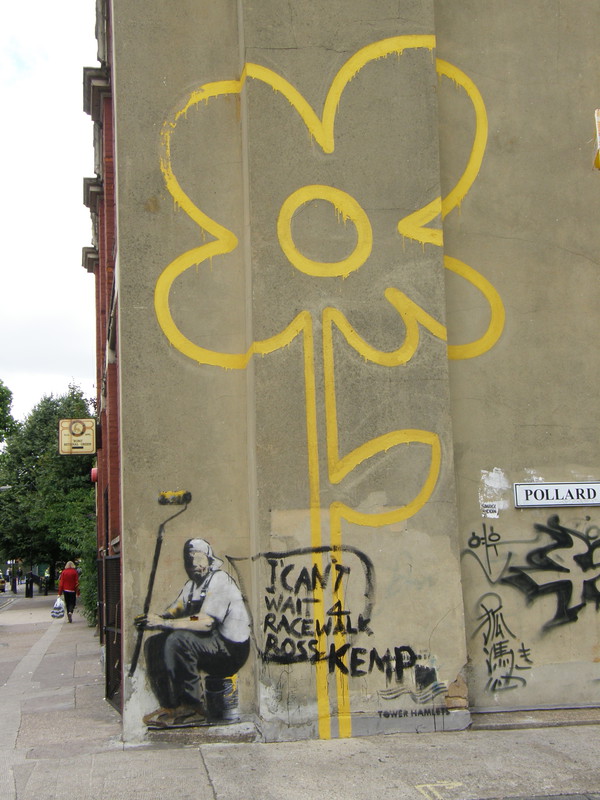
Just opposite the dispensary is the Bethnal Green Working Men's Club, which sports a piece of Banksy street art on its wall, depicting a man sitting down in front of a huge yellow cartoon flower, holding a paint roller with yellow paint dripping off it. As is often the case with street art, someone has made their own, less impressive contribution to the original, and the man now has a crudely painted speech bubble coming out of his mouth saying, 'I can't wait 4 racewalk Ross Kemp.'
No, I can't work it out, either, but that's what happens to street art, and its new composition neatly sums up this part of London: you have classic Victorian buildings rubbing shoulders with great modern architecture, but splattered all over the place are offensive carbuncles from the architectural equivalent of the Dark Ages, and it's a shame. Further into the backstreets I came across an estate where the all-white prefab buildings looked uncannily like the inside of a Victorian prison, with rows of doors leading out to long balconies, facing a similar row of cells on the building opposite. All that was missing was the suicide net...
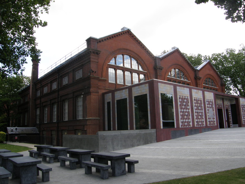
Back on Cambridge Heath Road, it's a short walk to the station past the Museum of Childhood. I can highly recommend the Museum of Childhood as a fun way to while away a few happy hours of nostalgia; devoted to all things childhood, there are games, dolls, teddy bears and all sorts of things that bring back memories of being small. You don't have to be old to enjoy the nostalgia; there are objects in there from my childhood, and I'm not even halfway through my life yet. It's a great way to celebrate your inner child, particularly if, like me, your inner child and your outer child are still the same person.
On the other side of Old Ford Road from the museum is York Hall, one of Britain's best-known boxing venues, and the spiritual home of East End boxing. Following years of decline and rumours of demolition, the hall was redeveloped with a three-year, £4.5 million programme, and it's now open again with a new gym, a 33m swimming pool and an extensive spa. It's an imposing building and very distinctive; even judging it purely from the outside, it looks worth saving.
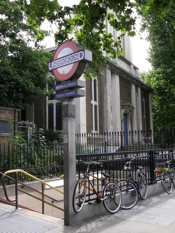
Bethnal Green station is underneath the junction of Bethnal Green Road and Cambridge Heath Road, the only signs of the station being the four stairwells down into the subterranean ticket hall. These stairwells might not look significant, but back in the Blitz there was a disaster that would forever change the way we built staircases on the Underground. It was , and although the Central line tunnels had been dug, they weren't yet open (and wouldn't open until 1946); instead, they were used as air-raid shelters, and at 8.17pm on that March evening, the air-raid sirens sounded and a crowd started making their way down the steps to the shelter. At 8.27pm a new type of anti-aircraft weapon started firing in nearby Victoria Park, and the unfamiliar sound started a panic; as the crowd surged towards the Tube station, a woman carrying a baby tripped on the stairs, and the crowds continued to pile in, crushing those in front and cramming 300 people into the small stairwell. 173 died at the scene, with one more dying later in hospital; 62 of those killed were children, but miraculously the woman and her baby survived.
The details of the accident weren't published for two years to avoid denting morale, but the effect on station design was immediate. Stairwells gained better lighting and handrails as a consequence, and this incident is the reason you won't find any long staircases on the Underground without breaks, in case crowd surge strikes again.
Bethnal Green to Mile End
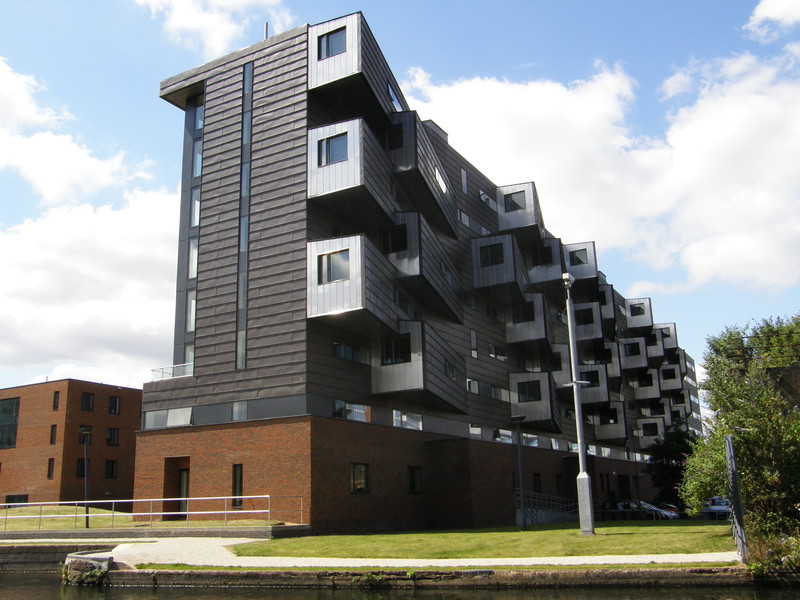
The same story continues along Roman Road: delightful Victorian architecture rubs shoulders with drab and faded 20th century social housing, until quality modern architecture takes over as the location changes from urban to desirable. One of the most notable buildings along this stretch of road is the London Buddhist Centre, housed in a large red brick mansion house on the corner with Globe Road. Behind it are some pretty terraces and for a while the road is a string of interesting shops with attractively plain two-storey terraces perched above, but the massive Greenlands Estate to the south of the road is not a pretty place (though, to be fair, not all of the blocks have been equally beaten with the ugly stick, and as estates go, I've seen worse).
As the canal approaches, a clutch of particularly drab tower blocks come into view on the northern side of the road, and then, wham! You seem to pass through some kind of looking glass, because all of a sudden the developments are extremely desirable and the location is a delight. The reason? It's the Regent's Canal, which flows from north to south under the main road, providing a waterside building site that the developers have leapt on in the race to make east London a desirable residence for people with money. Judging by the lush apartment blocks springing up along the western banks of the canal, the developers are winning, and it isn't hard to see why; the apartments overlooking the canal have west-facing balconies, so they must catch the sunset as well as having good views of Canary Wharf to the south. I'd like it, anyway.
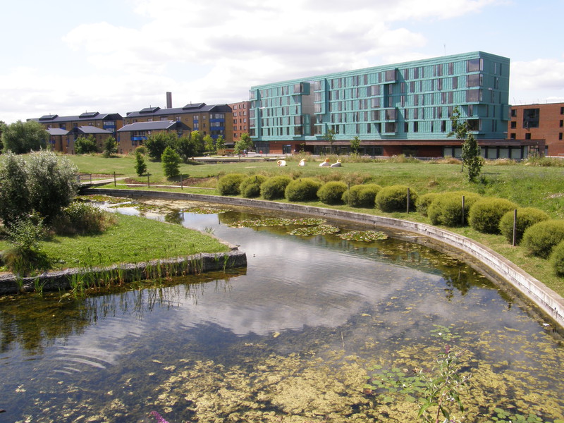
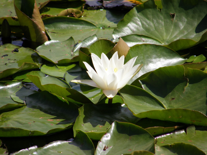
No doubt apartment blocks would be springing up on both sides of the canal if it wasn't for the stretch of parkland along the eastern fringes of the canal. To the north of the main road, the western edge of Victoria Park runs along the canal, but to the south of the road the canal flows alongside Mile End Park, and a great park it is too. Taking up a thin strip of greenery between the canal and the A1205, Mile End Park stretches from Roman Road all the way to St Paul's Way in Limehouse, and the northern half is a delight (I didn't visit the southern half). There's a lily-covered pond just off the main road, and after that is a huge man-made lake with a walkway over the back of it, giving great views of the canal and the ultra-modern apartments on the other side. Like most of London's ponds in this hot summer, the lake in Mile End Park is currently fighting a losing battle with green algae, but that doesn't make it any less enjoyable to walk round. Just after the lake is a mound that is worth walking up for the views to Canary Wharf, and the end of this part of the park is marked by a pretty little lock. This is not a bad place to stop for a breather, especially as there are some large millstones to sit on right by the mechanism, so if anything does come past (an unlikely event, as this is a very quiet canal), you can sit back and enjoy it. And if all is quiet, you can still sit back and have a good chuckle, as someone has kindly stencilled the following message on the first set of blocks:
BEWARE
GEORGE GALLOWAY IS THE NEXT HITLER
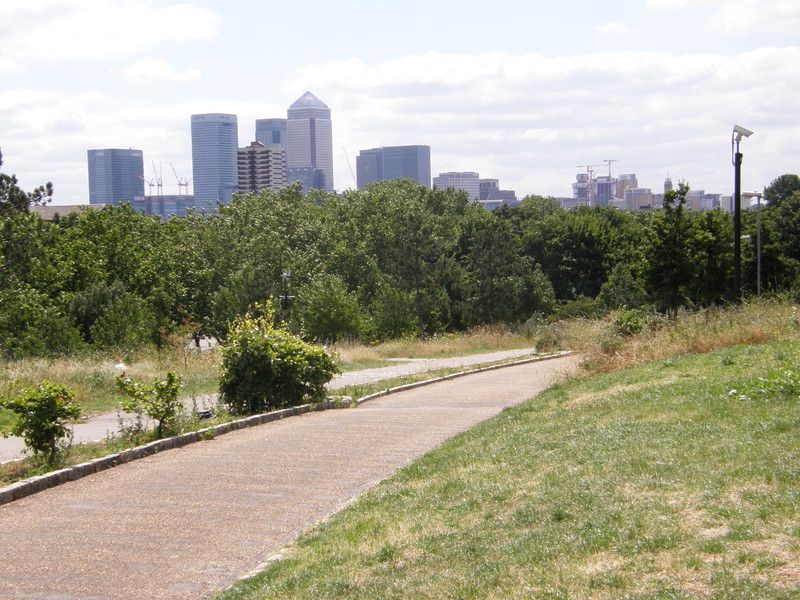
Although the park is cut in two by the busy Mile End Road, that doesn't mean the park has to end, because the designers have built the ingenious Green Bridge across to the other side, making Mile End Park one long, continuous strip of green all the way from tip to tail. The Green Bridge is planted with grass all the way over (apart from the wide walking lanes), which is how it got its name; it was originally lined with birch trees, but they appear to have died and the grass is all that remains. The structure of the Green Bridge itself is, surprisingly, bright yellow (which is why the locals know it as the Banana Bridge) and in this hot, dry summer the grass is more yellow than green, but even if its name doesn't make a lot of sense at the moment, it sure beats having to cross the chaos of Mile End Road.
Mile End station is over the bridge and a few steps along Mile End Road. I came this way back on my District line walk from Victoria to Bow Road, and I remember wishing for good weather for when I came back to cross the Green Bridge. That wish most definitely came true...
Mile End to Stratford
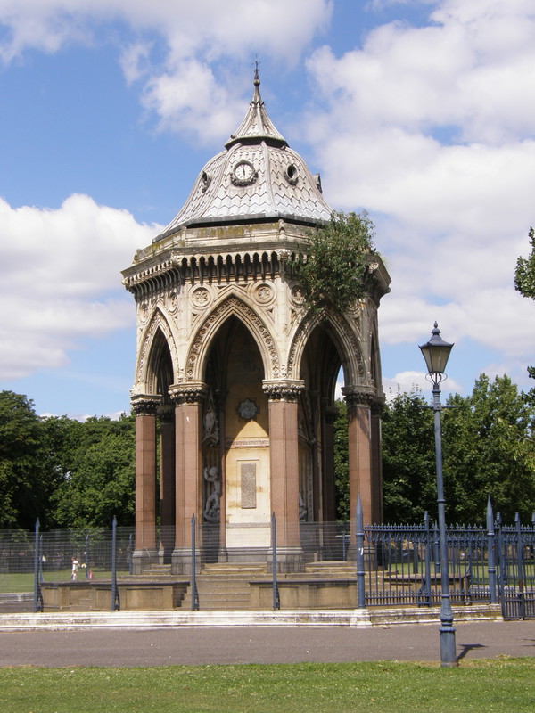
It's a bit of a boring road hike from the station up Grove Road, though there are some good buildings along the way, interspersed as always with modern high-rise estates that only help to accentuate the good architecture. The modern developments and less attractive high rises on the other side of the canal are clearly visible as Mile End Park doesn't obscure the view, and there's even a canal view of our own towards the top of the road. This is the Hertford Union Canal, which merges into the Regent's Canal just to the west of here, linking it up with the Lee Navigation on the other end of Victoria Park, near Hackney Wick.
However, the big story for this section is Victoria Park. This huge park was created following an 1839 report by the Registrar General, which noted the extremely high mortality rate in the East End and recommended the creation of a public park to make people's lives a little healthier and therefore a little longer. A year later, 30,000 locals signed a petition and presented it to Queen Victoria, asking for a Royal Park to be opened in Tower Hamlets, and in 1842 work started on Victoria Park. Building work was finished in 1850, and the oldest public park in Britain is still going strong.
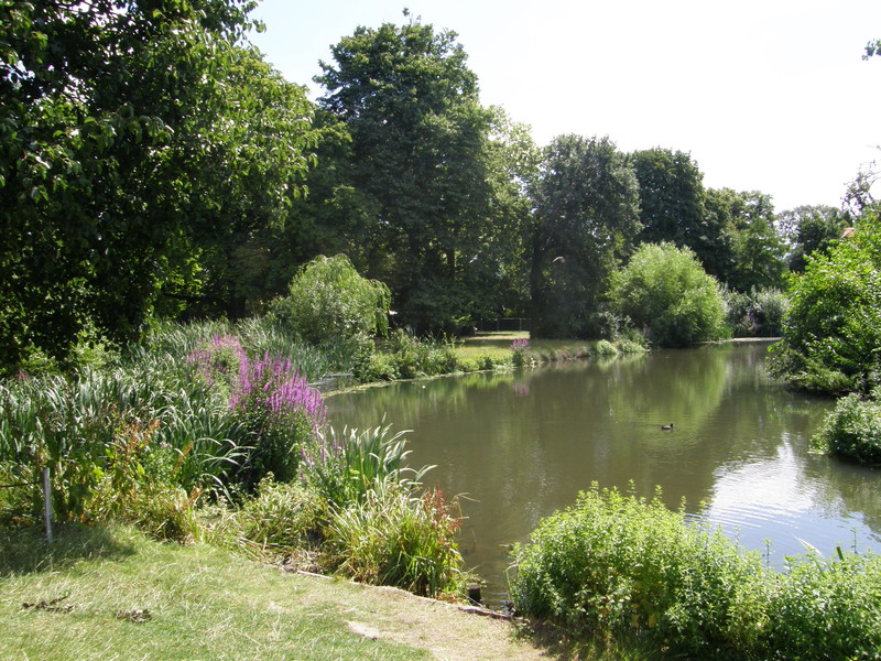
It's a pleasant stroll through the eastern half of the park, and from a visit earlier this summer, I can also vouch for the western half (indeed, the western half is arguably prettier, with its fountain, large lake and slightly less open aspect). The central part of the park is mainly open space, but to the eastern end there's a lovely little fishing pond, a pretty formal garden, a huge playground and a collection of tennis courts, before it opens up into more open space. One thing the park appears not to have anywhere are toilets, so don't bank on this if you're walking through: the maps don't show them (though I know there are some in the western half near the lake) and I couldn't find any as I wandered towards the eastern entrance, though there must be some round here, as a children's playground without toilets is like a pub without beer...
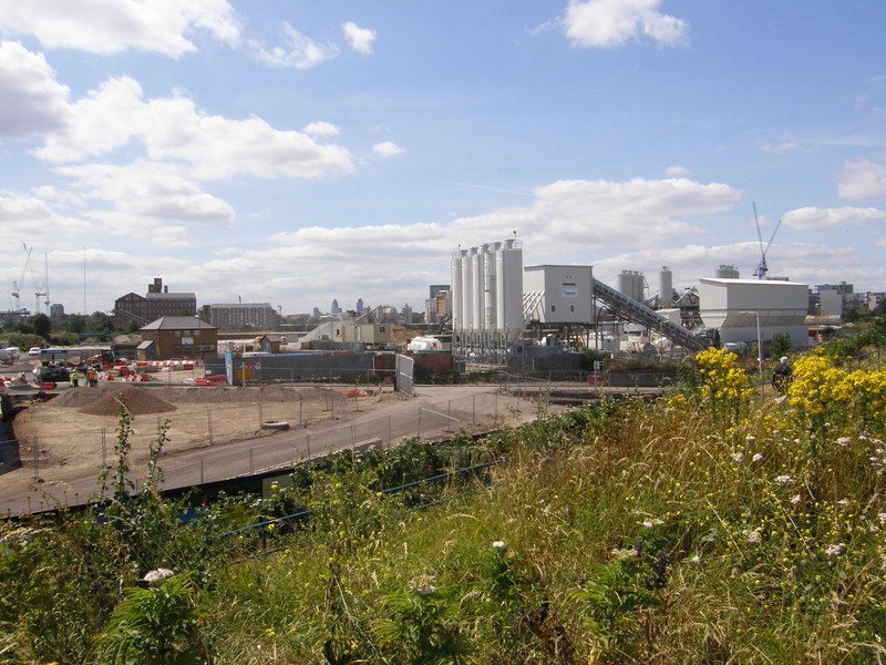
From the eastern corner of the park, it's time to hop onto the Greenway, the wonderfully long, straight cycle and walking path that I last used on my District line walk from Bow Road to Becontree, and which the Capital Ring follows on day 14. This is where the Greenway starts, and in weather like this, it's a delightful jaunt, even though this western section cuts through the industrial madness that will become the Olympic village for the 2012 games. When I did the Ring last summer, this part of the Greenway was closed for repairs and I had to make up an alternative route, but it's open again and it's an education. Lining the Greenway on either side are satanic mills sifting rocks and billowing out dust clouds that mix with the heady stench of the sewer under your feet, and although this probably doesn't sound like much fun, it is, because the Greenway is high up enough to feel completely safe. It's fun to peer over the organised chaos of the Olympic construction zone from this lofty walkway, and the scale of the enterprise is breathtaking.
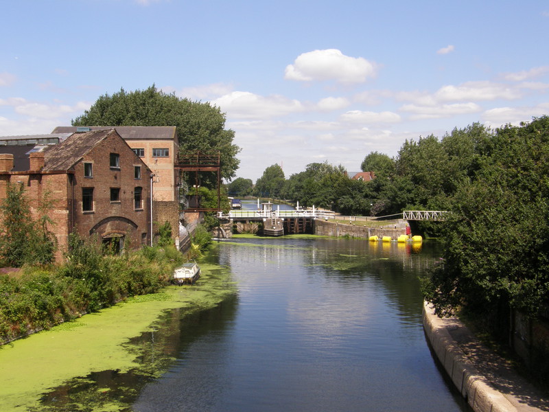
Soon after joining the Greenway, look left to see a junction of two waterways (the left one is the Lee Navigation and the right one is the River Lea). There's a large warehouse on the left bank, but hidden away in the greenery on the triangle of land between the two waterways is a small cottage; this is the Lockkeeper's Cottage that hosted Channel 4's The Big Breakfast back in the days when it was a seminal feast of cultural must-sees. This is the cottage where Paula Yates frolicked on the bed with Michael Hutchence in front of the whole nation, and where Chris Evans and Gaby Roslin redefined what breakfast TV should be. Hell, this is where Zig and Zag started out – surely there should be a blue plaque here?
The Greenway pauses for a short section so we can pass under the railway line at Pudding Mill Lane (a DLR stop, so I won't be visiting this on my tubewalk), and before it gets going again it's time to leave it for the considerably less delightful A11 into Stratford. The A11 is a fiercely busy road and is dual carriageway at this point, with a bus lane for good measure, so it's a bit like walking along a motorway. On the other side of the road are some interesting developments and some boarded-up old places that will no doubt disappear in the near future, but as you approach Stratford itself, things open up at the Railway Tree sculpture into a modern and airy town centre.
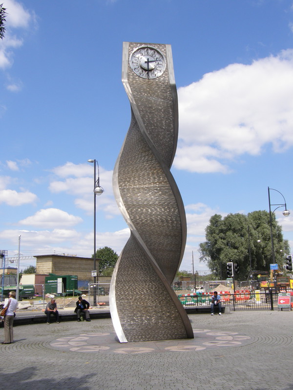
However, Stratford station is at the western edge of town, so I'll have to leave my exploration of central Stratford until my very last tubewalk from North Greenwich to Stratford on the Jubilee line. If the station is anything to go by, it should be an impressive place; the arrival of the Jubilee line in 1999 totally transformed things round here, and nowhere is that more evident in the large transport junction just below the Olympic park. There's a huge bus station here, and it was from this point in 1832 that Walter Hancock operated the first fee-charging London to Brighton bus service (a first for Britain) in his steam-powered ten-seater bus The Infant. The train station next door is even bigger, and looks more like an aircraft hangar than a train station, though it's an architectural aircraft hangar if ever there was one; the roof curves elegantly away from the entrance, and it's well worth poking your head inside to look at the gleaming ceiling. Even though Stratford station was built well before we started bidding for the Olympics, you get the feeling that this is what this station has been waiting for; it's huge, it's in the middle of nowhere, and now it's time to flex its muscles.
Oh, and just next to the station is a digital display showing a countdown to the Olympics. It's 1465 days, 22 hours, 12 minutes and 3 seconds away, though it might have gone down a bit by the time you read this.
Stratford to Leyton
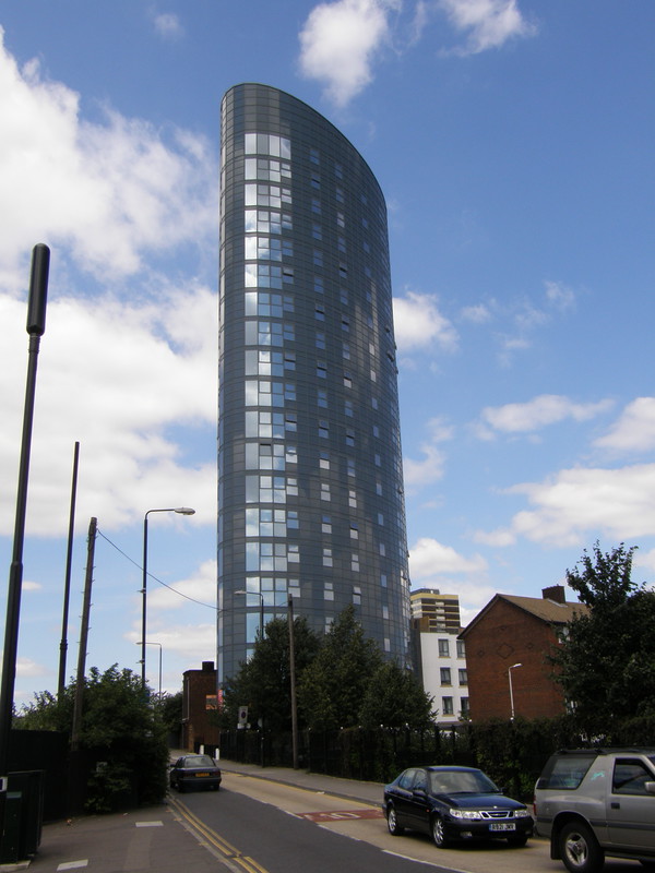
I perhaps should have picked a more interesting route from Stratford to Leyton, but the east-west side streets of northern Stratford and southern Leyton don't lend themselves terribly well to north-south walking, and I thought it might be interesting instead to walk along the edge of the Olympic park, in case I got a sneaky peak of what's going on inside. I shouldn't have bothered, because the whole stretch from Stratford to High Road Leyton is one big industrial estate, and not a very interesting one at that. Looking down the side streets, Leyton appears to be made up of row upon row of terraces, but all I got was the odd glance here and there, so don't quote me on that. I'm sure it's a lot prettier and a darn sight more interesting than Angel Lane and Leyton Road, whatever the reality.
Indeed, the only interesting thing I could find about this area was the possible site of radioactive waste just over the fence in the Olympic Park. There's a certain amount of speculation about this – especially as contractors are banned by the Olympic Delivery Authority from talking to the press about what they've found in the ground under the future Olympic site – but documents have been seen by The Guardian newspaper that claim waste contaminated with an isotope of thorium (a carcinogenic nuclear fuel) was dumped near to Temple Mill Lane in the northeast corner of the site back in 1959, and that levels of radioactivity on this site are three times the normal background level. The Radioactive Substance Act of 1960 controls dumping of nuclear materials, but before the act came into force, radioactive waste could be dumped without being properly recorded; it's scary stuff, digging up the underbelly of the capital.
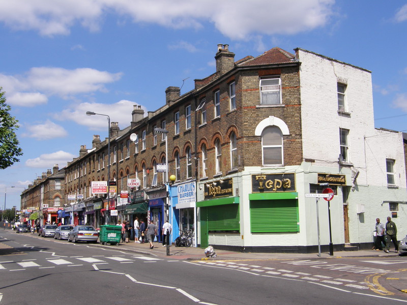
Things improve as you come to southern Leyton: the road is lined with flats above colourful shops, and the terraces off to the sides are pleasant enough, though there's quite a bit of flaking paint and a slight air of faded Victoriana that will no doubt change as the Olympic investment pours in. This is an ethnically diverse area – 2001 census figures show the local population is 46 per cent White, 28 per cent Black and 20 per cent Asian – and the shops reflect that: Plaistow and Upton Park aren't a million miles away, and there's a definite similarity between the areas. Leyton station is a little further on, perched on a bridge over the thundering A12; the original station was opened in 1856 by the Eastern Counties Railway, though Central line trains didn't stop here until 1947. The station building dates from an 1879 refurbishment, and is a modest affair, hidden from the road by a white and blue tiled wall along the roadside.
Leyton to Leytonstone

On the way from Leyton to Leytonstone, I thought I'd walk through St Patrick's Roman Catholic Cemetery, and I'm glad I did, as it's incredible. Originally opened in 1868, the western half of the cemetery is completely crammed with graves and monuments, so much so that at times the graves seem to be pushing against each other like commuters at rush hour. It's a bit less crowded to the east, but it's also less interesting, as that's where the more modern graves live, and these days you don't get many grand statues or mausolea. I'd originally planned to walk straight through the cemetery, taking the eastern exit into Hollydown Way, but the gate was locked so I had to walk all the way back again... not that I minded, as this is a particularly fine graveyard for nosing about.
The housing is again a mixture of old and new on the way to Leytonstone, though the new housing is consistently good; you get the feeling that you're walking into a more affluent area that Leyton, and the 2001 census figures confirm this. In Leytonstone 62 per cent of residents were in employment compared to 51 per cent in Leyton, while the latter ward's ethnic breakdown was 60 per cent White, 21 per cent Asian and 13 per cent Black; this change in ethnicity and income is visible as you walk from one ward to the other. There's a bridge on the way into Leytonstone that carries the London Overground over the High Road, and it's painted with bright suns, happy people and the greeting 'Welcome to Leytonstone', reflecting the improving picture.
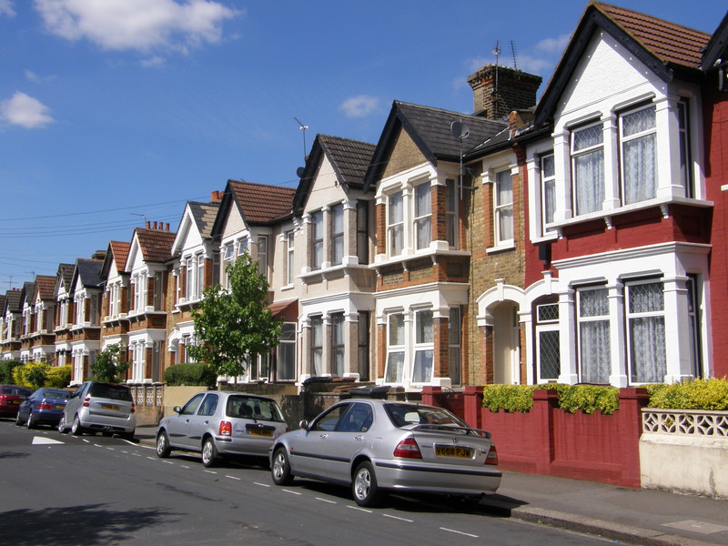
The shops and houses are interesting all the way to the Leytonstone station, which lies at the end of a particularly attractive terrace along Harrington Road. The station itself is nicely done out in mosaics of Alfred Hitchcock's films (Hitchcock was born and raised in Leytonstone) though architecturally there's not a lot to see as it's mainly subterranean; however, it does have a good café right next door, and on a hot day like this, that's the kind of beauty you need, and I spent a pleasant afternoon exploring Leytonstone's village-flavoured centre. I rounded the day off by meeting my friend David, who lives in Leytonstone, for a curry in the Star of India; this is one of London's best curry houses, if you believe the sales pitch, which I'm quite willing to after sampling their excellent chicken jalfrezi. You've just got to love the east of London...