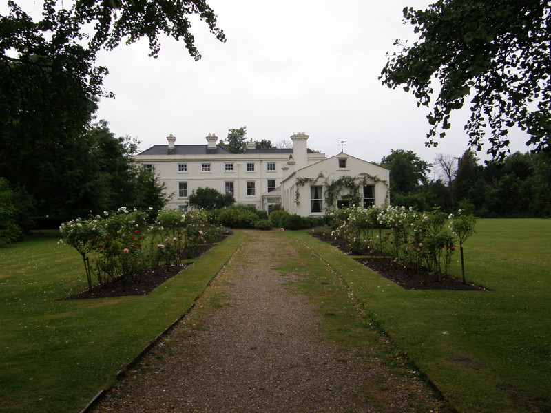
OK, I've got to be a bit careful here, because I don't want to be unfairly harsh on south London. The weather has taken a turn for the worse and the less trustworthy tabloids are claiming that it's going to rain solidly for the rest of the summer, but I mustn't let my sodden socks and grey-spattered photographs drag me down when writing up today's trudge. However, I don't think there's any way of avoiding the fact that I felt pretty morose along much of this walk, and deep down, I think it's the area rather than me.
I'm not coming at this section from a position of complete ignorance, as Peta and I lived along this part of the Northern line until three years ago (in Balham to be precise). I thought it might bring back lots of happy memories, wandering past our old haunts, but instead I came out the other end really rather thankful that we'd moved. I was happy enough when I lived here, but I was happy when I lived in Chiswick, and I loved my tubewalk through that neck of the woods... though as Chiswick and Ealing feel as if they're related, that's perhaps no surprise.
So I'll try to be objective, but bear in mind that I didn't see south London in its best light, and I perhaps might have missed its mojo. Still, at least the walk starts and ends on a high...
Morden to South Wimbledon
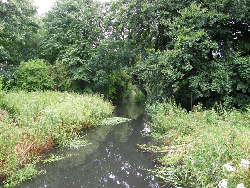
Morden station is on the busy London Road, just off the A24 (which I ended up following all the way to Clapham Common). I didn't fancy hanging around there in the rain, so I pulled on my Gore-Tex jacket, popped up my umbrella, started practising my one-handed photography technique, and headed east for Morden Hall Park. Morden Hall itself is just off Morden Road, and although I'm sure this National Trust property is well worth a visit, the real gem for walkers is the large and extremely lush park that stretches out to the north and east. I'd been expecting the usual landscaped grounds with a duck pond and rolling views to the Hall, perhaps with a tower block plonked in the background to bring us all back down to earth, but I didn't see Morden Hall Park coming at all. It's all overgrown and wild, and you need to take the paths if you're going to make any headway through the undergrowth (especially in this rain). Streams seem to come from all sides as the River Wandle splits into multiple channels, and it's easy to imagine yourself cut off from the bustle of London... because you are. It must be glorious on a sunny day; it's even great in the rain.
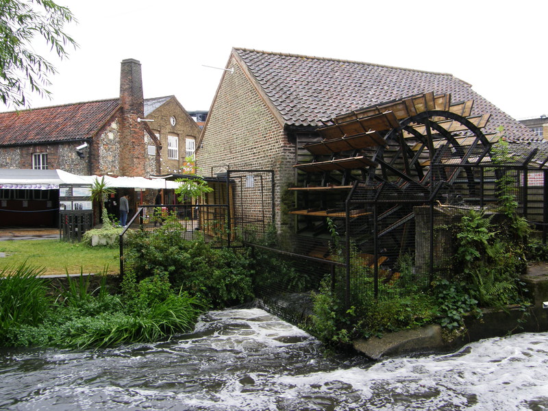
Signposts for the Wandle Trail take you north and across a set of tram tracks, before a path takes you past Deen City Farm, invisible behind trees to the left (though you do get the occasional glimpse of the farm). The Wandle keeps you company to the right, and soon after crossing Merantum Way, you come to Merton Abbey Mills. Back in 1802, John Leech, a calico printer, set up the Merton Abbey Print Works here, and in 1831 they were bought by the firm of Edmund Littler, who supplied printed material to Liberty & Co. in Regent Street; in 1881 the designer William Morris opened a design and manufacturing works a little further downstream, and the two soon became fierce competitors. Liberty took over Littler's factory in 1904 and continued to produce work here until 1972, but the area has a continuing association with arts and crafts, with a popular weekend market (which calls itself 'London's Alternative Market'), regular live music events, and 15 shops selling things like musical instruments, jewellery, books and all sorts of other arts and crafts.
If you weren't doing a tubewalk, you wouldn't bother to head west down High Path towards the A24; instead, you'd probably continue north along the Wandle Trail towards Wandsworth, where the Wandle meets the Thames. But I have to remember that I'm walking the Tube, so I turned off into a street of backyard garages, terraced cottages and large residential tower blocks, only to discover that down this road, on the corner of a fairly down-to-earth housing estate, lies The Trafalgar, CAMRA's 2007 pub of the year for southwest London. It wasn't open as I walked past, but this pub gets excellent reviews; maybe next time.
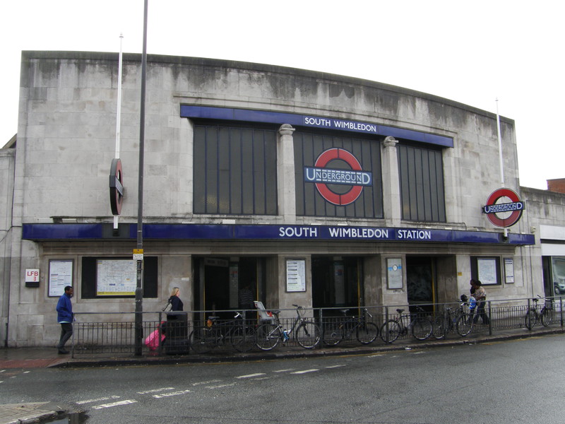
South Wimbledon station is back on the main Morden Road. It's a Grade II-listed Charles Holden station dating from 1926, when the Bank branch of the Northern line (known then as the City & South London Railway) was extended from Clapham Common to Morden; all the stations from Clapham South to Morden are 1926 Holden creations, and apart from Morden, which looks like it's been sat on by an office development, they are all Grade II listed. South Wimbledon station looks a little drab these days, as the white-grey Portland stone is starting to go black from the top, making the station look a little unloved. The vertical glass slats still look good, and even though this is a busy road junction and there's precious little space to fit in a building, Holden clearly knew his stuff.
South Wimbledon to Colliers Wood
I tried to find an interesting route from South Wimbledon to Colliers Wood, but I couldn't manage it without taking an unnecessarily long detour, so instead I just walked along the main road, straight to the station. As with pretty much every busy road in London, the road walking was hectic and pretty forgettable, though the road does join the Wandle again at the site of William Morris's printing works, which is now home to a spectacularly large Sainsbury's-cum-Marks-and-Spencer.
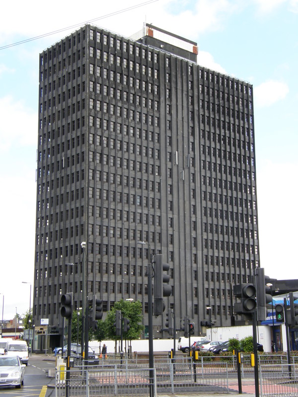
Even more spectacularly large is the Colliers Wood Tower, which really should be put out of its misery. Looming over the centre of Colliers Wood like a huge black monolith, it is stunningly ugly, a fact confirmed by a BBC poll in 2006 in which it was voted London's ugliest building, taking 52 per cent of the vote against 23 per cent for the next contender, the Tower Hotel by Tower Bridge. Colliers Wood Tower was also one of the 'dirty dozen' in Channel 4's Demolition programme, where the public nominated the UK buildings they would most like to see blown to smithereens. When the local council asked residents, 86 per cent described the Tower as the worst thing about living in Colliers Wood. I concur.
Colliers Wood station cowers beneath the shadow of the beast, another 1926 Holden creation that is suffering from black rot creeping down the stonework. I hope they manage to find the funds one day to clean these stations up; they'd look spectacular when sparkling.
Colliers Wood to Tooting Broadway
Just over the road from Colliers Wood station is Wandle Park, a small but prettily formed green space through which the Wandle winds in an explosion of plants and trees. The park was formerly the site of Wandle Park House, which Lord Nelson is thought to have visited on a number of occasions; the house, which was demolished in 1962, was built in about 1791 for the Scottish journalist James Perry, editor-owner of the Morning Chronicle, the most successful newspaper in Georgian times.
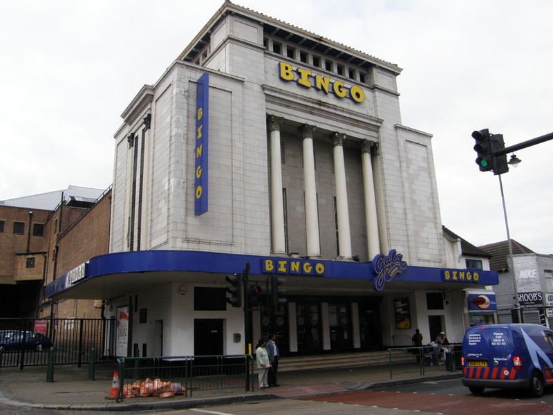
Round the back of the park are some attractive terraces, but to get to the next station you have to join the main road for a while, and that's not terribly thrilling. I decided to take a small detour via Mitcham Road to take in the newly cleaned Tooting Library and the 1931 Art Deco Tooting Gala Bingo, formerly the Granada Tooting Cinema. According to the V&A – and they should know – this latter building is considered by many to be the most spectacular cinema in Britain, though you have to go inside to appreciate the full grandeur. There's a foyer with columns, a grand staircase, and even a hall of mirrors, all of which were designed by Theodore Komisarjevsky, a Russian prince with a background in theatre management and design.
Tooting Broadway station, again a 1926 Holden design, has a 1911 statue of Edward VII outside, and although the statue came first, the station frames it as if they had been built together. Again the rot is setting into the Portland stone, but there's a little more space here, and Holden's design doesn't disappoint.
Tooting Broadway to Tooting Bec
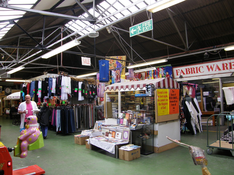
The trek north up Tooting Broadway is another noisy journey along the busy A24, now known as the Upper Tooting Road, though there are some interesting sights along the way. The first, just north of the Tube station, on the right, is Broadway Market, the largest indoor market in south London. There are over 100 traders tucked away in a honeycomb of corridors and open areas, with stalls selling fish, meat, clothes and all the other stuff you'd expect to find. It's definitely worth exploring.
There was one major downer that hit me at the market, though. I got shouted at by a group of loitering locals as I took a couple of snaps of the inside of the market – looking at me with undisguised disdain, they insisted that I should have asked their permission before taking a photo of their corner of the market, even though they were hidden behind the crowds and I didn't even know they were there until they leapt out of the woodwork. I think there may have been a bit of territorial black-alpha-male posing behind their in-my-face attitude, but whatever the reason for their anger, it did throw me off kilter a bit, rather like being the victim of road rage.
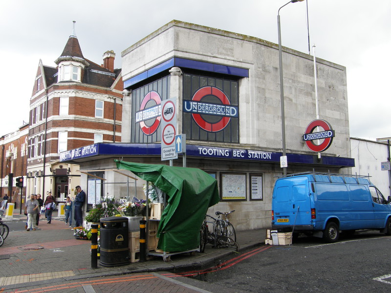
As a result, I didn't particularly enjoy the rest of my wander along the A24, despite the many interesting shops along the way. This is the centre for the Pakistani Muslim community in south London, and the shops reflect this, with quite a few Indian and Pakistani clothes shops, restaurants and sweet shops along the way. Normally I'd love this kind of thing, but I didn't feel welcome after my brush with the grumpy locals in the market, so I didn't waste any time getting to Tooting Bec station. The station has two entrances; the smaller one on the eastern side of the road provides access to a subway under the road, while the larger building on the western side contains the ticket hall and access to the station below. I like the subway access building; it's like a pocket version of a normal Holden station, and it's really rather cute.
Tooting Bec to Balham
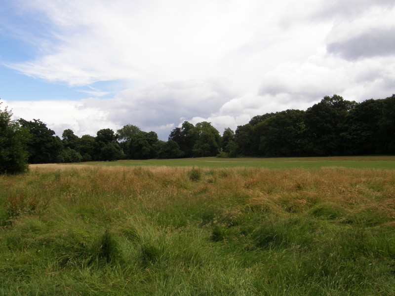
In an attempt to get away from the tedious A24, I designed the routes for all the rest of today's sections as loops, leaving the road as soon as possible and only returning to visit the next station. From Tooting Bec, the most scenic route is to head east to Tooting Graveney Common, and then on to Tooting Bec Common, a pleasantly open green space that's shaped like the constellation of Orion, with the railway slicing it in half from top to bottom, and Bedford Hill running across the belt in the middle. This has the effect of making the common feel rather smaller than it actually is, but it's an enjoyable space to wander through. I was particularly grateful for a few shards of sunlight as I followed the Capital Ring for a while, which comes through here on day 5; there's nothing quite as depressing as trying to walk across an open common when the wind is howling and the rain is pelting, but I was spared this ordeal... just.
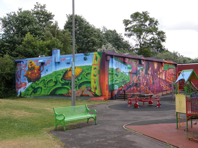
On the way out of the common, just north of the second railway bridge, is a playground with an amazing bit of graffiti on the building behind. This building is the Triangle Youth Club, and the graffiti is by VOP (that's short for Visual Orgasm Productions), a four-person graffiti writing crew made up of Stylo, Dane, Mear and Solo One. They've been creating street art since 1988, and if this is anything to go by, they're seriously talented (you can see more of their work on their website).
Balham station sits right next to a national rail station of the same name, though the two are operated separately. Again opened in 1926, Balham is perhaps best known for a devastating World War II air-raid incident, when a 1400kg bomb fell on the road above the station, causing the northbound platform to partially collapse. A bus then crashed into the crater, and the broken water mains and sewers above the platform gushed into the Tube tunnel, eventually reaching to within 100m of Clapham South station. Because the deep-level Tube lines were used as shelters by the public, 64 people died in the attack, according to a plaque in the entrance hall (though other sources say that either 65 or 68 died, depending on who you believe). Although the damage closed the line, it was fixed pretty quickly; the bomb fell on , and the line was reopened on , which is an impressive turnaround (particularly by today's standards).
Balham to Clapham South
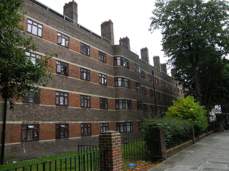
If you're ever inspired to walk between Balham and Clapham South yourself, I wouldn't recommend you take the same route as me. I only went this way to take in the flat where Peta and I lived in Balham, and I almost wish I hadn't, for the suburbia to the east of the main road is pretty uninspiring. It didn't seem quite as dull when we lived here, but you should never admit to yourself that your home is crap, at least not until you've moved out. We knew as soon as we moved from Balham to Ealing that we'd made the right decision, and heading back into Balham on a rainy Monday morning didn't change my mind.
OK, there are some pleasant terraces along Hazelbourne Road, and some of the older estates have some intriguing (though perhaps not terribly beautiful) architecture, so don't think I'm slamming the whole area. But the 1930s block of flats above Clapham South station is still as ugly as sin, the estates along Weir Road and Poynders Road are still fairly drab, and the main road – now called Balham Hill – is hardly riveting. It is much more pleasant to the west of the main road, so I'd stick to that if I were you.
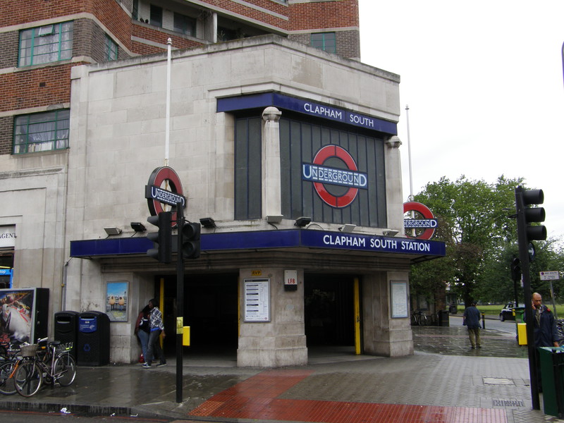
Clapham South station itself is another 1926 Holden station, bang on the southern corner of Clapham Common. What isn't apparent from the road is the deep-level shelter down below, one of eight built along the Tube to provide shelter during air-raids. Each deep-level shelter is made up of two parallel 370m-long tunnels, of the same dimensions as a normal Tube tunnel; the idea was that these tunnels would go on to form part of an express Tube line that would bypass certain stations, so shelters were only built next to stations that would be bypassed. Each tunnel was split up into an upper and lower deck and would hold up to 8000 people, and they were built between 1940 and 1942 at Belsize Park, Camden Town, Goodge Street, Stockwell, Clapham North, Clapham Common and Clapham South on the Northern line, and Chancery Lane on the Central line (proposed shelters at St Paul's and Oval stations were never completed). Originally only the government used these shelters – General Eisenhower used the Goodge Street shelter, for example – but as the bombing intensified, Belsize Park, Camden Town, Clapham North, Clapham South and Stockwell were opened up to the public. These days... well, who knows what's down there?
Clapham South to Clapham Common
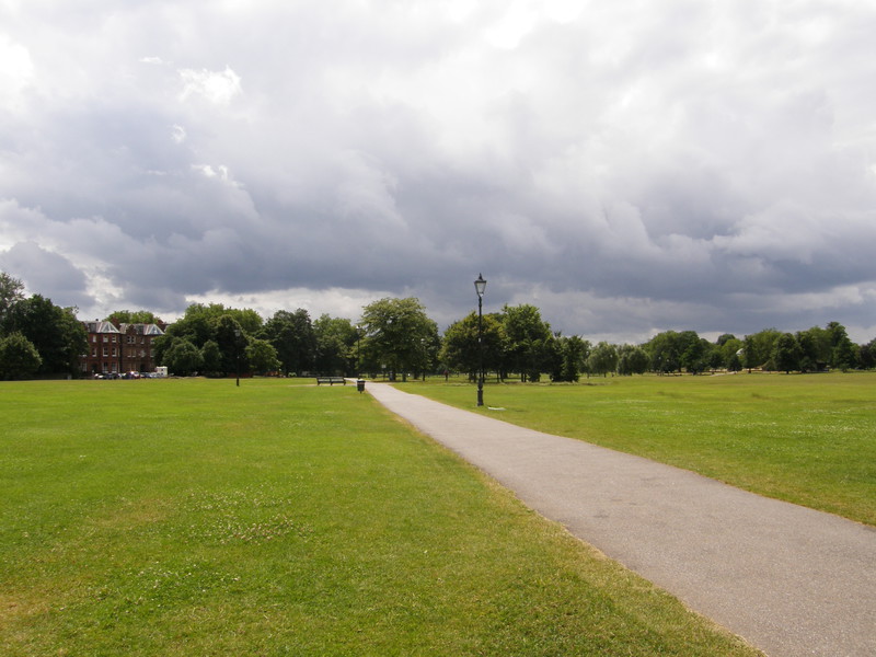
Clapham Common is a fairly typical common, except it's huge. Like most commons, it isn't landscaped, but is little more than a huge triangular wedge of grass, more like a big field than a park. There's a bandstand in the middle and an oval lake, the Long Pond, along the eastern edge, and on a windy day like today it catches the breeze like nobody's business. Stand in the middle of the common and the sky is very big indeed...
Clapham Common station is on the northeast corner of the common, in a traffic island at the southern end of Clapham High Street. It opened in 1900 as the southern terminus of the City & South London Railway, which had just been extended from Stockwell; it would remain as the terminus until the extension to Morden in 1926. The station entrance is a small domed building with two entrances that take you down into the ticket hall, which is completely underground; it's quite a cute-looking station, truth be told.
Clapham Common to Clapham North
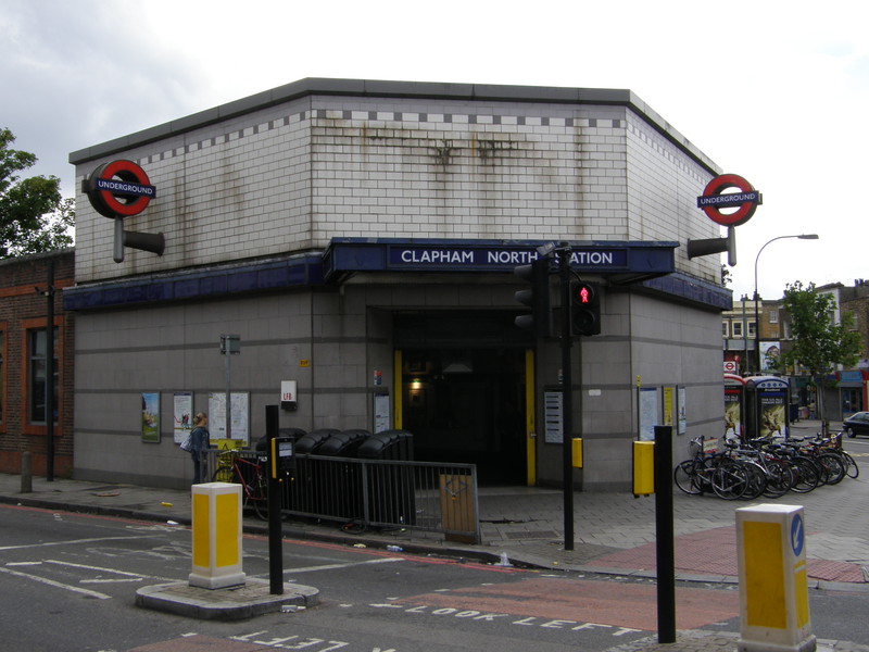
I simply followed Clapham High Street to reach the next station, because Clapham High Street is an interesting road in its own right. I've been clubbing down here more times that I can remember, mainly in the Two Brewers, and it's good to see that the mix of pubs, gay bars, restaurants and shops is still as varied as ever, even though the street still manages to look a little worn.
Clapham North station is not one of the best-looking Tube stations on the planet; it was originally opened in 1900 as part of the two-station extension from Stockwell to Clapham Common, but the external building was replaced in 1920, and since then it has been re-clad. It's a bit of a mess, though, and the white tiling around the top of the entrance looks like the inside of a particularly nasty public toilet. It's slightly more distinguished inside, as Clapham North is one of only two stations on the Underground that still has an island platform, wedged between the northbound and southbound tracks (the other station is Clapham Common, just down the road).
Clapham North to Stockwell
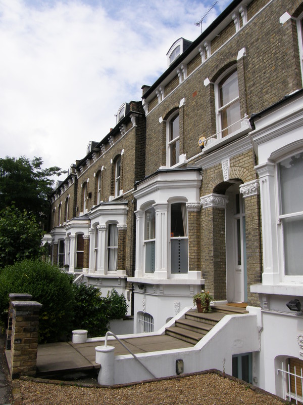
Heading west from Clapham North, you step into a strange mix of lovely Victorian terraced houses and large estates. The estate buildings are pleasant, if a little dark, and it's an entertaining wander through the backstreets towards Larkhall Park, a wide open green space in which I managed to pick up an unwelcome and extremely smelly dog shit that buried itself deep in the ridges in my walking boots; this is the first such accident I've had, which isn't bad really, and luckily the rain arrived not long afterwards and gave me a chance to wash it off in the wet grass.
Heading east from Larkhall Park takes you into some less attractive social housing, with high rises peeping over the terraces, but it still isn't as bad as some estates I've seen, and among the estate buildings are newly built private houses that help leaven the mix. Stockwell station sits on a corner on the A3, a not-very-attractive brick affair that dates from 1971, when the Victoria line was opened. The original building was similar to Kennington, but these days it's just a damp architectural squib on a busy A-road, more famous for the 2005 police shooting of Jean Charles de Menezes than anything else. However, it was the southern terminus of the original City & South London Railway, which opened in 1890 as the world's first deep-level tube railway, and north from here is the oldest tube railway in the world, so it isn't all bad.
Stockwell to Oval
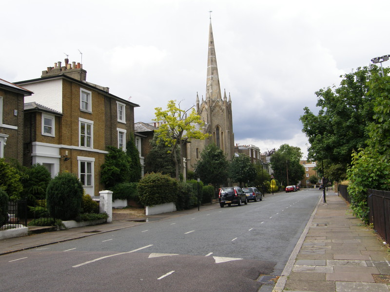
On the other side of the A-road lies Stockwell Park Conservation Area, a delightful collection of Georgian buildings dating from the 1830s. The spire of St Michael's Church dominates the area, which was set up as a suburban development and quickly became an exclusive neighbourhood with lots of imposing villas. It's surrounded by estates and social housing, in particular the 1930s Stockwell Gardens Estate and the 1950s Studley Estate, the latter following the destruction of the Blitz. The Conservation Area is like a little oasis of architectural brilliance among the more workaday housing that Stockwell is more associated with.
Mostyn Gardens is an interesting green space on the other side of the A23 from the Conservation Area, mainly because it isn't flat. It's a bit like a huge bowl, with grassy mounds all around it, and it probably makes a pleasant spot for relaxing when it isn't raining. Back on the A23, known here as Brixton Road, the buildings are actually rather pleasant, with the bizarre layer-cake Byzantine architecture of the 1902 Christ Church, and a row of attractive four-storey Victorian terraces behind a little lawn. At the top of the road is St Mark's Kennington Church, which was built between 1822 and 1824 and is now a Grade II*-listed building. Over the road from the church is Oval station, which is all clean and tidy, having been recently re-tiled, as befits a station next to one of the country's great cricket grounds.
Oval to Kennington
Oval Cricket Ground is just down the road from the station, though you'd be hard pressed to recognise it as a station; as you approach it, you're looking at the rear of the pavilion, and it looks for all the world like a normal mansion block, but with fewer windows. All the glory is inside the ground, but you can't peek in from the encircling road, as the stands are too high. Back in 1844, the Kennington Oval was a market garden that was owned by the Duchy of Cornwall; now it's the 21st-century home of Surrey Cricket Club, though it's still owned by the Duke.
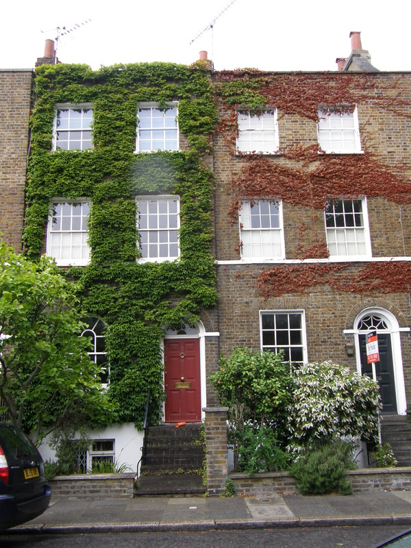
I was originally going to wander through Kennington Park on the way north, but this stretch of the A3 is deadly straight (having originally been a Roman road) and there are railings in the central reservation that stop you from jaywalking, so instead I stuck to the left-hand side of the road and headed for Cleaver Square. This delightful square is surrounded by lovely Georgian terraces and has a cracking little pub, the Prince of Wales, tucked away in the corner. Unusually for London squares, it doesn't have grass in the middle, but a hard dirt surface that's perfect for playing boules. The City and Guilds of London Art School is just round the corner, back on the main road.
Kennington station is just along the main road, with its distinctive dome on top. This dates from the original opening of the City & South London Railway in 1890, and indeed this is the only station on that original stretch that hasn't been rebuilt in some way. The dome was built to contain the lift mechanism, and it looks great, making for a charming end to this long slog through south London.