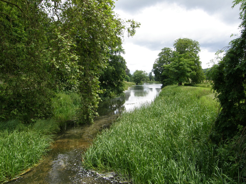
'Scattered heavy showers' said the weatherman, and he wasn't kidding. As I fell out of Neal's car into the paltry shelter of the bus stop at Chorleywood station, the rain cranked up from light drizzle to power shower, and all of a sudden my decision to travel lightly didn't look so clever. For the first time, and hopefully the last, I wished I'd brought my proper walking boots rather than my trainers, because out here, it's proper countryside, and proper countryside is no place for trainers.
That's why it's even weirder to bump into the London Underground roundel out here than anywhere else. Chorleywood station is in zone 7, along with Rickmansworth, Croxley and Watford, but Chalfont & Latimer is alone in zone 8, and Amersham and Chesham make up the entirety of zone 9. Other lines look on in envy: the Central, District and Piccadilly lines just about make it to zone 6, while the Northern, Bakerloo and Jubilee lines run out of steam in zone 5, but there's the Metropolitan, striding out, way past the M25, into territory that is truly its own. It makes for a tubewalk that is purely rural, with farms, cows, forests and rights of way being the norm. It's bizarre to think that this idyllic part of the home counties is served by the London Underground, but there you go: it is. And even in the driving rain, it's a charming place to explore, a whole world away from the other end of the line, back in the heart of London.
Chorleywood to Chalfont & Latimer
Until this walk, I've pretty much ignored my Ordnance Survey maps, apart from the odd confirmation when my printed Google Maps have been a bit ambiguous: in the city, Ordnance Survey maps are practically useless, as you really need a map with road names rather than contours. But out here it's different, and I tucked my printed maps into the depths of my pack, away from the looming rain clouds, and pulled out Explorer maps 172 and 181, which promptly got soaked before I could stuff them into my plastic map carrier.
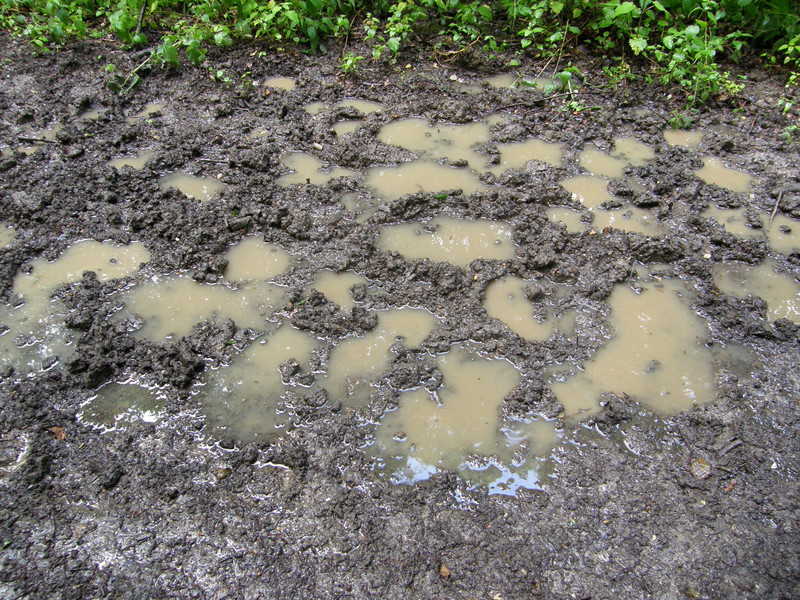
Indeed, the rain got worse before it got better, forcing me to take temporary shelter under a corner shop awning in the centre of Chorleywood before the weather gods finally took pity and eased back the throttle long enough for me to dash through the suburbs of Whitelands Avenue and into Carpenter's Wood. The first of an awful lot of woods on this stretch of the Tube, Carpenter's Wood and its neighbours Hillas Wood and Whitelands Wood were thick enough to create their own weather systems, because although the skies had temporarily cleared outside, I was to enjoy my own, personal weather display, squeezed as I was between the canopy and the slushy mud of the forest floor. The thing is, woodland is like the climate equivalent of Sky Plus, because the rain that had soaked my maps back in Chorleywood was now sitting trapped in the canopy, waiting for a brisk wind to bring it down on my head all over again... which happened every few steps through the woodland. Beautiful it might have been, but wow, was I soaked by the time I reached a tunnel under the Metropolitan line and joined the Chiltern Way, heading north.
When I designed my walking route for today, I got quite excited, as I knew I was going to be walking through some beautiful countryside. What I didn't know, and couldn't know, was that it would be hidden for most of the day behind high hedges, only peeping through every now and then, and rarely in a photogenic way. I'd thought that the Chiltern Way would be a guarantee of great countryside views, but I picked the wrong section, for the bridleway up to the A404 is thin, lined with thick hedges, incredibly muddy and, if I'm honest, a bit disappointing. It does wind through the pleasant trees of Halsey's Wood and on a sunny day it would be quite lovely, but I just managed to get wetter and wetter as my trainers got waterlogged and I built up an annoying sweat beneath my waterproof. I wasn't too sad to wave goodbye to the Way at the A-road; I obviously caught it at its least imaginative, because with a name like the Chiltern Way, how can you fail to be a great walk?
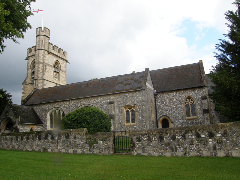
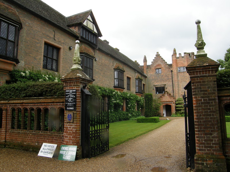
I left the Way to visit the nearby village of Chenies, and what a masterstroke this turned out to be. Chenies is delightful, with a small village green surrounded by lovely houses, a local primary school screaming with glee just nearby, a charming flint church, and most impressively, the Manor House. It was closed when I wandered past, but there's a right of way that slips between the Manor House and St Michael's Church, from where you can have a good old nosey into the front garden. It's English village beauty at its best, and I'm so pleased I made the effort to detour via the village green rather than taking the more direct route to the west.
The only downside of my detour was getting another royal soaking as the wind rattled the eaves of the wood to the north of the village... but even though I moan, I do love walking through woodland, even if all my photographs look the same (I'm not a supporter of the Woodland Trust for nothing, you know). Besides, being mollycoddled by woodland makes the views all the more impressive when they leap out at you, and the view along the Chess Valley towards Latimer – which I would walk through later on the way to Chesham – coincided with a break in the clouds and some welcome sunshine, making the countryside smell like a damp blazer and bringing a beam to my smile.
After another stretch through Walk Wood and a swift turn to the south, I reached the outlying houses of Little Chalfont before joining the A404 for a short hop to Chalfont & Latimer station, the first of two visits today, as it's at this point that the Metropolitan line splits, the western branch heading to Amersham, and the northern branch to Chesham. Arbitrarily choosing to do things alphabetically, I headed west.
Chalfont & Latimer to Amersham
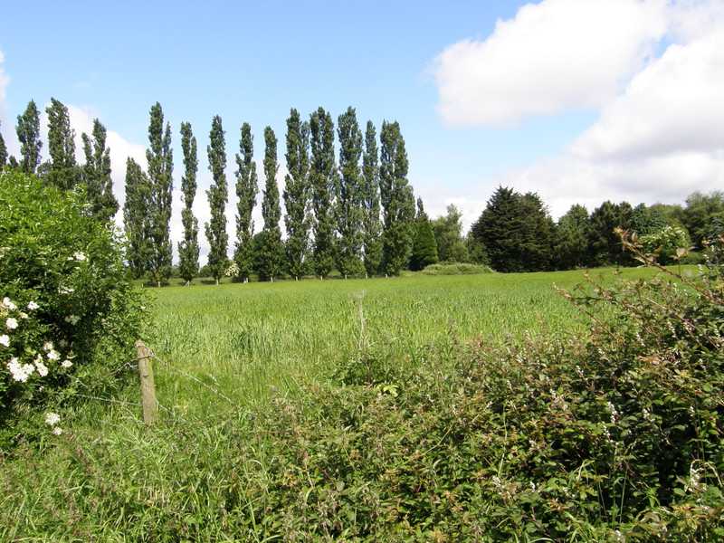
Little Chalfont is sliced in two by the Metropolitan line, and the suburbia on the northern edge of the line is not particularly stunning; indeed, the estate to the east of Bell Lane is perhaps best summed up by the fact that one house had a locked trailer parked in the drive proclaiming it sold excellent burgers, which I suppose makes a nice change from mouldering caravans or cars with bricks for wheels and tangleweed in the carburettor. Indeed, the estate was spotless, and suffered only from slightly uninspiring architecture rather than anything approaching inner city decay, and this is perhaps not surprising, as after a stretch through yet another dripping wood and past Boughton Business Park, the path suddenly bursts out into farmers' fields. This is Raans Farm, and even though it is bound to the south by the Metropolitan line track (which it shares with mainline trains at this point) and hosts an amazingly busy mobile phone mast at its western end, there's a definite rural feel to this part of the world.
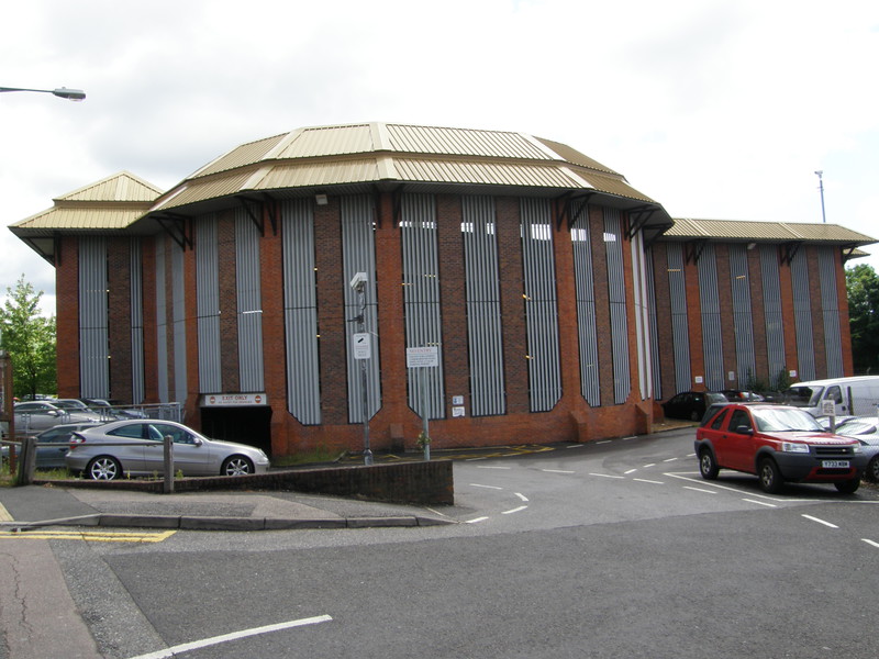
It's a bit of a shame to leave the fields and join Raans Road into Amersham, passing a large industrial park and joining the noisy and shockingly fast traffic on the A404. I'm convinced that the route I picked into Amersham was the wrong route, because along the whole stretch – along the A-road, past King George V Field and around the back of the law courts – the architecture (with a few pleasant exceptions) is pretty dull. I'm guessing that Amersham has a picturesque centre tucked away somewhere, but it doesn't appear to be to the north of the Metropolitan line. Instead, it's all red brick developments and slightly tired suburban houses, and the most impressive building, a huge behemoth near the station that I thought must be a council building or a strangely modernist church, turned out to be the multi-storey car park next to the Tube, and with that I walked up to Amersham station, touched the brickwork, and wondered if Chesham was going to be a bit of a let-down too. I shouldn't have worried, as the next leg would make up for the slightly uninspiring nature of this section... and besides, even though Amersham isn't that exciting, it is the highest Tube station at 147m above sea level, so in its own way, it's unique. Who needs architecture when you've got statistics?
Chalfont & Latimer to Chesham
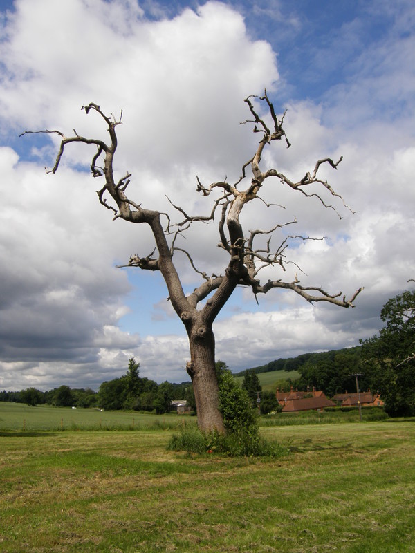
At a little under four miles (well, 3.89 miles to be exact, according to Transport for London), the Tube line between Chalfont & Latimer and Chesham is the longest section between two stations on the whole of the London Underground, which perhaps shouldn't come as a surprise, as zone 9 clearly has its own rules. It also turns out to be one of the prettiest sections, which again shouldn't ruffle any feathers. What is surprising is just how out in the sticks this part of the world feels, yet it's joined to the City by a Tube line. That, frankly, is bizarre, especially as that service is essentially one train every half an hour that shuttles between Chalfont & Latimer and Chesham, effectively making the spur to Chesham its own little self-contained line (OK, some trains from London do head to Chesham instead of Amersham, but they're a rarity). I can only assume that London Underground runs this section of the line at a loss in a spirit of public service; if so, then thank goodness for government-run services like this, as they manage to make walking the Tube that little bit more interesting.
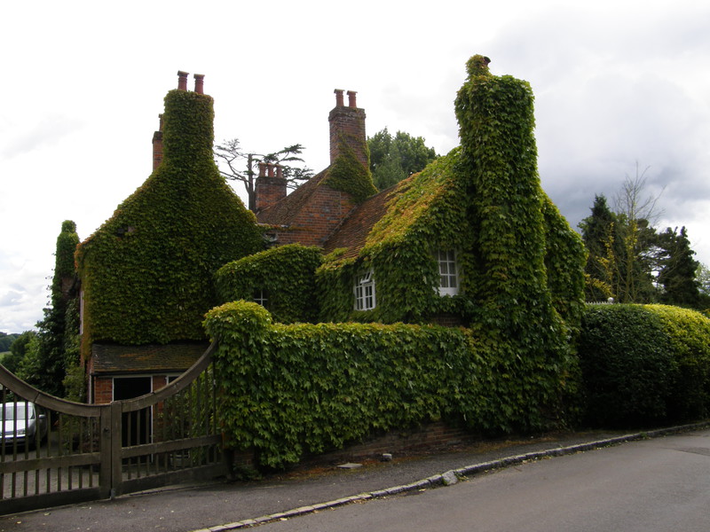
Right from the off there's a properly marked trail taking you from Chalfont & Latimer to Chesham, and not being a fool, I followed it. The Chess Valley Walk follows the River Chess all the way from Chesham to Rickmansworth, with a spur to Chalfont & Latimer station, and although it's light on way markers until you join the main route, it's a great little walk. From the off, it seems to pick out the loveliest places to live, heading through the northern reaches of Little Chalfont and through suburbs that defiantly don't have burger vans parked in their gardens. And then, boom! It breaks through the sodden West Wood and into the Chess Valley at Latimer, and suddenly you're in a different league. The sky stretches out along the valley floor, and perched on the hill opposite, hidden from view until you cross Latimer Road, is Latimer House, a defiantly private estate that's owned by the De Vere group, and which therefore devotes its life to hosting business conferences and the like. The Chess Valley Walk tiptoes round the eastern flanks of the house, ignoring a right of way that would take you past the front of the house, because much greater riches can be found in the village of Latimer itself, in the form of a charming church and an ivy-clad old rectory that makes your heart sing.
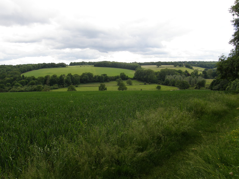
But obstinate privacy is clearly the theme for Latimer, as further up the road there's a stonking estate called Parkfield Latimer whose gates are not meant for those who've walked for miles through the dripping rain. Instead the right of way slips round the side, past fields and into the woodland of Tooley's Croft, where signs make sure you know your place and don't accidentally stray into the precious woodland that the estate has claimed for itself. It makes you appreciate the importance of the little green dashed lines on the Ordnance Survey, as without a decent network of rights of way, we simply wouldn't be allowed to explore our own country; I never thought I'd say this about a tubewalk, but I'm grateful for the brave souls who made the Kinder Scout trespass, because without their rebellious attack on the land-owning gentry, tubewalking in zone 9 would be all A-roads and angry drivers, and that doesn't bear thinking about.
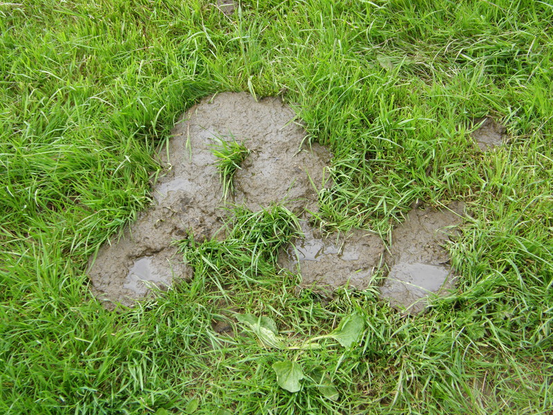
But we do have rights of way, and the countryside just keeps on rolling as the Chess Valley unfolds along its own green dash. After skirting the edge of Frith Wood, the Walk zigzags through Blackwell, slipping between Blackwell Hall and Blackwell Farm with only a glance or two of the buildings (though it's enough to make you wish you were lucky enough to live there). The farmland stretches on into fields full of cows and cow-pats, and it's a bit of a shock to have to re-join Latimer Road, albeit for a few yards only. There's no verge here, but there are helpful drivers who will whizz past at ridiculous speeds while flicking rude signs at you to tell you to get off the bloody road. There may be a right of way along here, but I don't think the drivers see it that way...
Luckily the signs take you off the road after just a few yards and take you alongside the River Chess, the first time this part of the Walk actually follows the river. It's not the biggest river in the world, and just as you're making friends you hit another set of fields and turn right into a water processing plant, where the blue bottles that grace water-coolers throughout the capital are loaded onto trucks.

Once the path rejoins the River Chess, it sticks to it, passing an old mill pond and flanking the large open area of Chesham Moor. This is nettle country and thin socks and trainers are on the edge of sensible footwear, but I wasn't expecting to be hissed into a huge batch of the buggers by a large swan protecting her clutch of cygnets right there, on the riverbank. Judging by the flattened troughs through the stinging thicket, I wasn't the first person to come across the warning hiss of Her Majesty's flock, and remembering that swans can break your neck if you think you're hard enough, I jumped into the nettle soup and winced my way in a wide arc around the nest. Man might have conquered the planet, but out here in zone 9, the veneer is pretty thin.
For the final hurrah, I headed back to the Metropolitan line, by now a single track line serving Chesham station and precious little else. The Balks, to give the woodland on the hill above Chesham its proper name, is thick and uninviting after heavy rain, and I'm not sure I'd recommend the claustrophobic cycle lane that skirts the Balks to get to the station, but it does give you one last look at the most remote Tube service on the network as it plies its gentle trade along the Chess Valley, and in that sense it's a fitting end to a delightful walk in the country. I'm not sure this is really tubewalking, but when the sun finally breaks through the rain clouds and you inhale a big lungful of country air, who's counting?