Ha! And I thought this section would be pretty boring, and possibly a bit grim. How wrong I was, which only goes to show you shouldn't always believe what you hear. For weeks people have been asking me about my route, and specifically whether I'm going to be walking through any dodgy parts of town, and the two areas at which people tend to suck in their breath are the eastern stretches of the District and Central lines, and the East London line. Thinking about it, though, most of those doing the sucking haven't actually been to east London, they just get their news from the Evening Standard or the Daily Mail, and assume that everyone east of Aldgate carries a knife. They are, of course, completely wrong, and it's a real shame.
Today was my first real walk in one of those areas, and I loved it. OK, there are some areas where the paint is peeling a little too much, and there are others where giving up and starting again might be the best course of action, but these are in the minority. For the most part, the eastern London boroughs are a fascinating cultural blur, and on a sunny June day, you can't go wrong. I can't wait to explore the rest of it.
Bow Road to Bromley-by-Bow
Turning right out of Bow Road station, it's a fairly uneventful few minutes above ground to Bow Church DLR station, because all the interesting stuff is below decks. On the approach into Bow Road from the southeast, underground trains have to negotiate the steepest section of track on the whole Underground. At 1 in 28, or 3.57 per cent, this is where trains heading into the City duck into the sub-surface tunnels under the Bow Road.
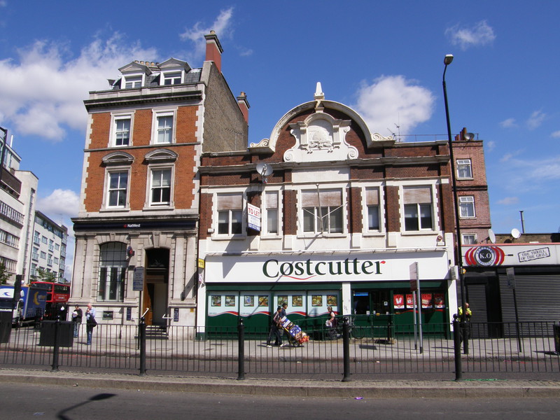
Soon after the DLR station, on the other side of the road, is an old Co-op building from 1932, though it's now host to a Costcutter store. A little further on is a statue of William Gladstone, trying to make himself heard over the traffic, and here I thought I'd turn south to follow the railway line, taking me into Bromley High Street. And this is where things start to go a bit wrong, though only for a short while.
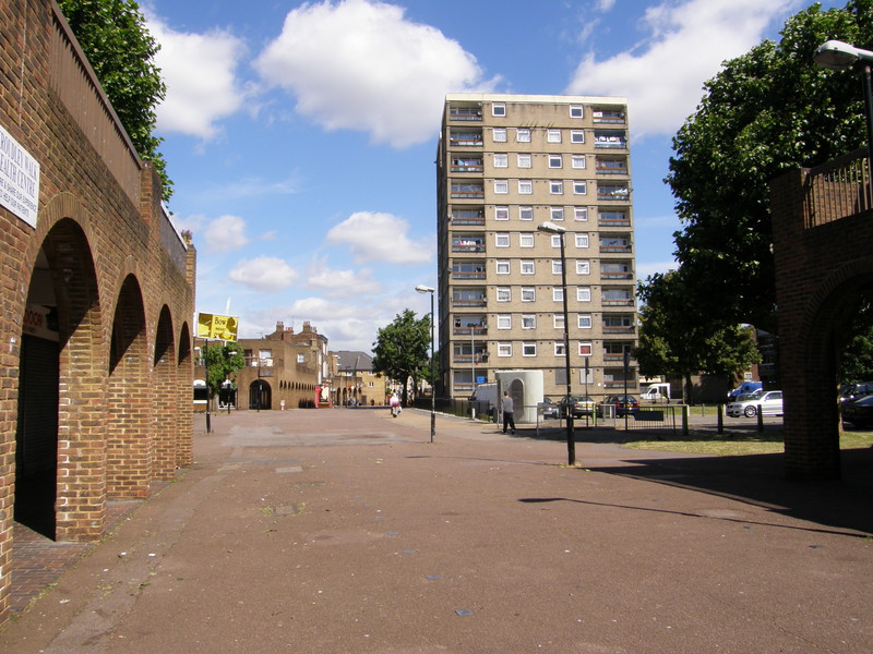
Bromley High Street feels a bit unloved. On a hot summer's day the barren square at the western end of the street is a lonely place, and the boarded up pub and tumbleweed atmosphere of the minimalist shopping mall are enough to bring anyone down. The local high-rises loom overhead and the sun bakes the tarmac, and it's hard to picture the old village green that used to be here, because there's not a lot of greenery in evidence these days. Back in , the suffragette Emily Pankhurst started her Bow campaign by making a speech here and smashing the window of the nearby funeral parlour with a brick, but the local council cleared the area in the 1930s and it was heavily bombed in the Second World War, so things have changed quite a bit. The Rose and Crown pub apparently dates back to the early 18th century, but it's currently boarded up, and the sense is of a past long gone, rather than of history.
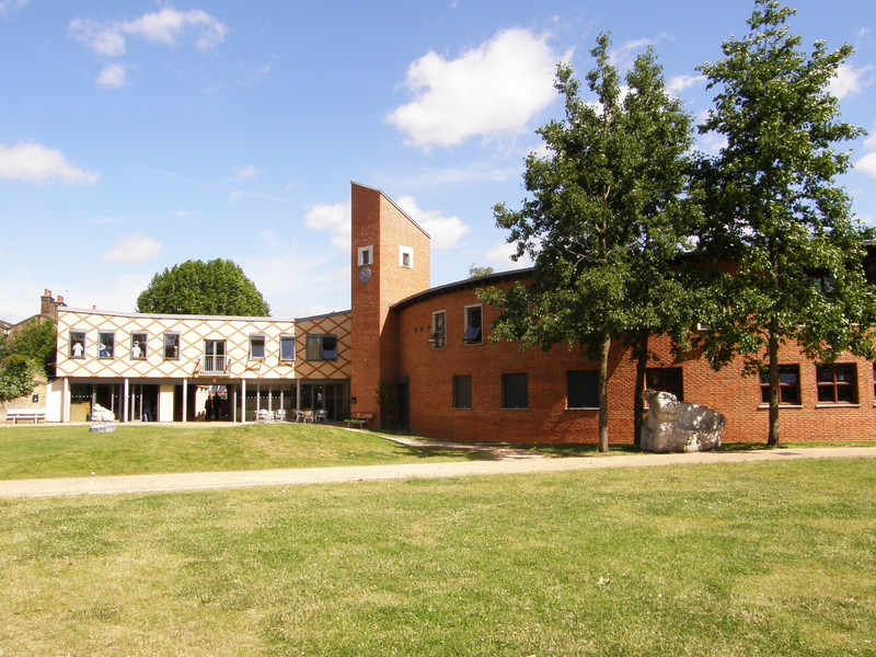
Don't panic, though, because a quick left turn down Bruce Road brings you to Kingsley Hall, and things immediately improve. Founded back in 1915 by Doris and Muriel Lester, who also ran a nursery school on Bruce Road, Kingsley Hall was set up as a 'people's house' where anyone could drop in for a chat and a bit of prayer. Indeed, such was the success of the hall that in 1931, when Mahatma Gandhi came to London for the Round Table Conference, he said he didn't want to stay in a hotel, but would come if he could live with the working classes. Muriel had stayed at Gandhi's ashram in India, so he came to stay at Kingsley Hall.
This theme of helping the community is neatly summed up by the lovely little green space behind Kingsley Hall. Bob's Park is a small place, and on the way in I smiled at a yawning street sweeper and got a bright smile back; this upbeat attitude is further personified by the Bromley-by-Bow Centre, which backs on to the park. When I walked past, the centre was busy and full of the kind of positive energy that it would be good to see in the high street, so when I think of Bromley-by-Bow in the future, I think I'll choose to remember Bob's Park, rather than the main drag.
Bromley-by-Bow station is a short walk south along the hectic A12, raised up high on the crest of the road bridge over the railway tracks. It's not a particularly lovely location for a station, and I didn't linger.
Bromley-by-Bow to West Ham
There's an underpass under the A12 near the Tube station, but although it gets you to the other side of the road, you can only turn south, which was no use for me as the District line swings north-northeast from here, a direction it maintains all the way to the end of the line (except for a small wiggle as it passes through Barking). Luckily there is another underpass a little further north, which takes you to the Tesco on the other side of the road, and then into Three Mills Heritage Area.
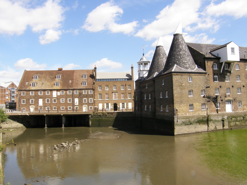
I came a bit of a cropper in Three Mills, which is a bit of a shame as I'd designed a route I was particularly looking forward to. The heart of the Three Mills area are House Mill and Clock Mill (the third mill in the name disappeared in the 16th century) which sit on the Lee Navigation in a pretty spot to the east of the A12. House Mill, with its stocky brickwork, is the largest tidal mill in Britain, though its wheels are no longer in use; the mill was built in 1776 by Daniel Bisson, and it is a Grade I listed building. Clock Mill, on the other side of the cobbled yard, has a clock tower and two conical towers in the style of oast houses in Kent (the mills were used for grinding grain before distilling it). The current Grade II listed building dates from 1817, with the clock tower dating from 1753, and between them, the two mills and the nearby Miller's House make for an atmospheric sight that's well worth the effort.
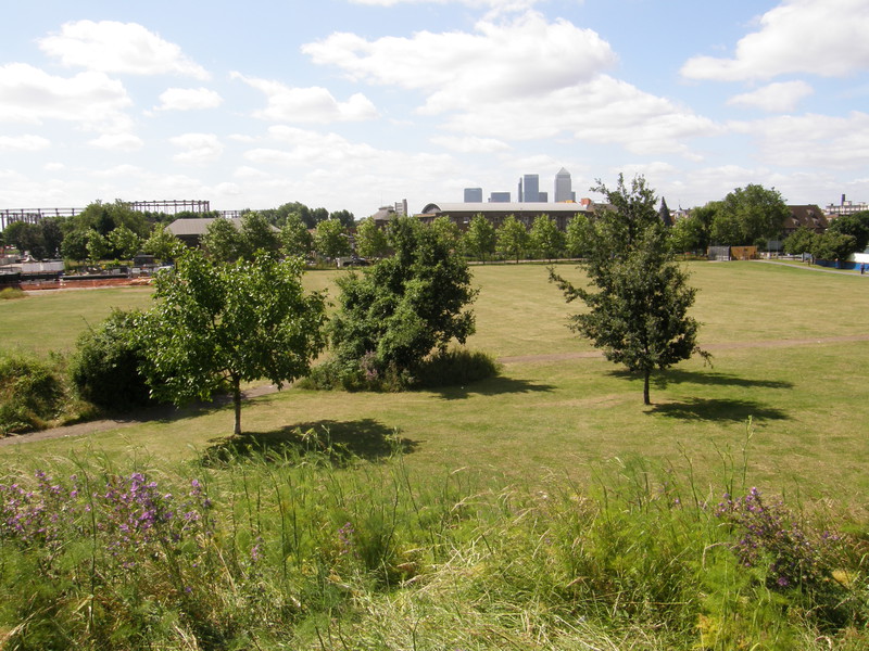
Also sharing the Three Mills area is Three Mills Studios, a dedicated film and television studio with 14 stages and more than 200 production offices. This is private property, so once you've wandered through the Three Mills area, you have to turn left towards Three Mills Green, a triangle of grass that's bound on two sides by water, and by the studios to the south. Unfortunately the southeast corner of the green is currently closed off due to engineering works on the Prescott Channel to the east, which cut off the route I'd been planning to take across Three Mills Island, past the site of the Big Brother house from series one and two, and up to the Greenway. I walked up a hill in the park to see if I could find a way through, and I poked my head into the site office to ask whether there was a way through, but finding nobody and not wanting to dither about too much, I gave up on my original plan and headed north along Riverside Road, eventually coming across the Greenway next to the Victorian Abbey Mills pumping station.
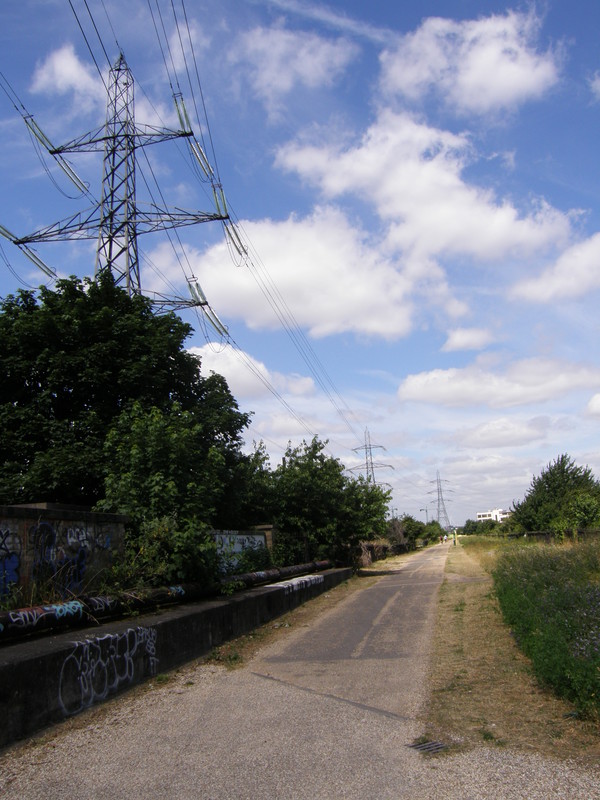
I like the Greenway. I first came across it when walking day 14 of the Capital Ring, and although it does rather whiff of sewage, it's a great walking destination. Designed by Joseph Bazalgette, who also designed the Victoria Embankment, the Northern Outfall Sewer stretches from Hackney to Beckton, where north London's sewage is treated and dumped into the sea; the Greenway is a cycle and walking track that sits on top of the sewage pipe, and apart from the strange smell every now and then (which is no worse than walking along the Thames on a hot, sticky summer's day), it's a lovely way of walking through east London, high up above the surrounding suburbia.
The Abbey Mills pumping stations are an impressive sight, particularly with Canary Wharf peeping through in the background. The Grade II*-listed Station A is right next to the Greenway and dates from 1868, and was built in an impressive Byzantine style that earned it the nicknames 'The Cathedral of Sewage' and 'The Mosque in the Swamp' (the latter due to the large minaret-like chimneys that used to tower over the engine house); Station F, meanwhile, is the modern replacement that came into use in 1997, and while it's not as beautiful as its elder sibling, it's an impressive sight, with its silver slatted walls and curved roof.
Soon after the pumping stations, the Greenway crosses the Jubilee line (where I will be walking on my very last day), and just after crossing the A1011, there's an exit down towards West Ham station. The station is red brick, blocky and looks more like a bus terminal than a Tube station, a result, perhaps, of the modernisation of the station when the Jubilee line extension came through here in 1999. It does have some shops, though, which proved a handy refreshment stop on such a hot day.
West Ham to Plaistow
For this section, I stayed on the Greenway, enjoying good progress along the flat and straight path. Looking over your shoulder back towards the City is a great game, as the skyscrapers of Canary Wharf stand as a backdrop to suburban views, railway lines, parks and, just before the turn off towards Plaistow, the East London Cemetery, though all you can see of the latter are a few half-glimpsed graves through the trees.
Turning left from the gentle walking of the Greenway into Plaistow (pronounced 'Plaa-stow') is a bit of a shock, as this is high-rise territory, and to be honest, it isn't terribly inviting. Plaistow Road station is a short walk west along the busy Plaistow Road, perched on top of a bridge over the railway line (a common configuration for stations along this part of the District and Hammersmith & City lines). The ticket booking hall is a listed building and dates from 1905, but that doesn't manage to make Plaistow any more delightful; on a positive note, though, Plaistow is currently going through extensive urban renewal, with the older council estates being replaced by new social housing, and the Olympics in 2012 should help too. I hope it does.
Plaistow to Upton Park
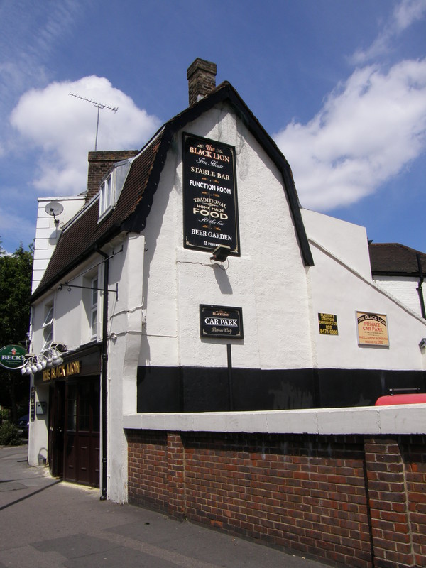
The short walk down from the station to the Black Lion pub is pretty forgettable, but at the Black Lion things start improving. Reputedly a favourite haunt of Dick Turpin, the Black Lion is Plaistow's oldest pub, and you can still see the entrance to the courtyard that coaches would have driven through, all those years ago.
Another interesting spot is along Richmond Street, just off St Mary's Road, where Old St Mary's Graveyard still contains a few old graves in the corner of a leafy urban park. When I visited, it was mainly being used as a place to shout loud swearwords into one's mobile phone, but photographs don't capture screeched obscenities, and it's not a bad-looking park, with a large children's playground. The childhood theme continues a few roads later, after passing a pub done up in the West Ham colours of claret and sky blue, as the path slips between two school playgrounds. Schools are a great way of getting to know an area's ethnicity, and the Borough of Newham (which covers West Ham, Plaistow and East Ham on this part of the Tube) is, according to 2005 figures, the most ethnically diverse borough in the whole country, with 39 per cent of the population being White, 33 per cent being Asian (mainly Indian, Pakistani and Bangladeshi), and 22 per cent being Black (mainly African). The borough also has the second-highest percentage of Muslims in Britain, at 24.3 per cent. Not surprisingly, the school yard reflects this diversity, though there's no difference in the amount of joyous noise made by kids, wherever you are, and taking a path between two different schools, both of them enjoying a lunchtime break, is quite the experience.
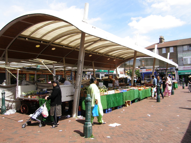
The happy cultural mishmash of Newham is even more evident as you approach Upton Park, and specifically Queen's Market on Green Street. It's great fun, and it's well worth wandering through the market, if only to soak up the bright colours, interesting smells and unashamed tack of the market stalls. The main road is equally vibrant, and after the slightly downbeat tone of Plaistow, I loved Upton Park; people cross the road here in the same way they do in Asia – without even glancing at the traffic, in other words – and when the crowd surges, you do too. It's the next best thing to being in the Indian subcontinent, and that's a real compliment, believe me.
Upton Park to East Ham
From the station, I headed east along the backstreets to Plashet Grove, where rows and rows of late Victorian terraced houses stretch past churches and mosques. The borough's image might be tarnished – in a 2007 study carried out for a Channel 4 programme, Newham came out as the fourth worst place to live in Britain, after Hackney, Tower Hamlets and Merthyr Tydfil – but in the strong midsummer sun, this doesn't feel like a deprived part of the borough. Some parts on this tubewalk, like Bromley High Street and the Plaistow Road, look like they're feeling the strain, with boarded up shops and front gardens doing a convincing impression of landfill, but along Plashet Grove it feels as if there's much more pride in the community; after all, it doesn't cost money to sweep your front yard, just effort, and effort is free, even in the most deprived areas.
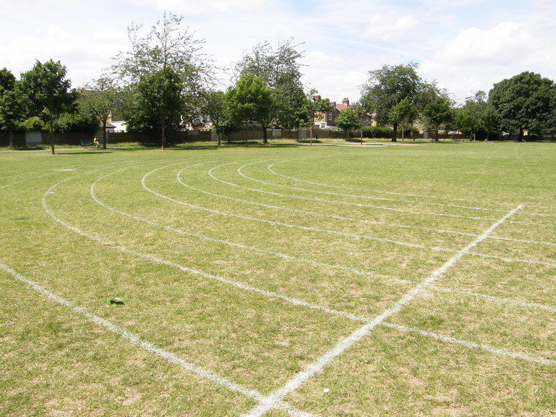
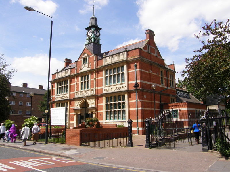
Plashet Park is a pretty and very open space to the north of the road, whose southern entrance is marked by the impressive Passmore Edwards Public Library building, now used as Newham Registry Office. The park itself is large and airy, and even has a zoo, which has been home to all sort of animals, including goats, ponies, wallabies, llamas and Vietnamese pot-bellied pigs.
Just down the road from the park – past a girls school where the large number of headscarves again demonstrates the diversity of the local population – is East Ham High Street, where an iron portal over the road welcomes you to the town centre. The high street is full of small, local shops, and has a completely different feel to the clinical brand names along the high streets of Hammersmith or Ealing. East Ham station was opened by the London, Tilbury and Southend Railway in 1858, though the District Line service didn't start until 1902; this is perhaps not surprising, as when the railway was opened, the area was described as a 'scattered village', something that's hard to imagine just 150 years later.
East Ham to Barking
East Ham is separated from neighbouring Barking by the twin barriers of the North Circular Road and the River Roding, which can be reached from East Ham via the long, straight Burges Road. The road is lined with terraced houses, with the side streets packed with yet more terraces, and even though the area could perhaps do with some more trees to provide shelter from the hot sun, there's nothing obvious to point to deprivation, apart from the large number of satellite dishes, which always seem to thrive in poorer areas.
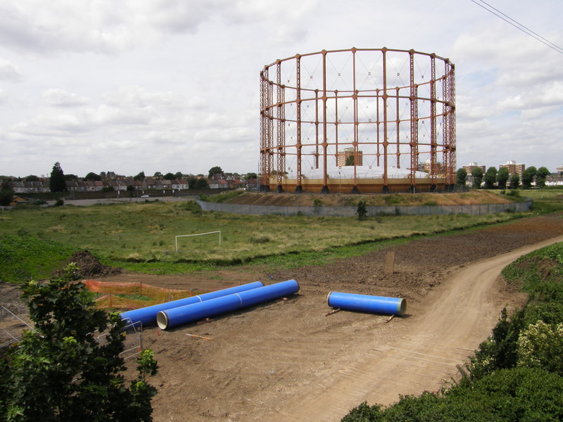
The throbbing North Circular is past a large gas tower (which was running on empty as I wandered past, perhaps not surprisingly given the current fuel crisis). On the other side are large industrial units selling storage space and building supplies, and the road weaves past a huge Wickes and a large Tesco before crossing the River Roding and arriving at Barking. This is no longer Newham (it's the borough of Barking and Dagenham instead), but in terms of deprivation, the centre of Barking is still ranked among the bottom 10 per cent in the country, and although it's not a horrible place by any means, it could benefit from a bit of urban renewal. When I visited, the centre of town was given over to a large market, which seemed mainly to specialise in cheap clothes and unidentifiable things made from brightly coloured plastic, but it was buzzing and busy, and that made Barking a pleasant place to wander through.
Barking station is nothing to shout about, and it signals the eastern terminus of the Hammersmith & City line; from here to Upminster, the District line flies the London Underground flag on its own.
Barking to Upney
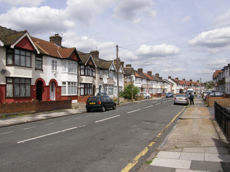
There isn't much between Barking and Upney except for suburbs, and they stretch on and on into the distance, like an urban equivalent of Route 66 crossing the American desert. Side streets turn off Salisbury Avenue at right-angles and disappear in a similarly straight fashion into the horizon, and along the sides of every stretch of roadside are endless terraced houses, all of the same basic design. Apart from some notable side streets, there are hardly any trees along the pavement, and when the sun is beating down on the back of your neck, the place feels like an oven; in west London, there are trees everywhere, and you take them for granted, but when they're missing, you really notice it. With trees, this would be a lovely place to explore; as it is, it's pleasant enough, but the roads do stretch a long, long way, and it's quite a trek to Upney.
Upney station is, like a lot of the stations along this stretch of line, perched on top of a bridge over the railway line, and as such it's not a terribly picturesque location. The station building is a squat and unimaginative brick affair, built in 1932 with none of the flair that, say, Charles Holden was applying to the likes of Chiswick Park in the same year, but you can't win them all, I suppose.
Upney to Becontree
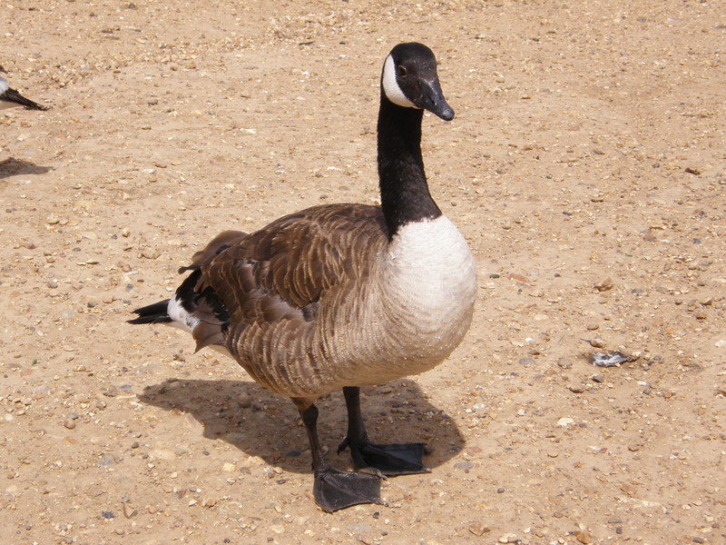
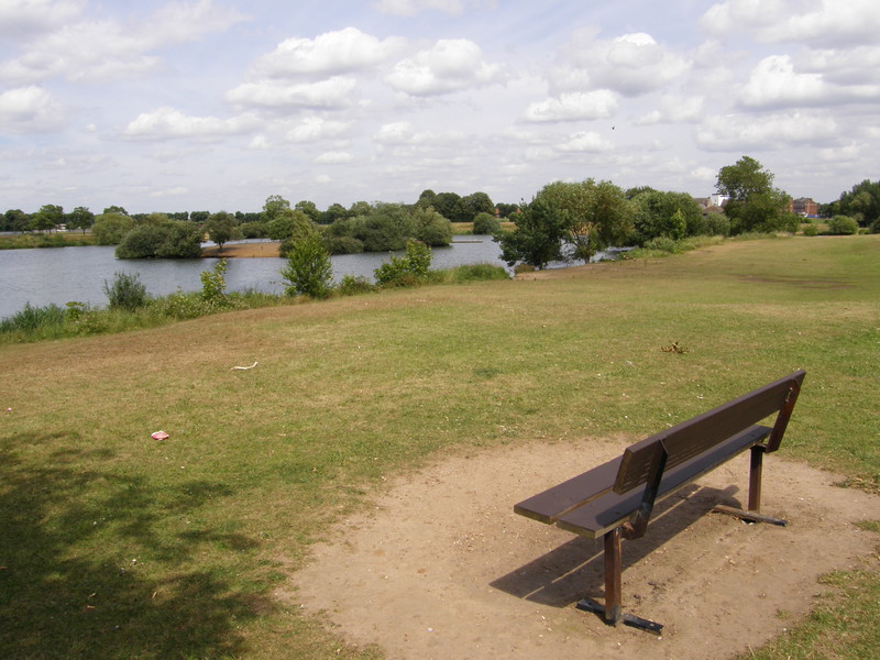
The designers of east Barking could learn a thing or two from the people who built The Drive, the road that leads from Upney Lane to Mayesbrook Park. Smothered in trees and bushes for the whole length of the road, and with neatly formed shrubbery beds at each end of the road, it's so much more enjoyable to walk down than the dry, desert plains of Salisbury Avenue, and it makes a suitable entrance to Mayesbrook Park. This wide, open space has two large lakes, a friendly local population of Canada geese, and locals who apparently bring their dogs here to fight (followed, interestingly, by the locals themselves fighting, proving that dog owners look and act just like their dogs).
The park denotes the switch from zone 4 to zone 5, a boundary that I always feel marks the end of London and the start of the home counties (though geographically this isn't the case, as Greater London generally stretches to zone 6). The wide open expanse of Mayesbrook Park certainly feels more rural than urban, though the suburbs after the park are fairly indistinguishable from the suburbs of Barking, so I guess the difference is all in my mind. Certainly, at the eastern edge of the park lies the Roundhouse, a pub which scores 2.2 out of 10 on the Beer in the Evening website, with typical comments from readers being 'Scarier than hell on a hot day' and 'Deep Purple played here in 1962 [and] it's been going downhill ever since.' This is a shame, because tucked around the back of the Roundhouse is Bragg Close, a small street named after Billy Bragg, the Bard of Barking. Somehow I think he deserves better than being stuck next to a pub that, according to one critic, 'has always got at least one broken window – enough said, I think!' Perhaps this is still London, after all.
It's another long suburban road to Becontree station, but at least the houses have a bit more breathing space here, with semi-detached housing taking over from the terraces every now and then. The station is again perched on top of a bridge and has the same blocky look as Upney; it'll be interesting to see if this theme continues to the eastern end of the District line, just one more day's walk away.