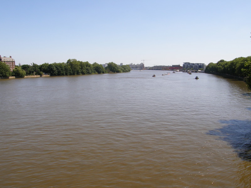
There were two themes to this walk today: the first was money, and lots of it; and the second was sun, and lots of it. Both of them are quite exhausting when stretched out along an entire 12.5-mile walk, but wow, the photographs are really something, especially when you consider that in this fierce sunlight, I've only been able to take north-facing pictures for most of the day.
I was joined for the Wimbledon to Fulham Road section of today's walk by Jez, a mate of mine from university days whom I haven't seen for years, and as always, company made the miles fly by. I almost felt guilty stopping us in our tracks to take yet another photograph, but the architecture of southwest London is simply stunning, and it would be a crime not to capture it under such perfect blue skies. I've walked around this part of London quite a bit, but I've never connected all the different parts into one walk, and I can safely say that walking from Wimbledon to Edgware Road is an education in desirable residences that comes as a bit of a shock after walking the eastern end of the District line. Wimbledon and Upminster might be connected, but you'd never guess it.
Wimbledon to Wimbledon Park
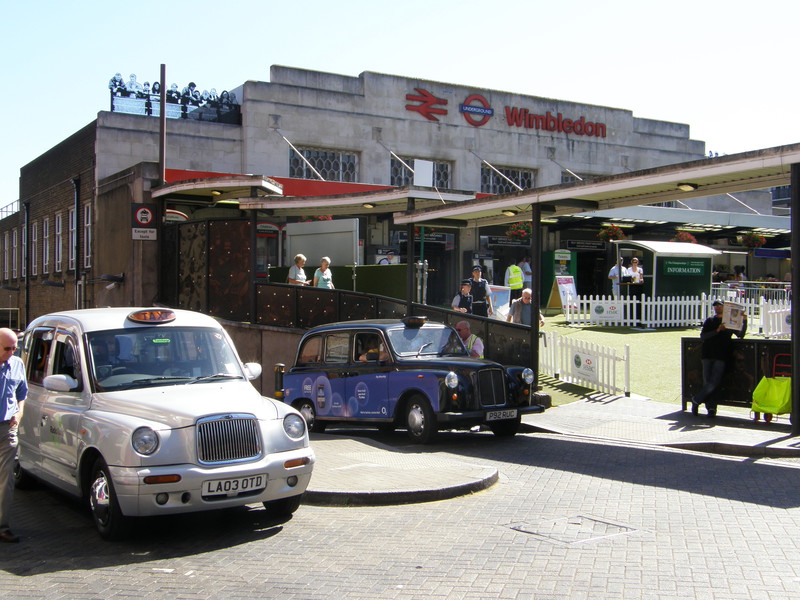
While I was waiting for Jez to negotiate the Tube to Wimbledon, I thought I'd take a few photographs of Wimbledon station, so we could set off as soon as he arrived. This is the first week of the Wimbledon tennis championships and the forecourt of the station is all done up in AstroTurf, with a large-screen Wii tennis game to occupy the crowds of people spilling out of the station, and a queueing system that looks rather like the line for a sheep-shearing station, albeit a really rather posh one. Because of this, security is predictably tight at Wimbledon station (even though the nearest Tube station to the tournament is actually Southfields, a couple of stops up the line), so I wasn't particularly surprised to be accosted by a couple of police officers – one of each sex, naturally, this being Wimbledon – who asked me why I was taking photographs of the station.
I gave them my usual spiel about walking the Tube for charity, and they smiled and said that was really quite cool, but then the policeman pulled out a pad and started scribbling. 'We've got to fill in a stop and search form,' he said, slightly sheepishly, and asked me for my name, address, date of birth and ethnicity while his colleague called in on her walkie-talkie, asking whether 'Mike Oscar X-ray Oscar November' was the name of a known criminal. Apparently it isn't, but I am now the proud owner of a stop and search form that says (and don't forget to put on a police accent when reading this):
The above male was stopped at the above location under Section 44 of the Terrorism Act as I saw him taking photographs of Wimbledon BR station. He informed us he was walking the London Tube network for charity; no further action taken.
Jez was quite impressed when he arrived, and we set off west from the station, wondering if we could collect any other forms along the way.
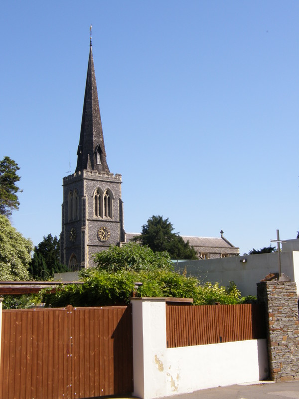
It doesn't take long to get from the busy main road in Wimbledon to the much more peaceful backstreets of Wimbledon Village. We only brushed the edge of the Village, which runs west to Wimbledon Common, but it's clearly a place where the money runs deep. Large houses sit behind tall trees, kept away from their neighbours at a good arm's length while Chelsea tractors sit on curved gravel drives, sharing a private joke with the other family cars. To cap it all, this part of the Village is crowned by a lovely English church spire, that of St Mary's of Wimbledon, which strikes into the pure blue sky like a conqueror's flag stuck into the top of the hill. It peeps out from behind the security fences, dominating the view for miles around, and along Arthur Road from the church, you come over the crest of a hill and the church's location makes sense, for on the distant horizon, away to the northeast, you can see the London skyline, with the London Eye, Battersea Power Station, Tower 42 and the Gherkin clearly visible (well, they are on a stunning day like this). Some of the palaces up here have this view from their bedroom windows; I guess that's why they cost so much.
Wimbledon Park station is a quiet little place that looks for all the world like a petite suburban cottage next to a bridge over the line. It opened on as part of the extension of the Metropolitan District Railway from Putney Bridge to Wimbledon, though the lines were actually built by the London and South Western Railway to connect this area to Clapham Junction. It feels decidedly sleepy round here, in contrast to the hectic Wimbledon station, just one stop down the line.
Wimbledon Park to Southfields
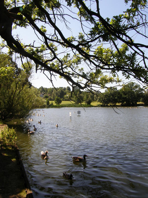
The Tube station gets its name from the park next door, a park that the Capital Ring crosses on its most glorious section, day 6. Landscaped by Capability Brown in the mid-18th century, Wimbledon Park has tennis courts and a children's play area near the eastern entrance, but the most impressive feature is the large park lake in the centre, where people come to sail and canoe among the geese and swans. It's a surprisingly large body of water, and just across the lake you can glimpse the All England Lawn Tennis and Croquet Club, which is currently hosting the Wimbledon tennis championships.
North of the lake and round the other side of the athletics stadium is the first evidence of the championships, as this is where people are allowed to camp overnight in the ticket queue; there's even a Code of Conduct for queueing pinned up on the fence, pointing out that 'queue jumping is not acceptable and will not be tolerated' and 'if you have to leave the queue, you should negotiate your position with those around you and/or a steward.' It makes you proud to be British, to see rules put down in writing that are genetically hard-wired into those of us who are born in these islands.
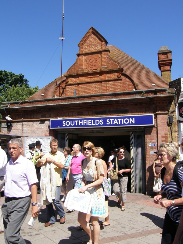
The Tube station that is closest to the All England Club is Southfields station on Wimbledon Park Road. We must have been the only people trying to head towards the station, but the crowds were terribly polite and good-natured, and even though we were swimming upstream, it was surprisingly easy, given the hordes pouring south to see the tennis. Andy Murray won a massive victory yesterday and the atmosphere is upbeat; it's probably good to enjoy it while it lasts, as, like the hot weather, it's probably too good to be true.
Determined to use the crowds to increase my chances of scoring another stop and search form, I stood resolutely in the middle of the flow, sticking out like a rock in a river as I snapped away at the Tube station, which looks very similar to Wimbledon Park, with the L&SWR lettering above the entrance and the date of 1889. But despite my best efforts, the copious policemen, who must have spotted me, didn't bat an eyelid; I guess there must be loads of people taking photos of everything round here, and if they issued a form to everyone, they'd still be processing last week's backlog; presumably here, rather than at Wimbledon station, judicious tolerance is deemed to be the best policy.
Southfields to East Putney
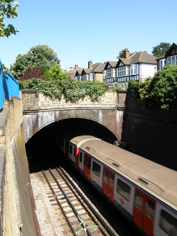
Although the suburbia between Southfields and East Putney is less mansion-esque than Wimbledon Village and a lot more semi-detached, it is still very pleasant. Striking new developments along Sutherland Grove rub shoulders with more traditional 20th-century suburbia, while the Tube line runs along a cutting, only ducking below ground for a short stretch under the A3. Mock Tudor makes an appearance at times, though on the other side of the A3, along Keswick Road, the houses break away from their neighbours to become detached again, and defiantly so. We've now crossed into Putney, and it shows; a quick scan of the Web shows that a two-bedroom penthouse flat on Keswick road can be snapped up for a measly £1.1 million, with a monthly service charge of £325 on top of that. Bring on the property crash, I say...
But Putney is a lovely place, and I am walking along the Tube line, where the most expensive properties live – if you're willing to live a walk or bus ride away from the Tube, the prices tumble pretty quickly, as away from Wimbledon, the Tube is your transport lifeline, and even a short distance brings prices down. East Putney station is tucked away on the Upper Richmond Road as Putney starts to morph into rather more affordable Wandsworth to the east; the station sits back from the road behind a covered florist's stall, its three red and yellow stone arches all but invisible from the road.
East Putney to Putney Bridge
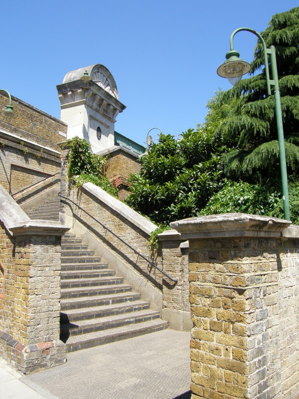
As the name East Putney implies, the Tube line actually runs to the east of Putney, leaving the main railway line to Richmond to take sole honours for having a station on Putney High Street. The Tube line crosses the east-west main line just north of Upper Richmond Road, and the bridge is visible from Oxford Road, where you can also get a good view of Putney railway station to the west. Travelling on a raised viaduct, the Tube line weaves through the lovely houses of northeast Putney, and as you walk north along Oxford Road, the side streets to the east are spanned by iron bridges, all the way to Deodar Road, whose houses back on to the river.
Most people cross from Putney to Fulham via Putney Bridge at the northern end of the high street, but there's a less-known pedestrian walkway along the eastern side of Fulham Railway Bridge, the eight-span girder bridge that carries the Tube across the Thames. Dating from the opening of the railway in 1889, the walkway gives expansive views of the Thames to the east (though the railway line blocks views of Putney Bridge to the west). We crossed at high tide, and the river looks absolutely massive from this vantage point; if you squint, you can just make out the next bridge along, Wandsworth Bridge, but it's right at the edge of your vision.
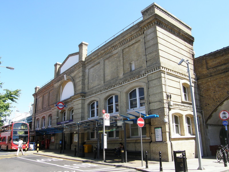
Over the river, on the far bank, are some deeply impressive mansion blocks that we'll walk past in the next section, and once across, it's a short walk under the arches to Putney Bridge station. The station is actually built into the arches of Fulham Railway Bridge, but it is named after better-known Putney Bridge to the west. Interestingly, the station isn't even in Putney, for we're now in Fulham, and north of the river; crossing the river on a tubewalk is always cause for celebration, as only 32 Tube stations out of a total of 277 live south of the river, and that's including four stations on the East London that will soon be incorporated into the London Overground, leaving just 28 south of the river. Six of these are on the District line, with the rest on the Northern, Victoria and Jubilee lines, so enjoy the south London tubewalks while you can, as there aren't many of them...
Putney Bridge to Parsons Green
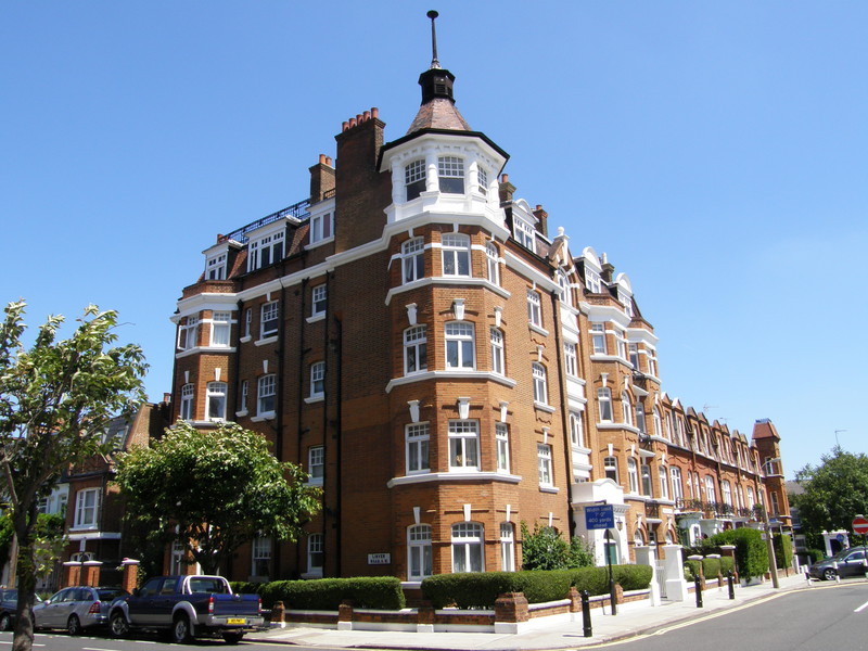
If you thought the architecture of Wimbledon and Putney was impressive, then wait until you see the mansion blocks of Fulham; they are deeply imposing, and I would have more photographs of them if the sun hadn't been in completely the wrong place for decent photography. Instead we slunk along Ranelagh Gardens in the shadows of the 1930s mansion blocks of Rivermead Court (where a four-bedroom flat can be snapped up for a measly £1.8 million), while on the opposite side of the road even the modern blocks manage to look great, with window boxes draping their greenery in pleasant contrast to the light brown brickwork.
At the end of the street is the Hurlingham Club, an exclusive sports club that is frequented by the kind of people who snap up four-bedroom flats in Rivermead Court for breakfast; the waiting time for membership is currently over 15 years, and there's no access for the likes of you and I, at least not until we find fame through the pages of Hello! magazine. Instead, turning north on Napier Avenue and east along Hurlingham Road takes you past the football pitches of Hurlingham Park (which is open to the public) and past yet more astonishingly pretty mansion blocks and terraces. This is Parsons Green, and yet again, money is everywhere.
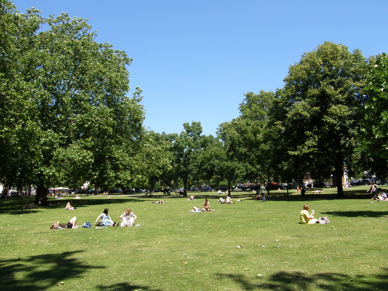
Perhaps the best illustration is the White Horse pub at the northern end of the green (where, incidentally, women happily sprawl in skimpy bikinis in weather like this, topping up their already impressive tans, but without having to pay by the hour). Known in its 1980s hey-day as the Sloaney Pony, it is a lovely pub with a small beer garden out the front, where Jez and I stopped for a cold beer and a natter, while the frankly beautiful women of Putney sailed past in their tiny summer dresses, on the way to spend an afternoon shopping on the King's Road, or perhaps to share a coffee with all the other yummy mummies while their nannies look after young Tarquin and Gwynnie back at home. With the scorching sun in the blue sky above and queues of eye-goggling beauties wandering along the road, it felt like being on holiday somewhere exotic; I had a continental lager to celebrate, as even I can't manage real ale in this temperature.
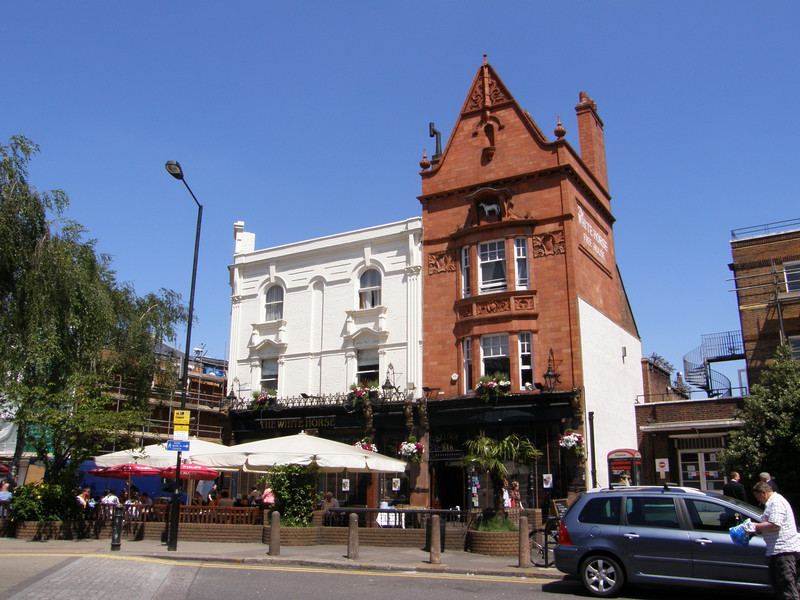
However, the summer dresses aren't the give-away that Parsons Green is a bit pretentious; no, it's the names for the White Horse's toilets, which aren't marked 'Men' and 'Women', but 'Pistols' and 'Dolls'. This is, apparently, a reference to Shakespeare's Henry IV Part 2, in which Pistol is a friend of Falstaff, and Doll Tearsheet is a whore in the Boar's Head Tavern. Whatever the reason, I had to think twice before picking my door, and frankly, I could do without that kind of crap in a pub. It's a good job the rest of it is so enjoyable...
Parsons Green station is just along the road from the pub, hiding just to the south of the railway bridge over Parsons Green Lane. It doesn't have any pretensions, but then, the Tube is a great leveller.
Parsons Green to Fulham Broadway
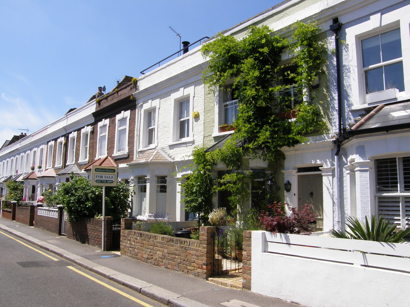
Fulham Broadway is not far from Parsons Green, and the back route along the south of the Tube line is by far the most pleasant way of connecting the two (the alternative, the Fulham Road, is busy and rather less pleasant). Heading east from the station, Novello Street is a treat, with a whole terrace of pastel-shaded cottages leading to the nearby Walham Green. There's a primary school opposite, which nicely ticks the box marked 'cachement area', and on a sunny day this looks like a little slice of paradise, but because the Tube line runs along the back of the gardens, houses here typically go for more than £150,000 less than an equivalent elsewhere in Parsons Green (though a three-bedroom house on Novello Street will still set you back £850,000, so the entry requirements are not a great deal lower).
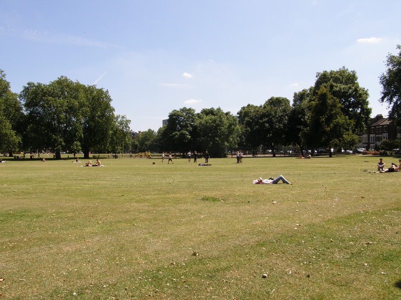
Walham Green at the end of the street is another pretty urban park where stripping off to one's sunbathing attire is clearly compulsory in this weather, and the houses beyond the green are just as eye-catching, with some delightful terraces overlooking the park. It isn't far to Fulham Broadway, though, where traffic and busy shops take over, and it perhaps is no surprise that the entrance to Fulham Broadway station is buried deep in the Fulham Broadway Shopping Centre, with the old street-level station, which was closed in 2003, now housing a TGI Friday's restaurant. Here I sadly had to leave Jez, who had to head back into town for a prior engagement, and I struck out for Edgware Road on my own.
Fulham Broadway to West Brompton
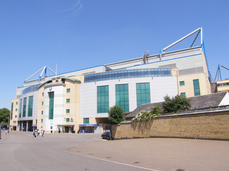
The most dominating feature along Fulham Road is Stamford Bridge Stadium, home to Chelsea Football Club. Stamford Bridge has been the home to Chelsea since the club's formation, and indeed the club was founded because the owners of the stadium offered it to Fulham Football Club but were turned down, so they decided to form their own club to make use of the stadium. Thus Chelsea Football Club was founded on in the Rising Sun pub (now The Butcher's Hook) opposite the Fulham Road entrance to the stadium, and they've since gone on to be one of the top clubs in the world.
The stadium is a massive and very modern-looking building, occupying a large corner of ground between the District line to the north and the London Overground line to Clapham Junction to the east, though in this age of health and safety regulations, the fact that fans can only enter the stand via the Fulham Road entrance is problematic, restricting ground capacity to about 50,000 (compared with a capacity of 100,000 when the ground was first opened). The club plans to expand capacity, so you can expect the stadium to become even more imposing in the coming years.
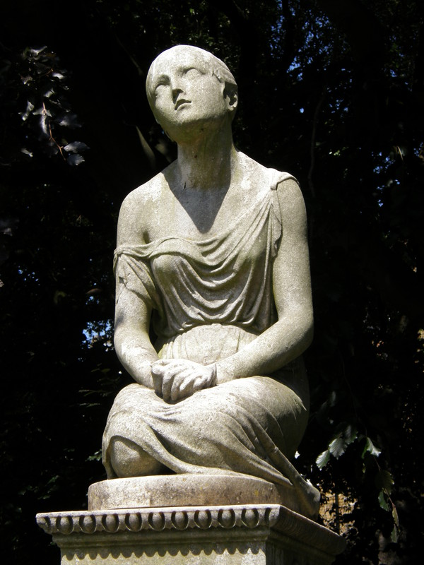
It's apt that on the other side of the London Underground line from this huge cathedral of football is a graveyard, and Brompton Cemetery is a fascinating place to explore. It's one of the 'Magnificent Seven' cemeteries built after an 1832 act of Parliament encouraged the establishment of private cemeteries outside London, to cope with the population of the city more than doubling and the consequential lack of burial grounds (the other six cemeteries are Kensal Green, West Norwood, Highgate, Abney Park, Nunhead and Tower Hamlets). Dating from 1840 onwards, the graves in Brompton Cemetery are impressive, despite (or perhaps because of) their large numbers; there are over 35,000 of them, packed in among the cemetery buildings. The locals use the cemetery as a local park, even bringing in deck chairs to soak up the rays among the graves, and with its formal layout and impressive Basilica-styled chapel at the end of the central tree-lined avenue, you can see why. Even more entertainingly, Beatrix Potter used to live nearby (incidentally, she lived just round the corner from where Diana Spencer lived before she married Prince Charles), and it is said she took the inspiration for a number of her character's names from graves in Brompton Cemetery; though most of them have now disappeared into the undergrowth, the records show there are graves here for the likes of Jeremiah Fisher, Mr McGregor, Mr Nutkins, Mr Brock and Peter Rabbett.
West Brompton station is to the west of the main cemetery gate, along Old Brompton Road. The station was opened in 1869 by the Metropolitan District Railway as the terminus and only station on the extension from Gloucester Road to West Brompton (Earl's Court station would be added as an intermediate station a couple of years later, in 1871). In this sense, West Brompton was the vanguard of the extension work that would link southwest London into the Tube network, thus creating the District line we know today.
West Brompton to Earl's Court
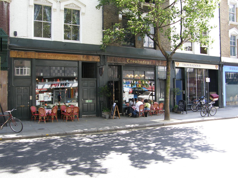
It isn't far from West Brompton to Earl's Court, but if you head east along Old Brompton Road, you pass two seminal London landmarks: the Troubadour Club and the Coleherne pub.
The Troubadour was founded in 1954 as part of the renaissance of the London coffee house; coffee houses had originally been popular in the 17th and 18th centuries, but they went into decline in the first half of the 19th century, and only made a comeback in the heady social upheaval that started in the 1950s and continued on throughout the 1960s. The Troubadour was arguably one of the centres of London intellectual life: it was here that Private Eye was first produced and distributed; early Ban the Bomb meetings were held here, which would lead to the formation of CND; the Black Panthers met here in 1968 after the Paris riots; and it was here that Bob Dylan first played in London. It also hosted gigs by Jimi Hendrix and Paul Simon, and Led Zeppelin would come and jam here after their gigs in Earl's Court. It's still going strong, with an expanded downstairs venue and an upstairs restaurant.
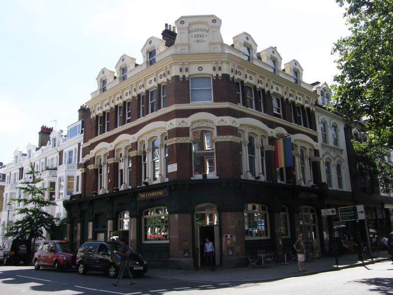
Next door to the Troubadour is an equally seminal venue, though perhaps for a different meaning of 'seminal'. The Coleherne can lay claim to be London's most famous gay pub, and it was certainly one of the first, as it's been plying its trade for over 30 years. It was mentioned in Armistead Maupin's Babycakes – the first work of fiction to acknowledge the arrival of AIDS – as well as the Stranglers' song 'Hanging Around' ('I'm moving in the Coleherne/With the leather all around me/And the sweat is getting steamy'). It was also infamous for being the stalking grounds for three different serial killers: Dennis Nilsen (whose houses I'll be brushing past on the Northern and Jubilee lines), Michael Lupo and Colin Ireland. My girlfriend used to meet her female friends here in the early 1980s, as it was one of the few pubs you could go into as a woman without the local drunks leering over you as you sipped your Babycham. Thankfully, things have moved on, and the Coleherne is just one of many gay pubs, but you could say that this is where it all started...
Earl's Court station is up Earls Court Road, past some busy shops, some equally busy traffic and a whole sequence of impressive mansion blocks built in distinctive red brick. The original station dates from , when it only occupied this, the eastern half of the present building; the western half opened on , to serve what is now the northbound line to Kensington (Olympia), but which back then was part of the Outer Circle. The entrance on Earls Court Road dates from 1915 and was designed by Harry Ford, who also designed the similarly styled station at Barons Court.
Earl's Court to High Street Kensington
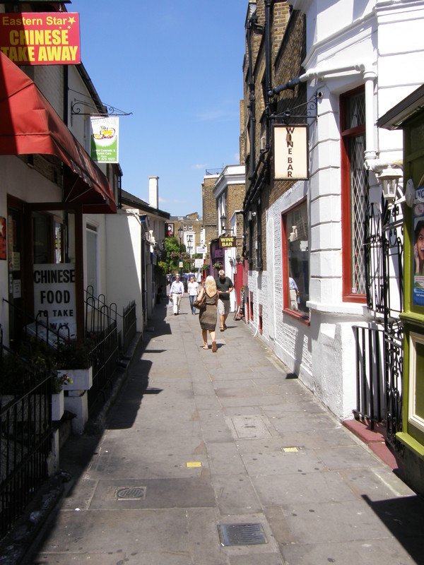
On the opposite side of the road to the station is Hogarth Road, and just down here, on the left, is Hogarth Place, a cute little pedestrianised street that's home to two wine bars, a pub, an estate agent and a handful of restaurants and shops. It leads into Kenway Road, a quiet place with a whole row of local shops and some attractive terraced houses.
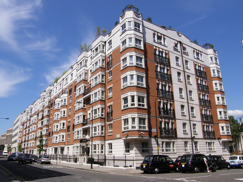
The architecture steps up a gear on the other side of Cromwell Road, with the pure white Victorian terraces of Abingdon Villas and Scarsdale Villas sitting comfortably next to more modern developments that happily manage to be sympathetic to their surroundings. One property in Scarsdale Villas is regularly used for 'stars at home' features in Hello! magazine, and it was once let out to U2 for two months when they toured Europe, so their families could have a proper home while the boys hit the stage. It's that kind of area, though interestingly, because the area is so full of terraces that have now been split up into flats, Kensington is part of the most densely populated local government district in the UK (or the Royal Borough of Kensington and Chelsea, as it's known). Walking along the backstreets, you can see why, though it's a long way from the 'pack 'em in' image the statistic might imply; this is crowded urban living, Kensington-style.
High Street Kensington station is just to the right along Kensington High Street, and like Fulham Broadway, the station is buried deep inside a shopping centre, some way from the road entrance. This western stretch of the District line was originally part of the Metropolitan line, rather than the District line, the two different lines being run by two very separate companies who often refused to do business together. The extension to the original Metropolitan line from Paddington through High Street Kensington to Gloucester Road was opened in 1868, thus completing the western half of what we now know as the Circle line (though the circle wouldn't be squared until 1884, when Aldgate and Tower Hill were finally connected after lots of squabbles and a very expensive bit of engineering beneath the City).
High Street Kensington to Notting Hill Gate
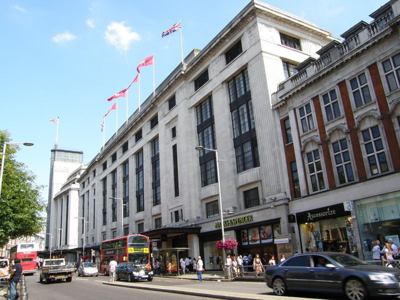
Kensington High Street is a busy place, and if you're not interested in the shops, it isn't a place to hang around, though the escape out of the chaos is enlivened by the impressive Barkers building, the former Derry and Toms building (on top of which you can find the largest roof garden in Europe, the Kensington Roof Gardens), and the fine Victorian Gothic St Mary Abbots Church, which dates from 1872.
Respite from the madness is only a short walk away, in the form of Kensington Gardens (which is effectively the western section of Hyde Park). Another popular spot for sun worshippers, the park is dominated by Kensington Palace, a residence of the Royal Family since the 17th century that is probably most famous for being Princess Diana's official residence until her death in 1997. It was outside the palace's gates that mourners created an ad hoc memorial of flowers that soon became known as the Field of Flowers.
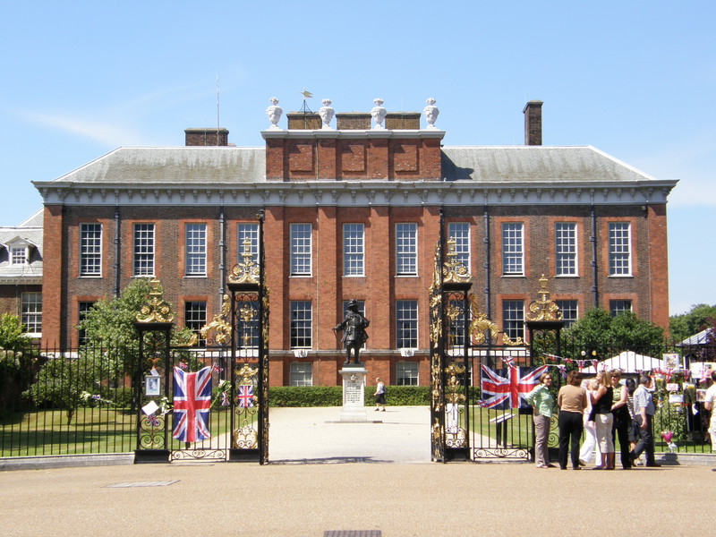
Flanking the palace to the west is Kensington Palace Gardens, the most exclusive residential street in London (it isn't known as Billionaires Row for nothing). Irritatingly, photography is forbidden along the entire street, mainly because the road is home to a number of terrorist targets such as the Israeli and Russian embassies, so I can't show you just how impressive the Queen Anne-style mansions along the southern section are. The more Italianate buildings along the northern stretch are less impressive but still feel steeped in money and power, and although it's a desirable residence, I couldn't help feeling a bit unwelcome. I'm sure this is the point; if I was rich enough to live here, I wouldn't want spotty Herberts like me poking their noses into my life, either.
At the top of Kensington Palace Gardens lies Notting Hill Gate, and the wide expanse of the A40. Notting Hill Gate station is completely subterranean, the only evidence of its existence being the four subways down to the station entrance under the main road.
Notting Hill Gate to Bayswater
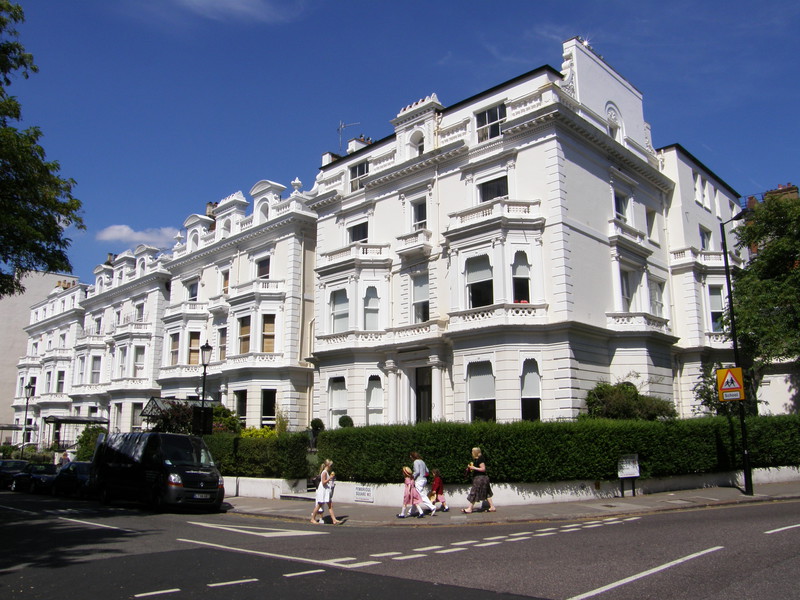
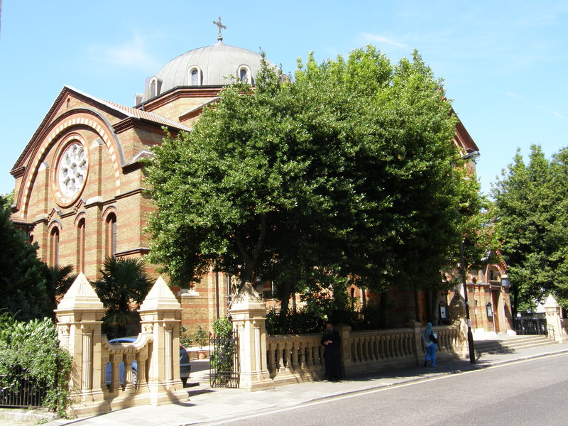
The white Victorian terraces of Notting Hill positively glow in the strong sunlight, and a walk along Pembridge Gardens and into Pembridge Square is an exercise in spotting snippets of ornate stucco through the thick trees. Equally well hidden is the Greek Orthodox St Sophia's Cathedral on Moscow Road; during World War II the Greek government ruled in exile from London, and St Sophia's became the cathedral of the entire Greek nation until Greece was liberated. It's of a Byzantine design, and is hidden from the road by trees, so you can only see the distinctive dome from certain angles.
Bayswater station is a little further along the road, on Queensway. As I approached the station, I spotted a couple of vested policemen loitering in the lobby, and aware that I'd probably be stopped and searched if I started taking pictures of the station, I thought I might help them along a bit. So I wandered up to the nearest Bobby and told him I was walking the Tube for charity and taking photos as I went, and every time I tried it in the vicinity of the Police they stopped me... so could I have permission to take a picture of the station without being questioned?
'That should be OK,' he said, 'but let me just check with my colleague, as we're in the middle of an operation.'
'OK,' I said as he went off to explain things to his companion, who glanced over to me with a look I'm getting used to, that of the establishment looking someone up and down, and concluding that they're harmlessly insane.
'That's fine,' said the officer on his return, 'but just one, OK?'
'Thanks,' I said, 'I'll be over the other side of the road,' and with that I popped over the pedestrian crossing and took two photographs of the station, purely because an authority figure had asked me not to. Take that, Section 44 of the Terrorism Act!
Bayswater to Paddington
My sense of direction took a bit of a bashing from the stupid stick after I left Bayswater, perhaps due to a rush of adrenaline at breaking the law. I really wanted to swing through Leinster Gardens, but the roads are all north-south round here, and I spent ages zig-zagging through the stuccoed terraces of Inverness Terrace and the hotels of Queensborough Terrace, trying in vain to find the connecting side streets that would take me east. In the end, the direct route would perhaps have been better, as the only reason I wanted to take in Leinster Gardens was to see numbers 23 and 24, and in the event, there isn't much to see at all.
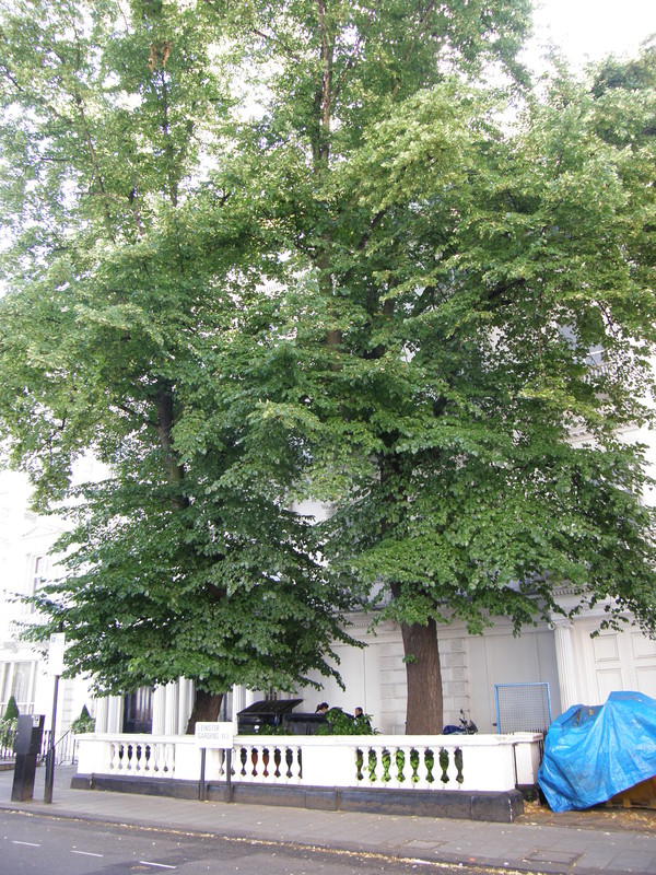
23 and 24 Leinster Gardens don't actually exist as houses, as they are simply façades. Behind them lies the Tube line from Bayswater to Paddington, and this open-air section was needed for the original steam-powered locomotives to vent their condensers, to prevent the tunnels from filling up with smoke. The Metropolitan Railway built fake frontages for numbers 23 and 24 so this process would be hidden from residents of this upmarket area, and the façades are still there today. Unfortunately there are two huge and very bushy trees bang in front of them, so after the wet spring and sunny start to summer that we've had, numbers 23 and 24 are practically invisible, and it's only by examining the windows closely that you can see they're blocked out and there's nobody home.
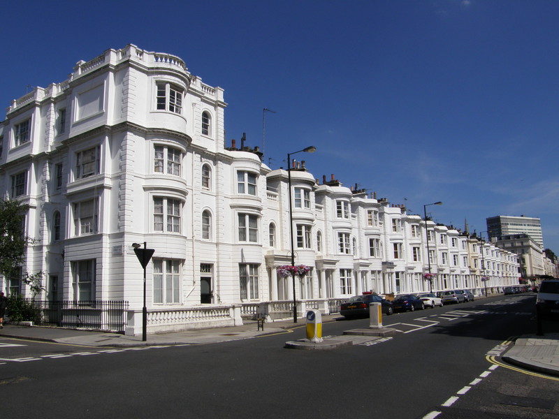
On the way to Paddington railway station on Eastbourne Terrace, you pass the 19th-century boulevards of Devonshire, Gloucester and Westbourne Terraces. The houses form long rows of stuccoed terraces, most of them four or five storeys high, and all of them built in a recognisably Georgian style (Victorian terraces had yet to replace traditional Georgian design in the early Victorian period). Bayswater was one of the most exclusive areas of its day, and it's not hard to see why; it's truly impressive.
Paddington station lies at the southern end of the railway terminus, on the southern side of Praed Street (pronounced 'Prayed Street'). This station was opened in 1868 as part of the Metropolitan Railway's extension from Edgware Road to Gloucester Road, and to differentiate it from the original Paddington underground station to the north (which is now on the Hammersmith & City line), it was originally called Paddington (Praed Street), though the latter part of the name was dropped in 1948. The original station frontage on Praed Street still has 'Metropolitan Railway' along the top of the building, just to remind us who started it all.
Paddington to Edgware Road
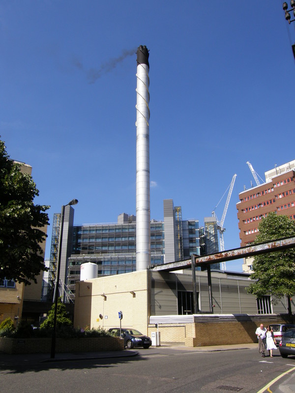
It isn't far from Paddington to Edgware Road, and to avoid repeating the Bakerloo line walk from Paddington to the similarly named but separate Edgware Road Bakerloo line station, I headed along South Wharf Road, between St Mary's Hospital and Paddington Basin. There are some interesting views of the hospital buildings, in particular the tall chimney of the incinerator and the block on the right that proclaims that Alexander Fleming discovered penicillin here in 1928 (though the laboratory where he made his discovery is actually on the other side of the hospital, along Praed Street). St Mary's Hospital is also where heroin was first synthesised in 1874; that's not a bad record for one hospital, really.
Edgware Road station is back along Praed Street, after a busy crossing with Edgware Road; here the District line ends and the Circle and Hammersmith & City lines continue east to the City. And that brings me to the end of the District line, a walk that encompasses the richest and the most deprived parts of London in one long and varied meander. I've really enjoyed it, and not just because of the amazing weather; the District line is a fascinating line to walk, and I can't recommend it enough.