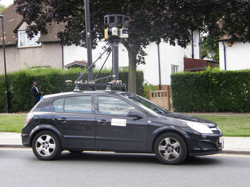
If today's walk had a theme, it was the invasion of privacy. As the sun shone down on a beautiful summer's day, I was stopped by the police and issued my second stop and search form, I was accosted by a grumpy local in Wood Green who wanted to know why I was photographing the suburbs, and to end the day with a dose of irony, I spotted the Google Street View car in Bounds Green and fired off a few photographs of him, just to redress the balance.
As for the walk itself, this is an interesting part of the world, going from the slightly run-down King's Cross and Caledonian Road areas, past the sparkling decadence of Arsenal's Emirates Stadium, around the lovely landscaping of Finsbury Park, through the pleasant terraces of Harringay and Wood Green, and right to the top of the world at Alexandra Palace. Throughout, the rich and the poor rub shoulders in typical London fashion, and on a sunny day like today, it's a great walk with some spectacular Tube stations to punctuate the miles.
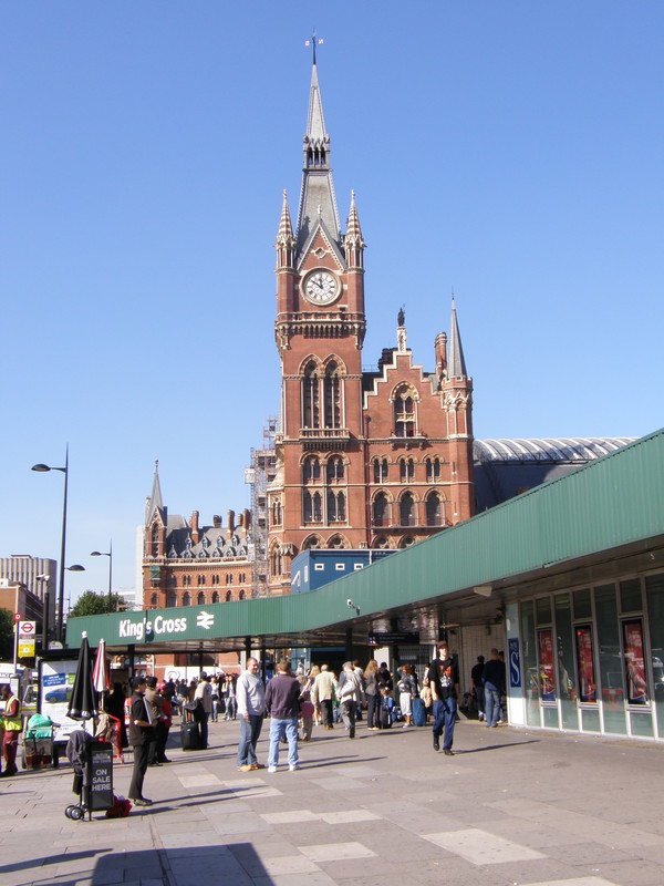
King's Cross St Pancras to Caledonian Road

The area round King's Cross is being tidied up big time, and the evidence is all along Caledonian Road. Close to the station the road is lined with glossy Tesco Metro stores and modern Premier Lodges, but as you wander away from the station, the original Victorian architecture starts to shine through, and now that the area is relatively clean, it's pleasant stuff (terraces blackened by decades of pollution are rather less attractive than the cleaned-up versions, and it's the latter that line the roads round here).
Caledonian Road is a fairly busy road, so I thought I'd explore a few of the backstreets to the east, to get a more realistic feeling of who lives here and how, and the story is a mixed one. My first steps off the main road took me through the Barnsbury Estate, which sits on the Regent's Canal as it pops out of the Islington Tunnel (I visited the eastern entrance to the tunnel on my Northern line walk from Kennington to Euston and back). It's a fairly uninspiring place, full of dreary blocks of flats and endless concrete, and as I crossed the canal, a local drunk kindly suggested I explore further down the canal, though when I asked him what was down there, he looked a bit flustered and had to admit he had absolutely no idea.
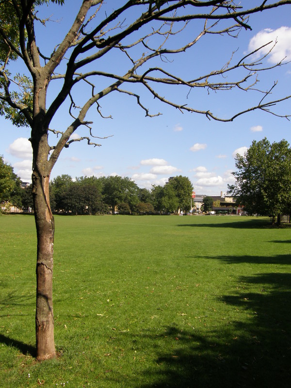
North beyond the estate is Thornhill Square, a very different proposition. This pleasant park is surrounded by Victorian and Edwardian terraces, lined in neat neo-Georgian rows among the leafy streets, and the children's playground in the middle of the park is full of young mothers and bawling kids who are obviously doing quite well, thank you very much. There's the imposing St Andrew's Church at the northern end of the park, and the delights continue along Hermington Road, all the way to the London Overground tracks.
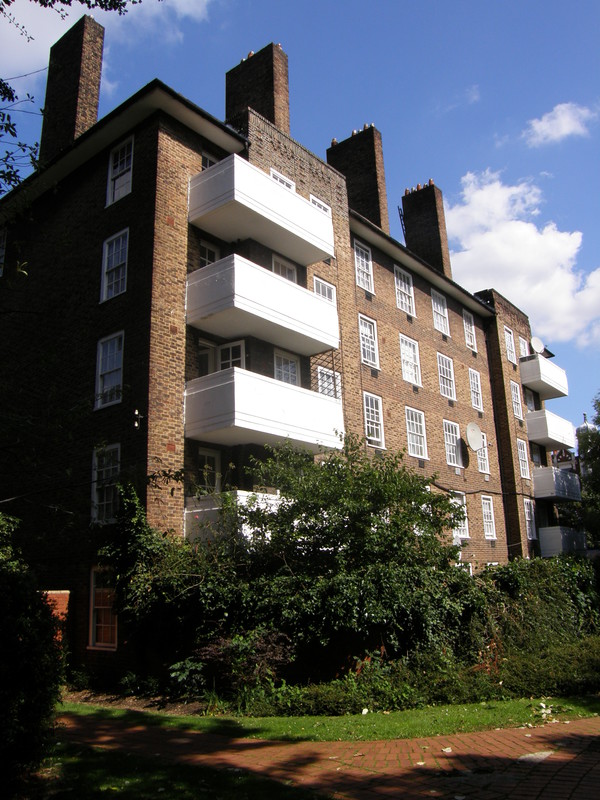
Things take a slight downturn as Pentonville Prison looms into view on the left, but you can't see a lot from this end of the prison, and there's more interesting architecture to the east as the red-brick Westbourne Estate takes over. I quite liked the architecture in this part of town, and even though Paradise Park isn't that big or remotely landscaped, it's a pleasant enough break on the way to the station.
Caledonian Road station is yet another ox-blood red terracotta Leslie Green station, standing alone on the side of the road in the same way it has done since opening in 1906, when the Piccadilly line first opened. It hasn't been built on yet, and on a day like this, the contrast of the red with the blue sky above is a wonder to behold.
Caledonian Road to Holloway Road
I designed my walking routes throughout last winter, and when I came to do this section of the line, I must have been having a bad day. It isn't possible to plan a completely reliable route using just the A-Z and Google Maps, as you simply can't tell where you'll find paths and where you'll find locked gates, but I've generally got it right, by luck more than by design. However, I must have been feeling particularly unsure of myself when I mapped out this part, as my planned route had me weaving all over the place, sticking to main roads and missing out some pretty obvious short-cuts. I originally had this leg going straight up Caledonian Road to the junction with Holloway Road, and turning back on itself to get to Holloway Road station, but I took one glance at the map on the way here and figured I'd try a more direct route through Stock Orchard Crescent.
It worked, though only just. I passed round the back of the Stock Orchard Estate and into Quemerford Road, hoping to pop out onto Holloway Road just north of the railway bridge, but it took quite a bit of poking around before I found a way through the estate on Pollard Close. The path to the road isn't marked on any map, but that's the way the cookie crumbles; I simply marked it on my printed map as needing correction on my return home, so the route you see here is the shorter route, with all the dog-legging removed.

Holloway Road station is another Leslie Green station, but the traffic is even crazier on Holloway Road than Caledonian Road, and it's rather hidden behind all the bendy buses and white vans that chug through this part of the world. There were plans to modernise the station to cope with the huge numbers of visitors to the nearby Emirates Stadium, but the cost of replacing the lifts with escalators came to a whopping £60 million, and the plans are now on hold; instead, the station closes or becomes exit-only on match days.
Talking of escalators, one of the two lift shafts in the station was used for an experiment by the inventor of the escalator, Jesse W Reno. He built a spiral escalator in 1906 that fitted in the lift shaft – which would have made adding escalators to existing stations much easier than adding the kind of escalator we know today – but the experiment failed and spiral escalators never made it to the Underground.
Holloway Road to Arsenal
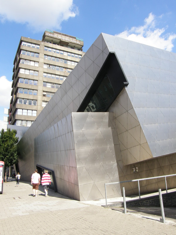
Yet again, I got hit by the stupid stick when planning this part of my walk. If I had my time again, I'd head straight to the Emirates Stadium by going down Hornsey Road just opposite the station, but when I planned this route, I decided to head south down Holloway Road to take in the campus buildings of London Metropolitan University, and in particular Daniel Libeskind's 2004 structure for the Graduate Centre. It's best appreciated from the west side of Holloway road, which I'm afraid I didn't find myself on, and it's not the kind of road you just pop over, so I had to make do with straining my neck to get a good look. It's worth the effort, though, as it is made from three intersecting rectangular blocks clad in stainless steel and looks completely unlike any other building I've seen on my tubewalks. Pictures of the interior of the building look fascinating – everything is irregular and at strange angles – though it isn't open to the public, so you can only guess from the outside what's going on behind the steel frame. The fact that it sits at the feet of one of the university's drab concrete tower blocks only highlights how exciting the architecture is.
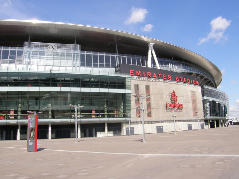
I probably should have doubled back to the stadium at this point, but instead I headed down to Drayton Park and past the train station, from where Clock End Bridge takes you to the Emirates Stadium, home of Arsenal Football Club. It's an amazing sight, crossing the bridge towards the massive hulk of the stadium, and it's easy to imagine the bridge heaving with chanting fans, squashing themselves towards the afternoon game. You can walk around the outside of the whole stadium, and it's interesting to peer through the large glass windows at the restaurants and hospitality suites inside, evidence (as if it were needed) that the premiership is dripping with money. The houses in this area might be mainly Victorian, but the stadium is most definitely a 21st century creation.
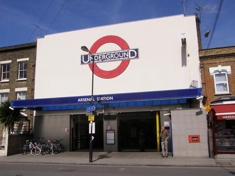
Arsenal station is just along the road from the North Bank Bridge. When it opened in 1906, the station was called Gillespie Road, but after the nearby Highbury Stadium was built in 1913, the manager of Arsenal, Herbert Chapman, successfully led a campaign to get the station renamed, and in 1932 it became Arsenal (Highbury Hill), dropping the part in brackets in the 1960s. It's an interesting station frontage, squeezed into the middle of a terraced street, taking up the width of about three houses (though it was even smaller before being rebuilt in the 1930s). There's no doubt it's an Underground station, though, as the roundel above the entrance is absolutely huge, no doubt to attract the crowds of football fans fleeing the nearby stadium.
Arsenal to Finsbury Park

It's a short but pleasant walk from Arsenal to Finsbury Park, brushing past the northern end of Highbury Stadium, Arsenal's old stadium, which is being knocked down and developed into apartments (I'll be walking past the stadium on my Victoria line walk from King's Cross St Pancras to Walthamstow Central). The terraces along St Thomas's Road are attractively kept, starting at the southern end with a block of modern social housing in the yellow-brown colour of London stock brick, and then moving on to an entire street of Edwardian terraces that slowly grow from petite two-storey terraces to four-storey tenements further up the road. There's a church at the southern end and the spire of the North London Central Mosque Trust at the northern end, and when the road spills out into Seven Sisters Road, it does so opposite a huge Arsenal shop, on the other side of the road from the impressive station complex.
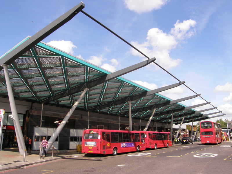
Finsbury Park station is just one part of the busy interchange at Finsbury Park. There's a national rail station, the Piccadilly and Victoria lines, and two bus stations, all huddled under a large steel and glass shelter that juts out from the roof at a jaunty angle, like the peak on a cheeky schoolboy's cap. It originally opened in 1961 as part of the Great Northern Railway, when it was called Seven Sisters Road (Holloway), but the station didn't join the Tube network until 1906, when the Great Northern, Piccadilly & Brompton Railway (now the Piccadilly line) arrived. Finsbury Park was the northern terminus until the line was extended to Arnos Grove in 1932, and then on to Cockfosters in 1933.
Finsbury Park to Manor House
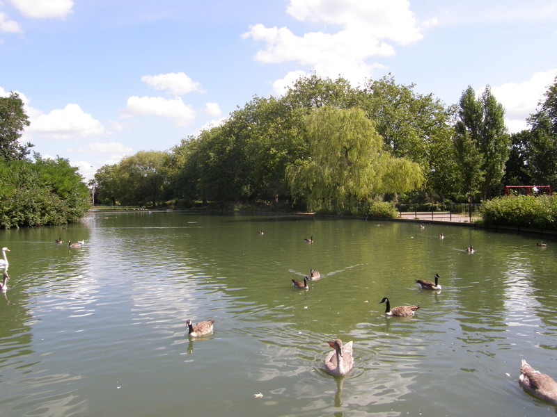
Between Finsbury Park to Manor House stations lies Finsbury Park, and what a lovely park it is, too. I first came across Finsbury Park when I walked day 12 of the Capital Ring from Highgate to Stoke Newington, and on a sunny day like today, it's a delightful place. Covering 112 acres, it was one of the first large London parks to be laid out in the Victorian era, following an 1841 petition from the people of Finsbury to the government to create a public open space. Plans for the park were first drawn up in 1850, and the government ratified the creation of the park in 1857, leading to the opening of the park in 1869. A recent cash injection of £5 million from the Heritage Lottery Fund has significantly improved the park, and the tennis courts are newly surfaced, there's a new children's play area and café near the lake, and the landscaping is immaculate. It makes for an excellent lunch stop, if you can manage to avoid falling asleep under the luscious trees that pepper the soft lawns.
Manor House station hides its light under the bushel of the road junction to the east of Finsbury Park. The Piccadilly line extension from Finsbury Park to Arnos Grove (1932) and on to Cockfosters (1933) provided Charles Holden with an opportunity to shine, and the stations along this part of the line are among the best on the whole network. Manor House, however, is subterranean, the only evidence of the station being a number of stairwells around the road junction and a small entrance building on the northwest corner. Luckily, more impressive station buildings are not far to the north...
Manor House to Turnpike Lane
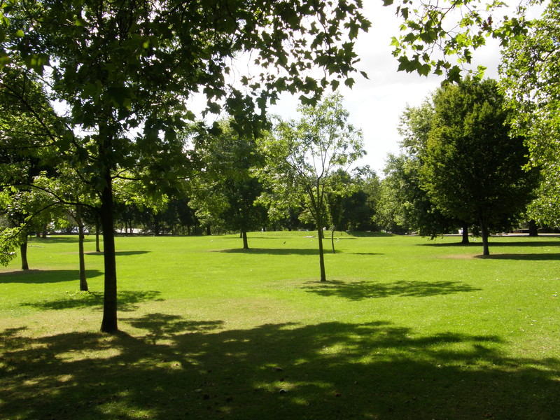
From the station I wandered randomly back into Finsbury Park, discovering in the process that there isn't an exit from the park in the northwest corner. So, after a bit of a diversion to the western edge of the park, I headed north up Wightman Road and to the top end of Duckett Road, from where you get a commanding view east down the hill towards Seven Sisters (which I'll be visiting on the Victoria line).
This part of the world is known as the Harringay Ladder, as that's what the street layout looks like on the map. Roads run downhill from west to east like rungs, all the way from Umfreville Road in the south to Turnpike Lane in the north, and they're hemmed in by the sides of the ladder in the form of Wightman Road and Green Lanes. Running south to north through the middle of this set of horizontal streets is a small footpath called either Haringey Passage or Harringay Passage, depending on who you talk to (the maps show it as Haringey Passage, but the council has recently replaced all the road signs to say Harringay Passage, except for one notable exception on Hewitt Road, where the path is still called Haringey Passage). The path lies on top of an old Victorian sewer, the Hornsey Outfall Sewer, which couldn't be built over when the area was developed on the former grounds of Harringay House; the path therefore survived when the area was covered in houses between 1880 and 1900, resulting in the Harringay Park Estate (to the south) and the Hornsey Station Estate (to the north).
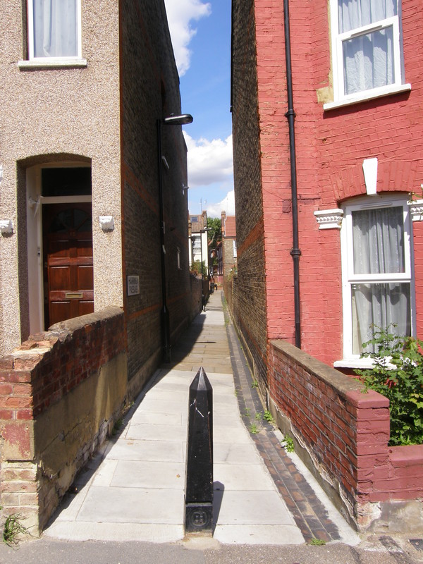
The passage has a bit of a grim reputation – the council's own website talks about cleaning up the passage as one of the improvements in an area that has 'in recent years experienced economic decline and some violent crime related to the drugs trade' – and parts of it are fairly urinal while dog turds pile up just a few feet from the bins that they're supposed to be in, but I still found the passage utterly charming. The housing along the streets is of a high quality, with red-coloured Victorian terraces pouring down the hill to the east. There are some large Victorian school buildings along Mattison Road and some excellent views downhill to the east, and even though the difference between each road is subtle, it's constantly exciting to pop out of the narrow passage into another row of houses. You can follow the passage all the way through both estates, and if I had my time again I'd probably take it all the way up from Umfreville Road at the southern end (I only joined it at Duckett Road because I wanted to see the view from the top of the hill, but I think the passage is more interesting, and if you want views, it's worth waiting for Alexandra Palace later on in the day).
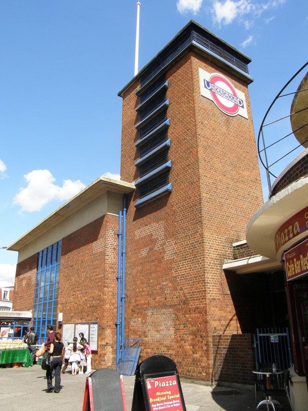
You could take the passage all the way north to Turnpike Lane and turn right for the station, but I chose to turn down Frobisher Road to Ducketts Common, and I'm glad I did, not because the common is particularly beautiful (though it's pleasant enough), but because you get a much better view of the station complex if you approach it from the south. To the south of the station itself are two curved, two-storey rows of shops, behind which you can find the bus station, but it's Turnpike Lane station that dominates proceedings. It sums up the modernist approach of Charles Holden nicely, with a red-brick tower complete with the London Underground roundel on the side and a white flag pole on top, and the station building itself is rectangular with a flat concrete roof and blue-framed glass panels in the sides to let the light in. The corner entrance is under a low-ceilinged curved roof, and the overall result is very pleasing.
Interestingly, I was stopped by the police as I snapped away at the station, the first time the police have bothered with me since my walk along the District line from Wimbledon to Edgware Road back at the start of July. Three PCSOs stopped me on the traffic island in the middle of Turnpike Lane and asked me why I was taking photographs of the Tube station, though once I explained about my tubewalk, they were politeness personified. However, as the group was made up of a more senior officer and two juniors who were learning their trade, they decided to follow the letter of the law and fill in a stop and search form, which of course they did in delightful police vernacular:
Subject was seen taking pictures at the entrance of Turnpike Lane Tube station. Stopped under Section 44 of the Terrorism Act.
It's not as poetic as the one I received at Wimbledon station and it fails to point out that no further action was taken, but I now have two stop and search forms, which might technically constitute a collection. I'm impressed, anyway...
Turnpike Lane to Wood Green
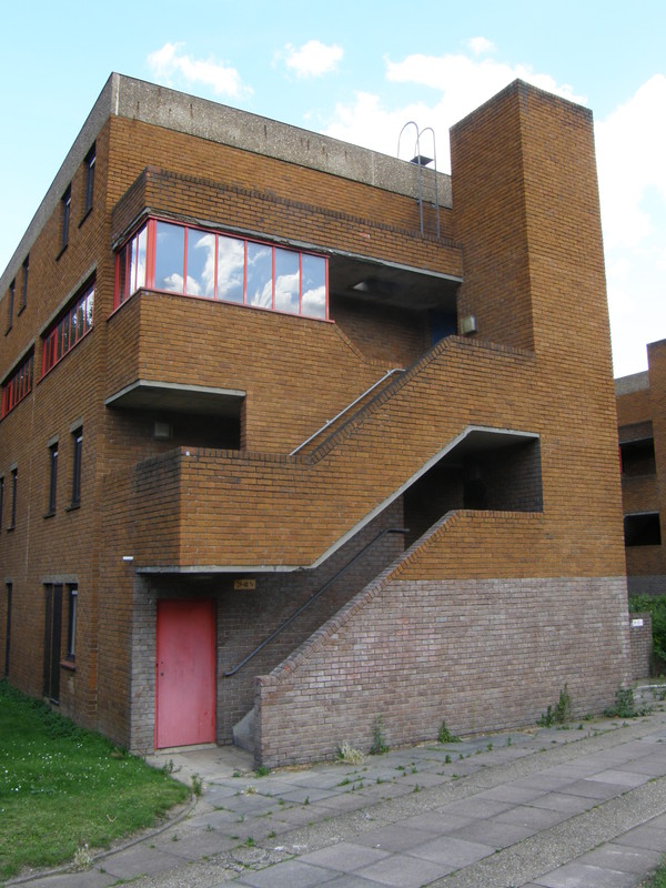
The area to the east of Wood Green High Road, which runs from Turnpike Lane station to Wood Green station, forms the Noel Park Estate, a conservation area that contains some of the best late Victorian and Edwardian suburban housing you are ever likely to see. The 100-acre Dovecote Farm was bought by the Artizans', Labourers' and General Dwellings Company in 1882 for £56,345, and by 1907 most of the building work was complete (though there was a second spurt of development in the 1920s).
When the estate was completed there were more than 2000 homes, along with a shopping centre and a theatre, but as the housing was aimed at higher-paid workers and was run to a strict set of codes, there were no pubs built within the boundaries. The same Company was responsible for a number of other park estates throughout London, in particular Shaftesbury Park in Battersea, Queen's Park in Westminster (which I visited on the Bakerloo line) and Leigham Court in Streatham, though they soon fell into financial trouble when their prices proved too high for the working class people they hoped to attract.
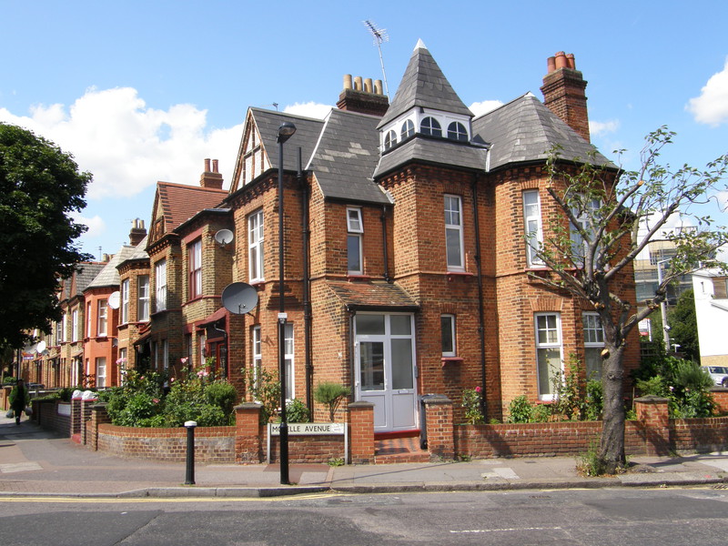
To explore the estate from Turnpike Lane station, it's best to turn down Whymark Avenue and then along the back of the modern and rather pleasant Sandlings Estate to get to St Mark's Church, which marks the western edge of the estate proper. Even here, on the edge of the estate along Gladstone Avenue, the beautiful terraces are hugely photogenic, though I'm not sure all the locals are quite as enamoured by the intricate terracing as I was. There I was, enraptured by the ornate porches, gables and corner turrets of the beautiful houses along Ashley Crescent, when I heard a voice shout, 'Hey! Oy!' in my general direction. Looking up, I saw a small group of men gathered round the back of a flat-bed lorry, with a Middle Eastern man in a dirty white vest and grey trousers walking towards me, waving his hands and pointing at my camera.
'Hello,' I said in as friendly a tone as I could muster.
'Can I ask you why you're taking pictures?' he said, getting straight to the point.
'Of course,' I said, and explained that I was walking the Tube for charity and taking loads of pictures as I went, just to record the event. He didn't look terribly convinced, so I started explaining why I was taking pictures of these particular streets. 'I mean, look at these houses. They're beautiful! They don't build them like this any more, you know; it's brilliant Edwardian architecture, and I love it. Don't you think so?'
He looked at me as if I was insane, so I asked him if he lived around here, hoping to point out that if he did, he was lucky to be living in such a delightful conservation area, but although he muttered a quiet 'Yes,' he said it in the same way that a man under police interrogation might say it, and I realised I'd crossed a line. I clearly wasn't supposed to be the one asking the questions, especially as I was the one with the camera.
'You're not from Google, are you?' he asked, presumably referring to the Google Street View project, whose cars are driving round London taking photographs for inclusion on the Google Maps website.
'Oh no, I'm nothing to do with Google,' I said, and told him I was just taking the photos to record my walk. He looked at me with barely concealed irritation that I was invading his patch, though he seemed to be content to leave it at that, and walked off shaking his head.
It reminded me of the grief I'd got from the grumpy black men of Tooting Broadway when I tried to take a picture of the Broadway Market, and although I can see why in some areas the locals might be a bit suspicious of people wielding cameras, what surprises me the most is that they still get the arse once I've explained what I'm doing and why I'm doing it. I mean, come on, I'm doing a charity walk here and taking photographs as I go: I'm not being invasive, I intentionally try to avoid taking pictures with people in them, I don't work for the police (hell, they stop me too, you know!), and in both cases I've been in an area with particular interest to visitors (historic ethnic markets and Edwardian housing estates are interesting, even if they aren't to the local ethnic population). It's a shame, because this kind of interaction colours one's opinions of an area; hell, even the police lighten up once they know what I'm doing, so why can't these guys?
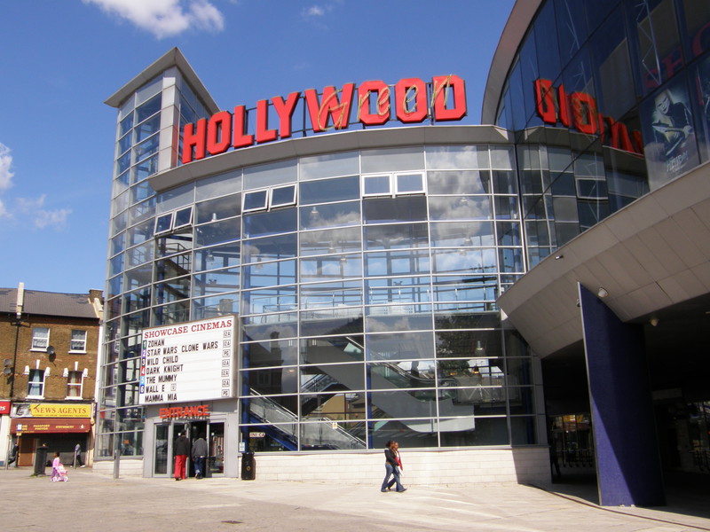
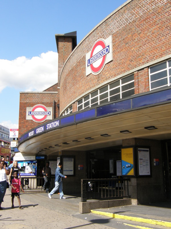
The wonderful architecture continues all the way to the huge Hollywood Cinema on the High Road, where Wood Green station dominates the northwest corner of the junction with Lordship Lane. The station curves outwards towards the road junction, with three panels of windows above the station name, and a large roundel above that. There's a tall brick tower on the left-hand side of the building, but although it looks like a trademark part of the Charles Holden design, the tower was actually added later.
Wood Green to Bounds Green
Although it's a little out of the way, I just had to take a detour from Wood Green to visit Alexandra Palace. Station Road links the Tube station with Alexandra Palace railway station, passing a couple of pleasant parks on the way, and the entrance to Alexandra Park is on the other side of the track, across the station footbridge (which you can cross without a ticket).
Alexandra Palace dominates the park, so I thought it would be fun to skirt the bottom of the hill on which the palace stands, before climbing up to explore the palace itself. The idea was good, but I did end up getting a bit lost on my way to the road that runs along the southern base of the hill, accidentally coming out at a cricket pavilion and football fields. Still, it's hard to get disorientated with the huge transmitter tower of Ally Pally sitting on top of the hill, and when I finally came out at the bottom of a path leading up to the western end of the palace, the effort was worth it, as it is a simply stunning building.

Originally opened in , the palace (which was named after Alexandra of Denmark, who had married Edward, Prince of Wales, earlier in the year) burned down just 16 days later, killing three members of staff. Undeterred, the palace was rebuilt and was once again open by , just two years later. Conceived as the People's Palace, it contained a concert hall, a museum, a lecture hall, art galleries, a banqueting room, a library and a theatre, and there was even an open-air swimming pool at the base of the hill. The park contained a racecourse complete with grandstand, a boating lake and a nine-hole golf course, but most famously of all, part of the palace was leased to the BBC, who used it as the centre for their new television service. The world's first high-definition television broadcasts were made from this site in 1936, using both the Marconi and Baird systems on alternating weeks until the Marconi system won out in 1937. The huge mast was the main television transmitter for London until 1956, with a short break in World War II when the transmitter was used to jam the navigation systems on German bomber planes. The main transmitter for London is now at Crystal Palace in south London, but the Alexandra Palace transmitter is still used for analogue television signals and radio.
The view from the top of the hill is quite staggering, with the city laid out right in front of you, but I found myself torn between staring at the city and staring at the palace, with its curved glass roofs and impressive stained-glass rose window. The transmitter is huge and it's hard to tear your eyes away from it, and on a day like today it's a dreamy place to sit and watch the world go by.
The suburbs from the park to the station are predictably pleasant, with road after road of neat Edwardian terraces giving way to the large houses along the northern side of Durnsford Road. As I approached the lights at the junction with Bounds Green Road, I spotted a car pulling up at the lights with a tall camera sticking out of the roof, and sure enough, there it was, Google's Street View car, merrily taking pictures of the surroundings. While a tramp clutched his can of strong cider and barked at the camera, I ran up to the lights1 and fired off a volley of photographs, glad to be able to turn the tables on the Google boys and their plans for world domination. Perhaps the man back in Noel Park had known the Google car was in the area and was therefore on high alert; whatever, it seemed an amazing coincidence that I'd been talking about this very car an hour earlier, and here it was, checking up on me. Now that is spooky...
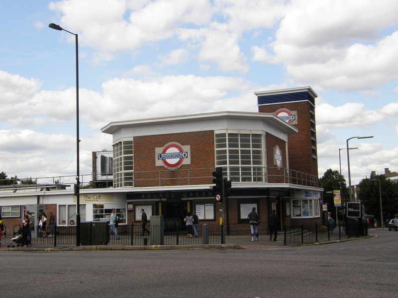
Bounds Green station has all the hallmarks of a Charles Holden station, but it was actually designed by his colleague CH James. It's clearly based on the great man's template though, as it sports an octagonal ticket hall with a large roundel on the front, huge clerestory windows letting light flood into the hall, a flat concrete roof, and a ventilation tower at the back (sporting another roundel, of course). The entrance to the station is neatly tucked away under a low concrete skirt along the two sides of the building that face the road, with the station name modestly spelled out in white letters just above the door. Apparently the stations get even more impressive as you head further out towards Cockfosters, which is really saying something, as I'm already in awe of the modernist designs along this part of the line.
1 Interestingly, you can see me quite clearly in Google Street View. I'm crossing at the lights, wearing a black T-shirt with blue jeans and clutching a map in my right hand. Proof!