My original plan for this tubewalk didn't include the East London line, as it was closed in , and when it re-opens, it won't be part of the Tube network any more (it's going to be extended and included as part of London Overground instead). So I happily ignored it when planning my route, and thought nothing of it until someone posted to a London Underground blog saying that until it re-opens, the East London line is technically still part of the Underground, as London Underground is running a replacement bus service, thus effectively keeping the line open. So, here I am, walking the East London line, much to my surprise.
Truth be told, I was quite pleased to have to shoe-horn the East London line into my schedule, as this line contains the oldest section of railway in the whole network – the bit that goes under the Thames between Wapping and Rotherhithe, through the Thames Tunnel. The only reason that the East London line isn't regarded as the first underground railway is that Sir Marc Brunel's Thames Tunnel originally catered for pedestrians only. The tunnel – which dates from 1843, some 20 years before the Metropolitan line opened – didn't carry trains until 1869, some six years after the Metropolitan line became the first subterranean railway.
This is also a part of London I've never explored before (I visited a friend in New Cross once, but I don't think that really counts as exploration). People who get their impressions of east and southeast London from the Evening Standard tend to wince a bit when you mention the likes of Millwall Football Club, Wapping, Deptford and New Cross, and this morning didn't exactly help. Last Sunday the bodies of two French students were found in a burned-out flat in Sterling Gardens, just a few yards from my planned route from Surrey Quays to New Cross, but this morning police announced that instead of being the accident they first thought it was, it turns out that they were tortured and stabbed up to 250 times before being set alight.
All aboard for a lovely walk to New Cross, then!
Shoreditch to Whitechapel
Shoreditch station closed in so that work could start on extending the East London line north to join the rest of the London Overground, but the bus replacement service still serves the station, so I thought I'd better start here. Predictably for a station that's been closed for two years, it's smothered in graffiti and looks a little forlorn, an image that isn't helped by the barking winos who live in the park next door. The City of London might be just a stone's throw away, on the other side of Brick Lane, but the City this ain't; this is Tower Hamlets, and a forgotten corner of Tower Hamlets it is too. As if on cue, it started to drizzle as I snapped away, and I was thankful that at least my photography wasn't irritating the local police, wherever they were.
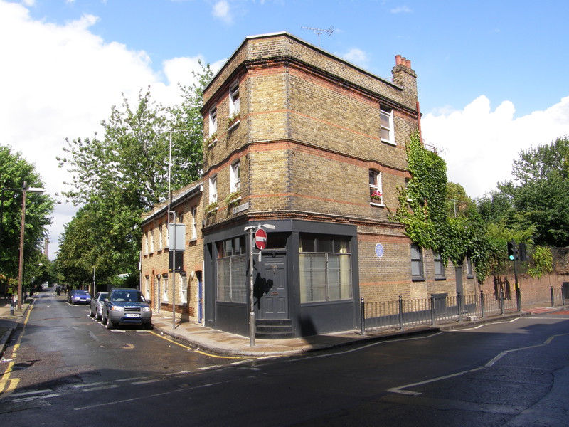
Heading along Buxton Street, past Spitalfields City Farm and a school, things started to liven up a little bit. On the corner with Vallance Road is a house with a blue plaque to Mary Hughes, the daughter of Thomas Hughes, the author of Tom Brown's Schooldays. In her desire to care for the impoverished locals of the East End, she ended up living with them, where she stayed until moving to Kingsley Hall in 1915, by which time she had become a 'shabby and sometimes verminous woman' who was totally committed to helping those around her. She met Gandhi when he stayed in Kingsley Hall in 1931, and in 1926 she set up the Dew Drop Inn in this corner house on Vallance Road, the name being an intentional pun, as it was set up as a hostel for the homeless and needy. She ran it until her death in 1941, at the ripe old age of 81.

It's a short walk from the old Dew Drop Inn through the renovated terraces of Lomas Street to the back of Whitechapel, where Durward Street runs east-west behind the station. This street used to be known as Buck's Row, and this is where Jack the Ripper perpetrated his first murder, in the wee hours of . The victim, Mary Ann Nichols, was the first of the Ripper's five murders, all of which occurred in this area of London. I'll be visiting three other Ripper murder sites on my tubewalk – one on the Circle line and two the Central line – as well as the odd Ripper victim's grave.
Joining Durward Street to Whitechapel Road is Fulbourne Street, a diminutive street that boasts a connection with communist Russia. Back in , this street hosted a meeting of communists that included a number of people who would become household names, including Lenin, Trotsky and Stalin; during the conference, Stalin and Litvinov slept in a hostel for down-and-outs in Fieldgate Street, which I visited on my walk from Victoria to Bow Road.
Whitechapel station is along the main road, tucked away behind the Whitechapel Road street market, opposite the Royal London Hospital.
Whitechapel to Shadwell

The stretch from Whitechapel to Shadwell has one theme: housing. The variety is impressive, from slightly grim-looking tower blocks to Victorian mansion blocks, with some good examples of good, modern social housing, as well as examples of why the 1960s weren't a particularly great decade for architects. There are building sites where glass-clad office blocks are rising into the sky, but for a lot of this section the architecture is old and slightly faded; there's enough renovated terracing to give the area a positive boost, though, and you come out the other end with a feeling that although it isn't terribly pretty, it probably will be one day, because the buildings have great character. All they need is a bit of repointing, a bit of a clean, and they'll be worth a fortune...
Historically, this area was known as Blue Gate Fields, which was one of the worst slum areas in Victorian London. As the docks grew up on the river to the south, this area became a home for many of the dock workers and passing sailors, and a contemporary report from 1883 said, 'the dens to which, every night of the year, drunken sailors are betrayed, swarm and flourish openly and defiantly in spite of the police.' It's not quite as bad these days...
Shadwell station is still up and running, as it's also on the DLR, and the presence of a working railway station livens things up. Along the railway arches to the west of the station are some great fishmongers and butchers (all halal, of course) and there's a new bus stop being built outside the station, which is buried deep within the bridge carrying the east-west DLR line overhead.
Shadwell to Wapping

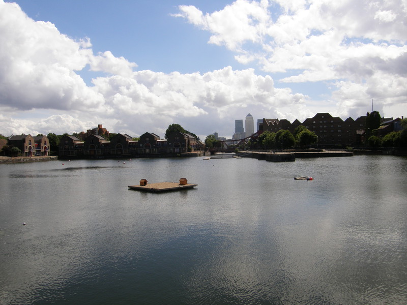
The shops continue from the station down to The Highway, where things suddenly start to look a lot more polished. Turn south down Garnet Street and look for a sign pointing left into Shadwell Basin, and after negotiating a small set of steps, there, laid out in front of you, is a huge expanse of water, lined with attractive apartment blocks. Most of the London docks to the west of here were land-filled to save the cost of maintaining them, but Shadwell Basin, which is still connected to the Thames, was left alone, and the view east to Canary Wharf is lovely. Peeping over the trees to the east of the apartment blocks is the spire of St Paul's Church, which is traditionally known as the Church of Sea Captains; originally built in 1656 (though the current church dates from 1820) this was Captain James Cook's regular church, and John Wesley used to preach here.

The theme of turning docklands into residences continues throughout this section, all the way to the king of the conversions, Wapping. Regeneration of this area started in earnest in the 1980s, under the auspices of the London Docklands Development Corporation, a government quango set up to redevelop the area with a combination of commercial and residential properties. In 1986, News International – publishers of The Times, The Sunday Times, The Sun and the News of the World – built a massive, £80 million printing works in north Wapping, and relocated the production of their newspapers here, causing the print unions to strike, and consequently lose their jobs. The sacked workers picketed the plant, which gained the nickname 'Fortress Wapping' when the protesters effectively besieged it, though things didn't work out for the unions and the strike was called off in 1987.
Wapping station is at the eastern end of the high street, and is currently closed, the Tube logo scrubbed from the outside along with anything that might identify it as a railway station.
Wapping to Rotherhithe

Although Wapping and Rotherhithe stations are within spitting distance of one another, only separated by the Thames, they're a long way apart by foot. The nearest pedestrian crossing (now that Brunel's tunnel is used for trains) is Tower Bridge, some way to the west, but this detour does contains some wonderfully atmospheric stretches of river bank, and it's a pleasure rather than a chore.
For a start, the regeneration of Wapping is spectacular, and strolling along Wapping High Street is a delight. The street is lined on both sides by old warehouses, now converted into riverside apartments and restaurants that ooze urban charm. Although you can't see the river from the street, you can feel its presence in the buildings around you; the rebuilding has managed to preserve the atmosphere of a city dockland, and it makes for a very enjoyable stroll. Of particular note is the Prospect of Whitby pub, which claims to be the oldest Thames-side tavern in the country, dating from 1520. It became known as the favourite pub of 'Hanging' Judge Jeffreys, the judge who presided over the Bloody Assizes, at which harsh sentences were handed out to the Duke of Monmouth's followers following the rebellion of 1685. Another pub in on the street, the Town of Ramsgate, also claims to have been a haunt of Judge Jeffreys; clearly he brings in the tourists.
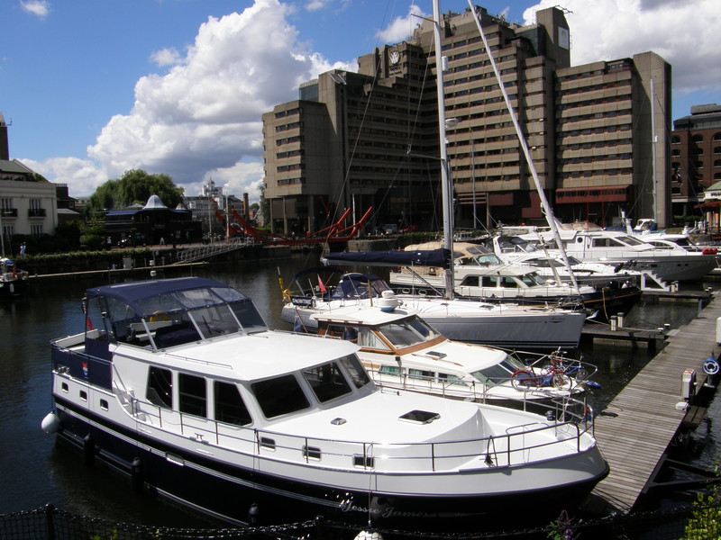
Further along the river, the docklands of Wapping suddenly give way to more modern creations on the river banks just east of Tower Bridge. At last you get some decent views of the river, and what views they are, too, with Tower Bridge just upstream and Butler's Wharf on the opposite side of the river. The impressive glass-frontages of the development on Cinnabar Wharf give way to a small park, where a dove-shaped sculpture rests as a memorial to all those who lost their lives in the docks of London during the Blitz. From here it's a short walk along St Katherine's Way to St Katherine Docks, which I never even knew existed, even though I've visited the Tower of London and wandered across Tower Bridge on a number of occasions. It's an amazing area, with expensive yachts lounging in the marina, overlooked by boutique shops, residential flats, offices and the rather dated Tower Hotel, which takes pebbledash architecture to new heights.
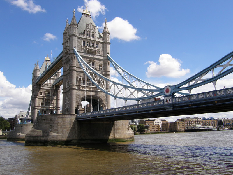
Next door to St Katherine Docks is Tower Bridge, the Victorian masterpiece that has become an icon of London. It's a busy tourist area and this whole area is worthy of dedicated exploration, but for those of us just passing through, the grassy spot on the south bank, just to the west of the bridge, has to be one of the most entertaining places to stop for a lunch break that London has to offer. With the Tower of London on the other side of the river, the sun on your back and plenty of tourists to watch, it's a classic.
Heading east from Tower Bridge, along the south bank of the Thames, the main story is yet more converted warehouses, in particular the imposing Butler's Wharf, which was built in the 19th century as a wharf and warehouse complex. It apparently contained the largest tea warehouse in the world, but now it's home to a string of pleasant restaurants along the river bank, with great views of Tower Bridge and the City from the apartments above. The warehouse conversions continue through St Saviour's Dock and past New Concordia Wharf. This area was originally called Jacob's Island, and in the early 19th century it was a notorious slum. Charles Dickens use it as the setting for Fagin's den in Oliver Twist, and Bill Sykes met his maker in the dank swamp that was the Folly Ditch, which surrounded Jacob's Island. It's considerably more civilised these days.
As you reach Bermondsey Wall East, things slowly start to pull away from the breakneck redevelopment around Tower Bridge, and the warehouses begin to get a bit more derelict. The Chambers Wharf and Cold Stores building is a good example; built in the 1930s, it was the building of this huge warehouse that split the continuous Bermondsey Wall lane into Bermondsey Wall East and Bermondsey Wall West. Apparently it is now earmarked for development into 750 apartments, and it's hoped that you'll be able to walk along the river front (which you can't currently).
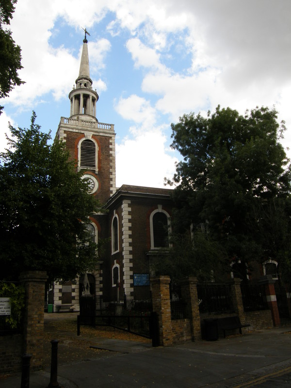
The transition away from the developers is complete by the time you reach Rotherhithe, and it's easy to picture the old Victorian streets, with their poverty, crime and fascinating characters, in a way that it's much harder to do in spotless Wapping. I'm not saying Rotherhithe is grim – far from it, I found it rather charming – it's just that its character hasn't been redeveloped to the same degree, so the streets feel that bit more authentic. The views across to Wapping are expansive, and around St Mary's Church there's a palpable sense of history, with a church having existed on this site since 1282.
Just before the station, you come across the Brunel Museum, which is housed in the engine house for the Thames Tunnel (it held steam-powered pumps that were used to extract water from the tunnel). Rotherhithe station itself, again shorn of all markings that might give it away as a train station, sits a little further south on Brunel Road.
Rotherhithe to Canada Water
It's a short walk from Rotherhithe station to Canada Water, but the transition is impressive. The housing around Rotherhithe station is relatively modest, but at the southern end of Swan Road there's an open green space, and on the other side the developers have really got stuck in. New apartment blocks are rising round here like mushrooms after rain, and the reason is just round the corner.
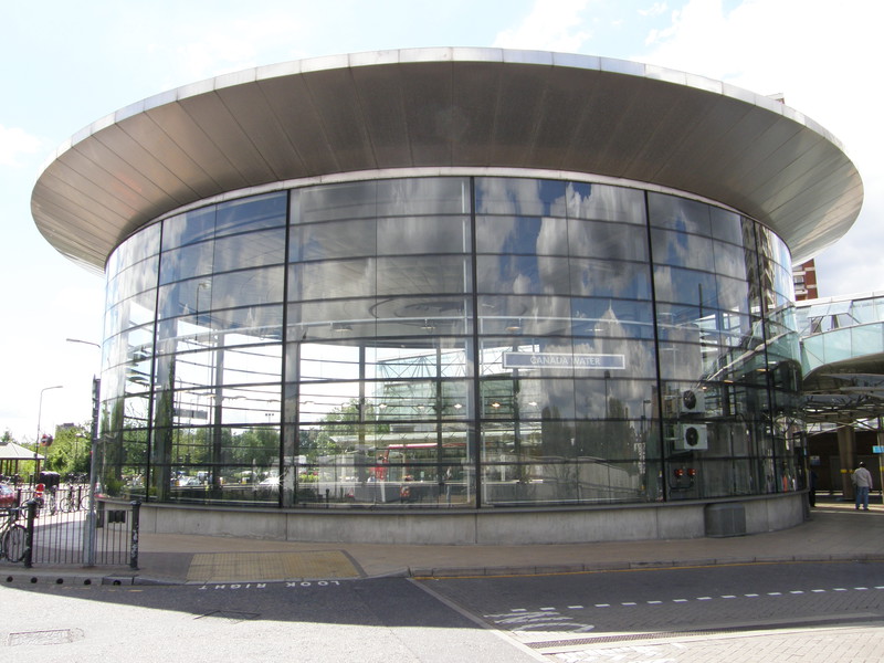
Canada Water station is on the newly extended Jubilee line, and it shows. Opened in 1999 and built on a derelict site that was formerly occupied by Albion Dock (part of the old Surrey Commercial Docks), the station building is based round a massive glass drum, 25m across, into which you descend to reach the platforms. Natural light floods the ticket hall in a nod to Charles Holden's high-ceiling designs on the District and Piccadilly lines, and it's a beacon of modernity in this previously quiet backwater of southeast London.
Canada Water to Surrey Quays
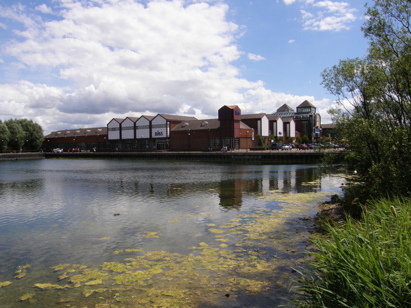
South of Canada Water station is Canada Water itself, a lake and wildlife refuge that was created out of the Canada Dock. This whole area was part of Surrey Commercial Docks, which stretched north and east all the way to the river, but as with the docks to the north of the river, they closed down in the 1970s, leading to a decade of decay, before the London Docklands Development Corporation took over in the 1980s and started injecting money. One of the biggest projects was to fill in the southern half of Canada Water, on which they build a huge shopping centre, leaving the northern half intact for conversion into a wildlife refuge. It's a little crowded in by the Tube station and a huge sports and leisure mega-store on the other side, but that doesn't make it any less enjoyable as an oasis among the shoppers.
Surrey Quays Shopping Centre, which occupies what used to be the southern half of the dock, is huge, and crossing the car park seems to take ages, but if you're in need of refreshment before hitting the twin stretches to New Cross, it's a useful stop-off. Surrey Quays station is again an anonymous building on the corner of Lower Road and Rotherhithe Old Road, at the southern tip of the car park.
Surrey Quays to New Cross
There are two separate lines from Surrey Quays to New Cross, which makes absolutely no sense when you consider how close New Cross and New Cross Gate stations are. Predictably, this is down to the competitive nature of the Victorians and the railway boom of the 1830s. The first line was opened in 1839 by the London and Croydon Railway, who built a station near Hatcham and called it New Cross; then, in 1849, the South Eastern Railway built a station about 600m to the east, which they also called New Cross. This strange situation continued until 1823, when both companies were taken over by the Southern Railway, when the western station was renamed New Cross Gate.
In order to walk the line in the proper order, I decided to walk from Surrey Quays to New Cross, then to take the replacement bus back to Surrey Quays and walk to New Cross Gate. I didn't realise this when planning my walk, but this allowed me to explore both east and west New Cross, and they're surprisingly different.
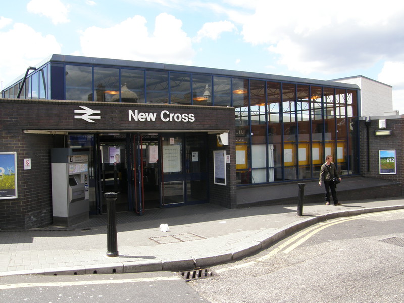
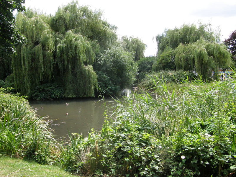
The eastern journey to New Cross starts off along the busy Lower Road, which does have some pretty buildings tucked away from the traffic, though generally this is a place for cars, not humans. A quick turn right into the suburbs north of Deptford Park improves things considerably, and the park is large and open, though fairly flat and functional. Over the other side of the railway line is the more landscaped Folkestone Gardens, with a pretty pond with weeping willows draping into the water, and a large children's playground at the southern tip.
Back across the tracks again, social housing starts to take over, with three large pastel-coloured tower blocks to the east and, at the northern end of Kerry Road, a rather sad, boarded-up area that clearly needs some attention. This turns out to be a blip, though, as the neat housing of Kerry Road soon gives way to the allotments along Amersham Vale, after which the road is dominated by the huge Waldron Health Centre. New Cross station, which is still going strong as a national rail station, is just on the right, before New Cross Road.
Surrey Quays to New Cross Gate
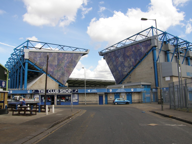
So the eastern route to New Cross starts off with a main road and some enjoyable parks before getting a bit earthier as it approaches New Cross, but the western approach does things in reverse, starting with the earthier side of life before leading to a lovely conservation area.
The initial stretches along Oldfield Grove are pleasant enough, though the views at the end are dominated by the nearby waste processing plant, with its huge chimney and satanic-mill design. The housing round here is new and not unpleasant, and one of the road names – Regeneration Road – gives it away.
Things change considerably on the other side of the many tracks separating west New Cross from east (I counted at least six bridges, though some of them are clearly unused). Turning south you come across New Den Stadium, home to one of the most notorious football clubs in the capital: Millwall Football Club. Local cars have stickers on them proclaiming, 'No one likes us, we don't care', the name of the song that Millwall fans started singing in the 1980s as a response to continued criticism of their behaviour. The bad old days of Millwall being known for hooliganism are long gone, though, and the area is not at all unpleasant. The stadium is difficult to see in its entirety from the road, though as you turn away from it, towards Ilderton Road, you get a better sense of how large the venue is.
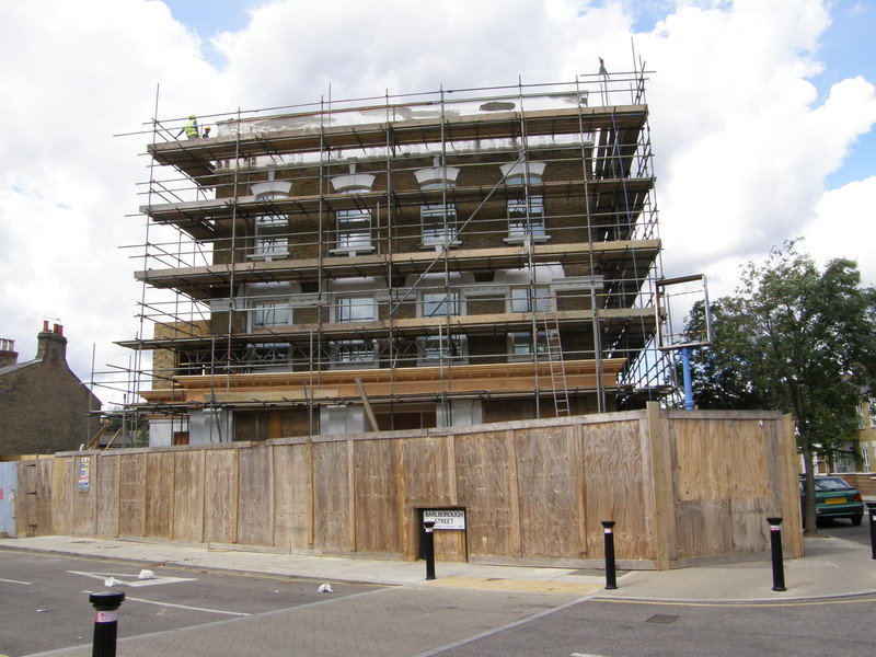
After the stadium, I headed east along Surrey Canal Road, which follows the route of the long-gone Grand Surrey Canal. It's easy enough to imagine that this road was once a canal, as it has banks and a bridleway while the traffic rumbles along what was once the canal basin. To the east, where the railway crosses at the junction with Mercury Way, used to be a junction with the short-lived Croydon Canal, which was the first canal to be formally abandoned by an Act of Parliament, back in 1836; this section was sold to the London and Croydon Railway, who opened their line along the canal's route to what is now New Cross Gate.
Mercury Way has some pleasant new housing to the west, but what the estate agents won't point out is the cacophony of industry on the other side of the road. This is where skips are brought once full, and an army of diggers crunches their contents into a big pile of scrap, ready to be taken to landfill. The clouds of dust and screeching noise of machinery are quite impressive, though perhaps not so much if you live round here. Luckily it doesn't last too long, and the houses to the south are a little more peaceful.
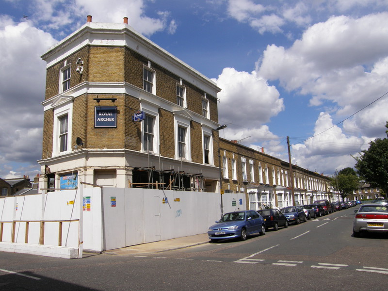
Heading south along Monson Road takes you into an area of much older housing, though the developers are still at it. Specifically, they are attacking the Duke of Albany pub with vigour, which is all the more interesting because this was the pub that was used in Sean of the Dead, where it was known as the Winchester Arms. It's being turned into apartments, which means some lucky people will be able to say they live in the Winchester – nice.
On the other side of Eckington Gardens lies the heart of Hatcham Conservation Area, an estate that was built between 1848 and 1894 by the Worshipful Company of Haberdashers on what used to be the grounds of Hatcham House. Most of the houses were meant for working class people, though I'm sure things are different now, as the terraced houses are lovely and no doubt command a handsome sum.
Meanwhile, down on the main New Cross Road, New Cross Gate station is still active, serving national rail trains. And that, ladies and gentlemen, is how to get to New Cross in two different ways, both of which are worth the effort.