Apart from one thankless section through an industrial park from hell, this is a pleasant walk through west London, and I'd do it again. Sure, the busy A40 is a recurring and not terribly welcome companion, and it's always irritating for walkers to have to shuffle through golf courses that would make for wonderful urban parks, but I particularly enjoyed discovering parts of Ealing and Acton that I had no idea existed, and as I currently live in the former, I'm happy to say that it's opened up my horizons.
The weather continues to be kind, too, which is good news for those of us who believed the tabloids when they said it was going to rain solidly for the rest of the summer. Of course, putting my thoughts in print is guaranteed to bring the skies down on my head, but for now, the weather gods are proving very co-operative, and I'm very grateful. The suburbs of west London would be a lot less enticing in the rain...
Perivale to Hanger Lane
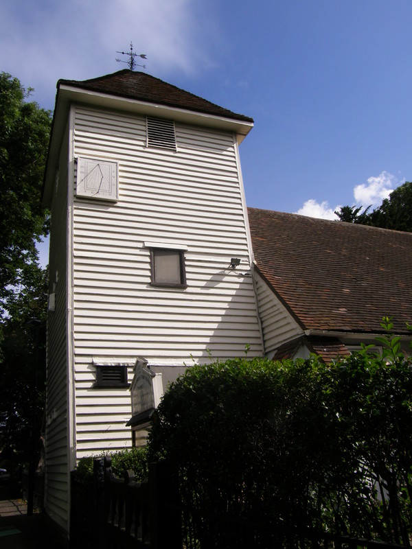
Heading south from Perivale station, it's a short walk to a pedestrian bridge over the throbbing A40, but fear not, for just off Perivale Lane is an entrance into a long, thin path that takes you through Ealing Golf Course and into Perivale Park. It's a shame that you don't get anything other than snatched glimpses of the golf course, but there's still enough to entertain, including the lovely St Mary's Perivale Church just off the path, complete with graveyard. This small 70-person church dates back to about 1135, and the current 12th-century building is a Grade I-listed structure that's been transformed by the Friends of St Mary's Perivale into a lively music and arts centre.
The River Brent is just south of the church, and from this point we join the Brent River Park Walk, which takes us almost all the way to Hangar Lane. Unfortunately the arrival of the river doesn't open things up, and it's a long, covered walk along the path to Pitshanger Park, which is open to the public. It's a pleasant stroll east past the tennis courts, but the park is fairly small, as it's hemmed in by another sports field to the east, and you have to leave the park at the gate into Meadvale Road.
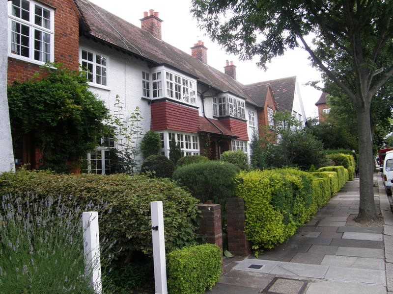
This is good news, though, as Meadvale Road is to die for. This is Brentham Garden Suburb and the houses along here are simply wonderful. Brentham Garden Suburb was the first garden suburb in London to be built under co-operative principles, and its origins go back to the Garden City, Co-operative and Arts and Crafts movements of the late 19th century. Most of the buildings were built between 1901 and 1915, predating the larger and more famous Hampstead Garden Suburb by some years (the latter was started in 1907). Brentham is now a conservation area, and it's easy to see why: the houses are solidly built but very attractive, and the gardens are simply amazing. Kudos to the locals for taking such pride in their community; it makes for great walking.
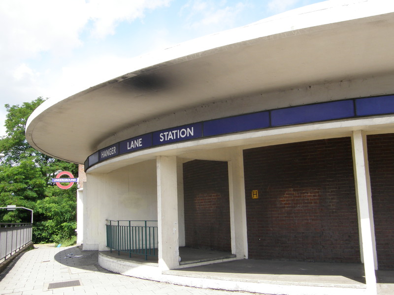
The Brent River Walk heads north from the eastern end of the conservation area, but Hangar Lane station is best reached along a path just to the south of some allotments, and then along Brunswick Road, which might not reach the standards of Brentham, but still contains some pretty early 20th-century houses. The station is stranded in the middle of the infamous Hanger Lane Gyratory System, one of the busiest road junctions in west London, though when you reach the station via one of the subways under the roundabout, it turns out to be a rather attractive affair, with a lofty circular rotunda with glass slats letting light down into the ticket hall.
Hanger Lane to North Acton
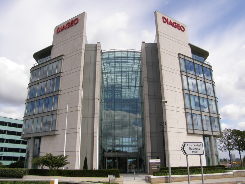
It's a relief to get away from the insane traffic of the gyratory and into the housing along Twyford Abbey Road, but don't be fooled by the pleasant-sounding road name, for this leg is pretty drab. The first section along Coronation Road and past the imposing Diageo Headquarters is OK, with a combined cycle track and walkway taking you through corporate gardens to the foot of the brewer's glass and stone offices, but it's downhill from here, especially as the old Guinness Brewery that used to sit next door has been razed to the ground.
From Diageo HQ it's a very long slog through the utterly uninspiring industrial park of Park Royal. This is London's largest industrial and business park, and is home to over 1200 businesses and 35,000 lucky employees. The figures are easy to believe as you wander past factories the size of football pitches, and on through the backstreets where countless smaller businesses line the streets. I'll be coming back through here on my Bakerloo walk from Willesden Junction to Harrow & Wealdstone and my Piccadilly walk from Uxbridge to Acton Town; I'm already dreading it.
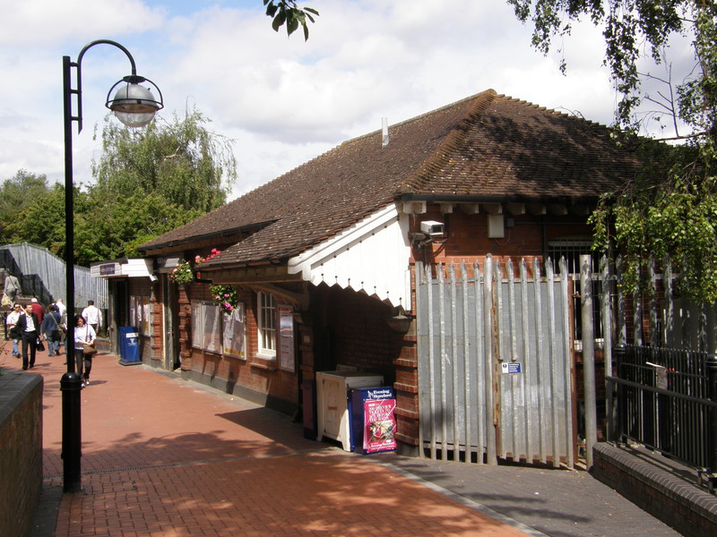
The only respite is Acton Cemetery, squashed into a corner just north of the ubiquitous A40, and then a couple of large residential blocks herald your arrival at North Acton station, a surprisingly pretty station that lives down a long pedestrian walkway along the back of Victoria Road. The station dates from 1923, when it was opened on the Central London Railway's extension to Ealing Broadway (which itself had opened three years earlier in 1920); it looks like a little bungalow, an image enhanced by the hanging baskets and curved streetlights along the pathway.
Ealing Broadway to West Acton
I took the Tube from North Acton back to Ealing Broadway so I could head east without further backtracking, and stepping out of the station into the sunlight, I had to stop myself from turning left and walking home, following the commute I've been doing for months. Instead I turned right and brushed past Haven Green, a pleasant bit of green in the chaos of central Ealing that kindly provides a home to the local drunks.
Pleasant late-Victorian terraces and detached houses line Madeley Road all the way to the A406, and although a lot of them have been converted into apartments, and therefore have car parks out front rather than gardens, they're still an attractive bunch. Just after crossing Hangar Lane, North Ealing station appears on the right opposite a row of shops, but this is a Piccadilly line station, and I won't be visiting it until my walk from Uxbridge to Acton Town.
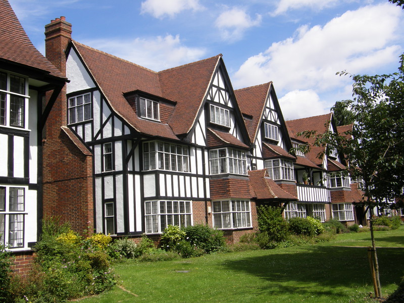
Just past the station you enter Hanger Hill Garden Estate, and I have to say it's one of the prettiest garden suburbs I've walked through so far... and yet, at the same, I can't help feeling a bit unnerved, because this entire state consists of Mock Tudor housing. Known to locals as 'Stratford-upon-Acton', the area was built between 1928 and 1936 to a design by architects Douglas Smith and Barley, and it's a quiet place, with lovely gardens, formal landscaping and trees breaking up the vertical lines of the black and white timbering. I took loads of photographs, and I have to admit that in Hanger Hill Garden Estate, Mock Tudor works an awful lot better than it does in the more run-down parts of town. You never know, I might even grow to like it...
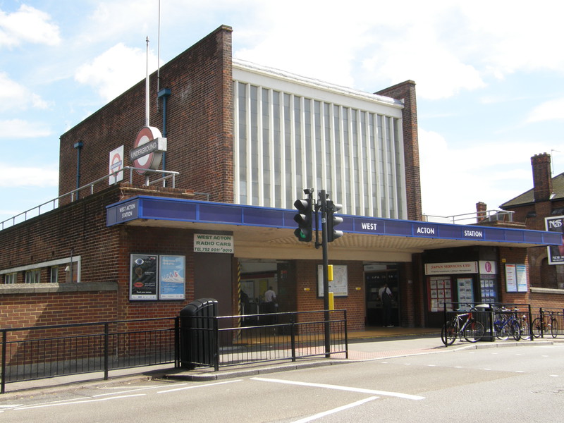
West Acton station dates from 1923, and it's an imposing sight. A rectangular glass-fronted tower rises out of the station, looking for all the world like the front of a huge factory, with solid, red brick sides and the Underground roundel on a pole to the left. The ticket hall is extremely well lit by light coming in through the high glass slats, and the overall effect is very pleasing.
West Acton to North Acton
This is a popular area with the Japanese, as there's a Japanese school nearby, and the evidence can be seen around the station, where you can find two Japan-friendly estate agents and at least one Japanese restaurant and a nearby Japanese school. They've picked well, because this is a very pleasant area, and although it's not quite as perfect as the Hanger Hill Garden Estate, the locals clearly take pride in the houses along Noel Road.
Just round the corner is North Acton Playing Fields, which is much more like a park than the name might suggest, with a tree-lined path through the middle and plenty of benches to soak up the sun. The houses surrounding the green are particularly nice, and although some of the terraces along Park View are a little worse for wear, the surroundings are enjoyable all the way to the A40, which rather predictably spoils the fun.
From the A40 to the station, we're back in the huge industrial complex of Park Royal, passing the massive Carphone Warehouse Headquarters on the right before dipping into the shadows of the residential blocks that greeted us at the end of the Hanger Lane to North Acton leg. North Acton station is just around the corner, hiding from all the industry down its long and tranquil ramp.
North Acton to East Acton
It isn't far from North Acton to the A40 – nothing is very far from the A40 on this leg, it seems – and again the theme is one of large industrial units. The Carphone Warehouse Headquarters continues through to Wales Farm Road, where there's a great-looking pub, The Castle, and a row of houses with well-tended gardens, perhaps designed as an antidote to the rush of oncoming traffic. Over the road is where the BBC used to store its costume and wig collection, though the costumes were sold to Angels and Bermans in March of this year, and the hairpiece collection went off to the Wig Store; given that the Corporation spent 50 years building up about one million outfits and 10,000 hairpieces, it must have been some collection.
Crossing the railway via the A-road, a little respite can be found by turning left into a small estate, squashed into the triangle between the Richmond branch of the London Overground and the main line into Paddington. It's not a bad place, considering the location, and there's a small exit in the eastern corner that takes you over the London Overground line (providing some excellent views towards the City in the process) and along a long, thin path between fences that eventually bursts out into Old Oak Common Lane.
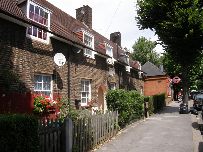
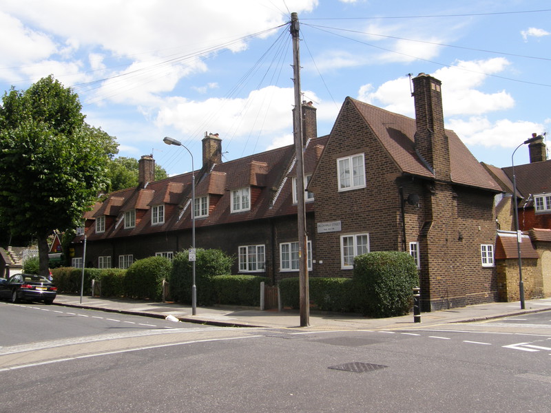
I instantly fell in love with this area. The buildings along Old Oak Common Lane and Fitzneal Street really appeal to me, perhaps because they're incredibly neat and tidy. This whole area was developed by the council after the First World War, and the red-brick houses look solid and dependable while managing to exude considerable period charm. The gardens are trimmed and well kept, there's no sign of the kind of building decay you associate with more modern concrete developments, the streets are lined with attractive trees, and to top it all, East Acton station is as cute as can be, sitting at the end of a row of lovely workmen's cottages, like a diminutive Post Office in a pretty rural village. What a delightful place.
East Acton to White City
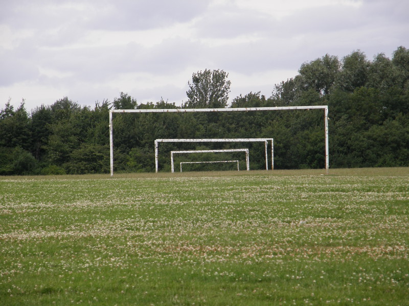
OK, here's a quick test. Think, if you will, of 'Acton'. And now, think of 'Wormwood Scrubs'. Are you full of happy, positive thoughts, or are you thinking of the darker side of urban living? I was pretty down on both places before I tackled this section, but now I'm proud to say that Acton and Wormwood Scrubs are both great places (though when I say 'Acton', I mean northern Acton, rather than the much grimmer South Acton Estate... and when I say 'Wormwood Scrubs', I mean the large green area, rather than the prison; but you catch my drift).
I've already raved about East Acton, and the appealing residential buildings continue along Erconwald Street, with houses attractively grouped round mini-roundabouts and a classic corner shop just up from the station, sporting the 'A Mars a day' tag-line as if it were still yesteryear. Eventually the housing gives way to the wide open spaces of Wormwood Scrubs, a huge area of common land (one of the biggest in London) that stretches out to the football pitches in the east, and if you look to your right before crossing into the park, you can see the prison of the same name. It's an incongruous sight after all this delightful suburbia, but the prison was here first, being built in the 1880s using prison labour. This was where Keith Richards spent 30 hours in detention in 1967, following a one-year conviction for allowing cannabis to be smoked in his house; the sentence was overturned on appeal after widespread condemnation of the harsh sentence, including the famous editorial in The Times entitled, 'Who breaks a butterfly upon a wheel?'
Next to the prison, to the south of the common, is Hammersmith Hospital, which includes the relocated Queen Charlotte's and Chelsea Hospital, and just to the north is the Linford Christie Athletic Stadium, with its brightly coloured running track hidden from view by the seating. This is a good spot for a quiet lunch on one of the benches lining the access road, with its large horizon and fresh breezes.
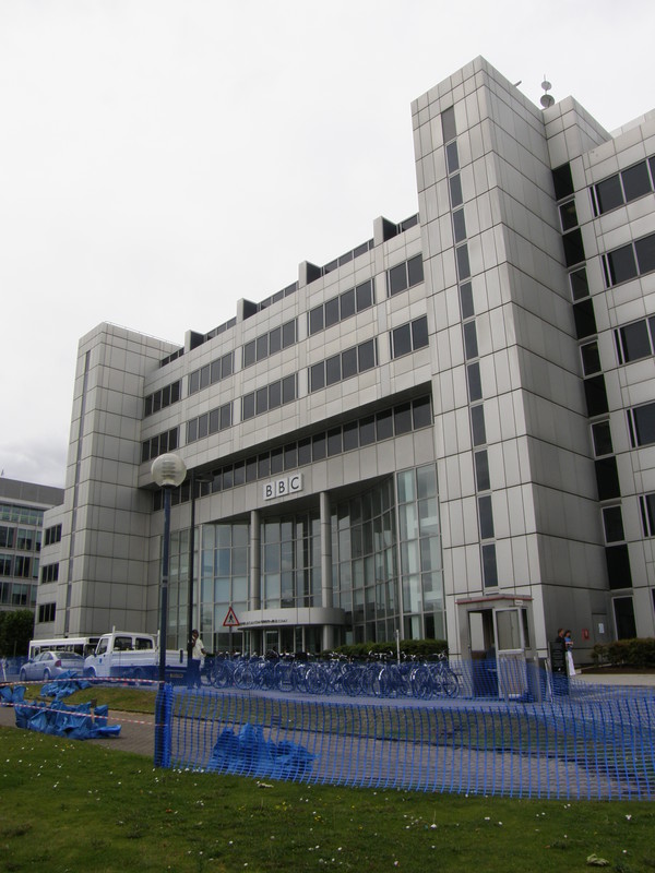
Back on the main road of Wood Lane, it's a short walk south to the A40, and on the other side of the pounding flyover is BBC White City, a huge complex of offices that were built on the site of the 1908 Franco-British exhibition. The buildings at the exhibition were mainly white pavilions, which gave the area its name, and the area was also home to the White City Stadium, which hosted the 1908 Summer Olympics (the finishing line for the marathon is marked just outside the BBC Broadcast Centre). The stadium was then grassed over for greyhound racing but was demolished in 1985 to make way for the BBC.
White City station is currently smothered in scaffolding and white sheeting, as it's being polished up ready for the opening of the huge shopping centre next door. Opened on , it replaced the earlier Wood Lane station which was temporarily set up just south of the current location to serve the 1908 Franco-British exhibition, but which stayed open following the success of the exhibition. White City eventually replaced Wood Lane as the latter was just too congested, but a new Wood Lane station is being built on the Hammersmith & City line to coincide with the opening of the Westfield London shopping centre, and both should open later in the year.
White City to Shepherd's Bush
Just opposite White City station is the iconic BBC Television Centre, home to most of the BBC's television output. The building was officially opened in 1960, but the glass entrance is much more modern, as the original was destroyed by a car bomb on (a bomb that I heard go off in the early hours of Sunday morning while lying in my bed in Chiswick). It's a great building, though the BBC is planning to move out of the building in 2012, so it will be interesting to see what happens to it then.
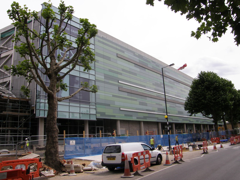
The story for the rest of this short section is redevelopment, and on a massive scale. The whole area to the south of White City station is being turned into Westfield London, a huge shopping centre that will be the largest urban mall in Europe when it opens. The centre is due to open later this year, and it is a monster; currently being clad in green, grey and light blue tiles, it completely dwarves the surrounding area, rising above the backstreets of Shepherd's Bush like a warehouse on steroids. It looks as if it's going to be spectacular, and hopefully it will provide the shot in the arm that the local economy needs; one also hopes it will spur on the tidying up of Shepherd's Bush, which in comparison is starting to look a little tired.
Shepherd's Bush station is currently closed, as it's being rebuilt for the Westfield opening, though as there is a bus replacement service, it still forms part of the Underground, so I still have to visit it on my tubewalk. It's currently hidden behind barriers, but peeking through the slats reveals a large rectangular building with lots of glass walls. It will be interesting to see what it looks like when it's finished; I'll certainly be back when all the chaos has subsided, because this looks like the beginning of a whole new chapter in the history of White City and Shepherd's Bush. We'll soon see.