After yesterday's soaking, the weather has turned more pleasant, with sunny intervals being the order of the day (it only drizzled on me once, and that was only for ten minutes or so). I'm sorry to keep banging on about the weather, but it makes such a difference, especially out on the further reaches of the Tube, where there's at least a small chance of coming across mud and wet grass. Weather-wise, today was a considerable relief.
It was also a much quicker walk than the section from Kennington to Euston and back, because out here in zones 4 and 5 you can get some real speed up. I hoofed through the 10.7 miles in just over four hours (an average of 2.5 miles per hour), compared to over six-and-a-half hours for the 12.9 miles around the centre of town (closer to 1.9 miles per hour). It might not sound like much of a difference, but when they're your feet, it's noticeable, and I really enjoyed the freedom of being able to chew up the miles today. God bless the outer zones...
East Finchley to Finchley Central
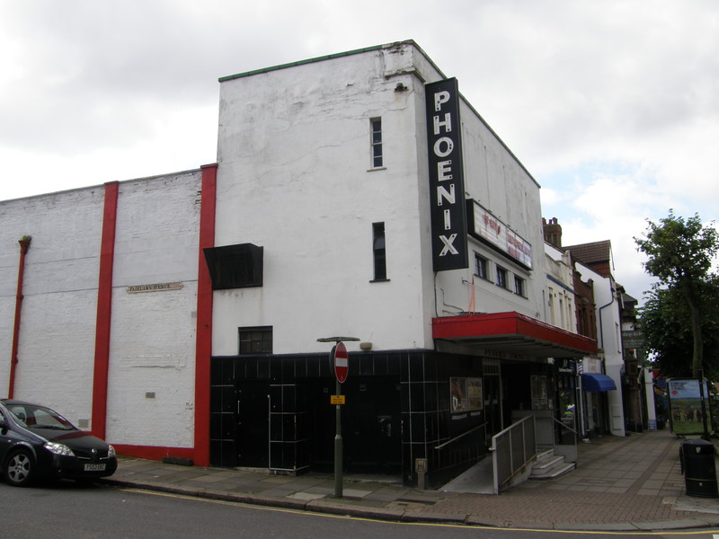
Heading north from East Finchley station, it's an enjoyable jaunt along the High Road; the traffic isn't too crazy, the range of shops is good and the pavements are very wide. This clearly isn't central London, where space is at a premium, and the area is neatly summed up by the Phoenix Cinema, the oldest purpose-built cinema in the UK. Opening in 1910 as the East Finchley Picturedrome, the cinema is Grade II listed, due to its original 1910 barrel-vaulted ceiling and 1938 Mollo and Egan decorative wall panels.
Not quite as suited to the art-house image of East Finchley is the headquarters of McDonald's UK, which occupies a large, red brick building on the opposite side of the road to the Phoenix. I'd assumed their head office would be heavily branded, but I walked right past it without noticing. Presumably they don't want people popping in to voice their opinions on child obesity, which I can fully understand; it can't be an easy time at the moment, working for the biggest junk food brand on the planet.
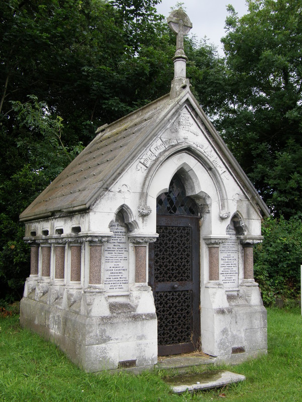
As you walk north up the High Road, you pass a couple of interesting churches, a listed Art Deco public library and the gates to a large collection of allotments run by Barnet Council, but the real reason for heading this way is the amazing St Pancras and Islington Cemetery. Established in 1852, this is the largest and the oldest municipal cemetery in London, covering approximately 190 acres that are split between the boroughs of Islington and Camden.
You could wander round here for hours, it's that big, but even in a cursory wander like the one I took, it's an impressive place. There's a very neat section of over 100 war graves, a large crematorium and several chapels, but the most memorable aspect is the huge network of tarmac roads that thread through the cemetery, with graves lined up on either side. It's like a suburban estate for the deceased, and most of the graves talk about their occupants 'going to sleep', adding to the feeling that this is indeed a community, albeit a slightly unusual one.
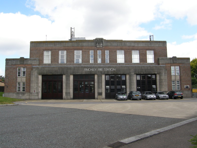
Heading west through a housing estate and under the rumbling bridge carrying the North Circular Road, there's a fairly standard stretch of slightly faded but perfectly serviceable suburbia. Keep an eye open for the imposing Finchley Fire Station just after the bridge; it might be the effects of this tubewalk, but I reckon it bears quite a resemblance to a typical Charles Holden Tube station. And that's a compliment...
The suburbs take us all the way to Finchley Central station. The station dates from 1867, when this part of the line was opened as a suburban railway line by the Great Northern Railway; a branch line was opened in 1872 from here to High Barnet, and this line was incorporated into the London Underground as part of the Northern Heights project, which extended the Tube line from Archway to Mill Hill East and High Barnet. There were plans for further expansion, but the Second World War got in the way, and the plans, which included linking Mill Hill East to Edgware, were shelved. Oh, and Finchley Central was also the home station of Harry Beck, who designed the original 1933 version of the schematic Tube map that we know and love today.
Finchley Central to Mill Hill East
The spur from Finchley Central to Mill Hill East is, like the Metropolitan line spur from Chalfont & Latimer to Chesham, operated as a back-and-forth shuttle for most of the day. The original 1935 plan for this part of the network was to take the existing LNER line from Finsbury Park to Edgware and tack the western section onto the Northern line, thus joining Finchley Road to Edgware via Mill Hill East and Mill Hill (The Hale); however, this was put on hold by the arrival of the Second World War, and only the section from Finchley Road to Mill Hill East was opened, to serve the barracks at the latter. The rest of the LNER line was never electrified and the tracks are now gone, leaving the Mill Hill East spur as a bit of an anomaly, but it makes for a sleepy and rather rural walk, which is always welcome.
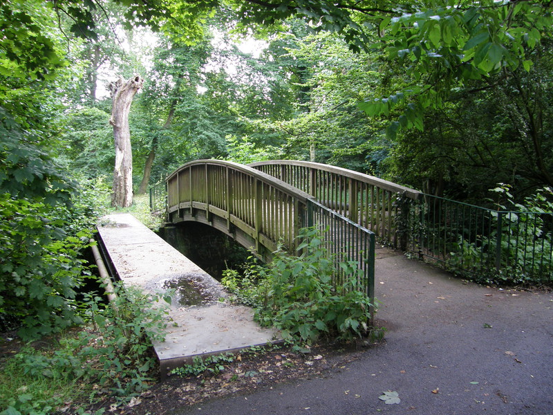
The initial section along Dollis Road is through some fairly standard suburbia, though the views ahead from the top of the hill are enticing. At the bottom of the hill, look to your left to see the huge Dollis Brook Viaduct, which carries the Northern line to Mill Hill East. The direct route would be to continue along the main road, but for a more scenic route, strike east along the Dollis Valley Greenwalk, which we'll also be following from West Finchley all the way to High Barnet. The Dollis Brook winds along the eastern edge of Finchley Golf Course, through thick trees that obscure everything to the left and right. The secret of following the Greenwalk is to stick to the paved path; I made the mistake once of following a side track, and although all roads lead north and eventually join up, it was a muddy old affair after yesterday's rain.
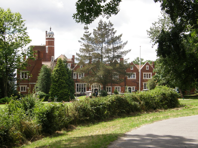
At a major bridge over the Dollis Brook, turn left onto Lovers Walk for a sheltered and peaceful wander west through the golf course. The course is very definitely private, and signs stop you wandering onto the course, should you be tempted, but you do get some pretty glimpses onto what is obviously a top quality course. Towards the end of the lane the impressive clubhouse comes into view to the left, originally built in 1883 as the home of the wealthy Victorian businessman Henry Tubbs, and soon enough you come to the course driveway, lined with huge redwood trees.
Frith Lane and Bittacy Hill take you to Mill Hill East station in fairly bland style, though there is an impressive Waitrose near the station, if you like that kind of thing. The station itself is understandably the least-used station on the Northern line, and it manages to retain its Victorian character, perhaps not surprisingly as it was opened in 1867, more than 20 years before the deep-level Tube section of the Northern line, and only four years after the first subterranean railway, the Metropolitan Railway.
Finchley Central to West Finchley
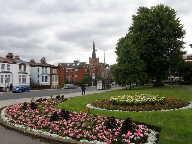
Taking the shuttle back to Finchley Central, I wandered through yet more pleasant but unremarkable suburbia to Victoria Park, a landscaped park that hosts the annual Finchley Carnival, a large fun fair that has been held here since 1905. On the other side of the park is the striking red spire of Finchley Methodist Church, and tucked away behind the church are some lovely little detached houses and larger Mock Tudor mansions that are in contrast to the more modern blocks along Ballards Lane. The houses down Essex Park are slightly less imposing, though this is clearly still a desirable place to live.
West Finchley station hides away from the road like a shy child; it was opened in 1933 to serve a new housing development in the area, and from the start it was built in a fairly minimal style, with hardly any station buildings. As with Mill Hill East, it's a quiet station, though probably because this is an affluent area, and cars are a way of life out here.
West Finchley to Woodside Park
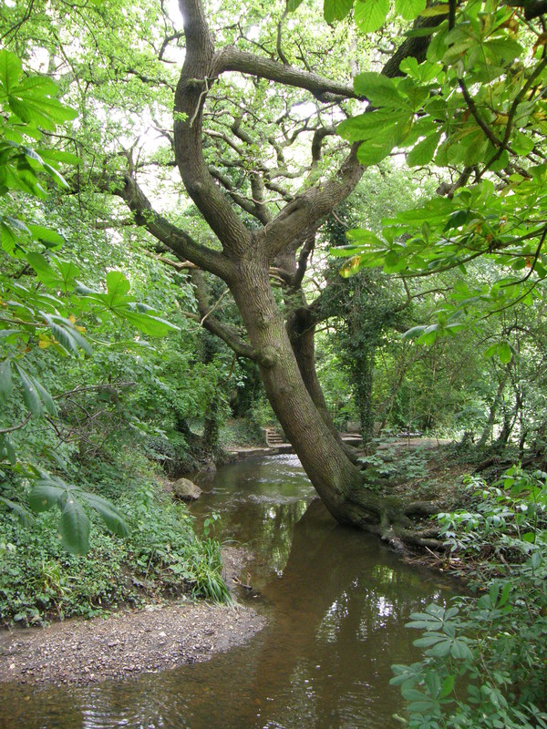
At the end of Fursby Avenue we come across the Dollis Brook again, our companion almost to the end of the line in High Barnet. The pavement of the Dollis Valley Greenwalk follows the brook through pleasant strips of parkland, though as the trees lining the walk obscure pretty much all of the suburbia around, it does feel rather cut off from the rest of the world. When the sun comes out, it's a lovely little walk, and because you're blindly following a paved path, you just can't get lost; it makes a nice change from hoofing round the City, turning left or right every few minutes.
North of Argyle Road the path leaves the brook to join the road through yet more expensive suburbs – I spotted at least one Rolls Royce, which is not something you see parked in suburban driveways every day – and it isn't far to Tillingham Way, which goes past the cute houses of Twineham Green before crossing the Dollis Brook on the way to Woodside Park station. Originally opened as Torrington Park in 1872 as part of the Great Northern Railway, the main entrance to the station is on the northern side of the tracks, which you can reach by crossing the bridge over to the other side (for which you don't need a ticket). The station looks for all the world like a house; welcome to the outer suburbs.
Woodside Park to Totteridge & Whetstone
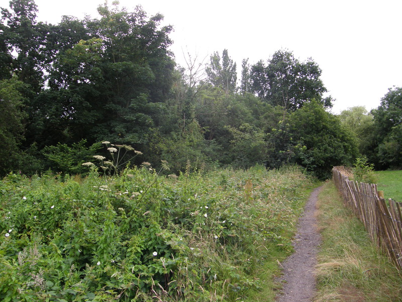
The Dollis Brook Greenway continues north of Argyle Road, though the path is a little scrubbier and less paved for the initial section. It does pick up again, though, and it makes for a very enjoyable walk through lots of small meadows, all the way to Totteridge Lane. This part is a bit wilder than the previous section (and, indeed, the next section), and although it's rather more constricted than the other parts, it has a slightly more rural feeling because it's been left to look after itself.
Totteridge & Whetstone station is a few yards to the right along the main road, perched on a bridge above the railway, with stairs down to the tracks below. Dating from 1872, as with most of the stations on this section, it again looks like a large suburban house, though this is tempered somewhat by the estate agents' office that takes up the left-hand side of the station.
Totteridge & Whetstone to High Barnet
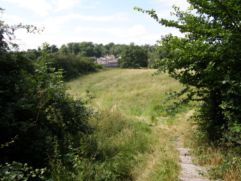
The final stretch to High Barnet again follows the Dollis Brook Greenway, though this section is more of a motorway than a walking path, with two parallel tarmac paths, one for cyclists (on the left) and one for walkers; don't pick the wrong one, or you won't make any friends. This is Brook Farm Open Space, an area that used to be used for growing hay, but which is now an enjoyable sequence of meadows that follow the line of the brook northwards.
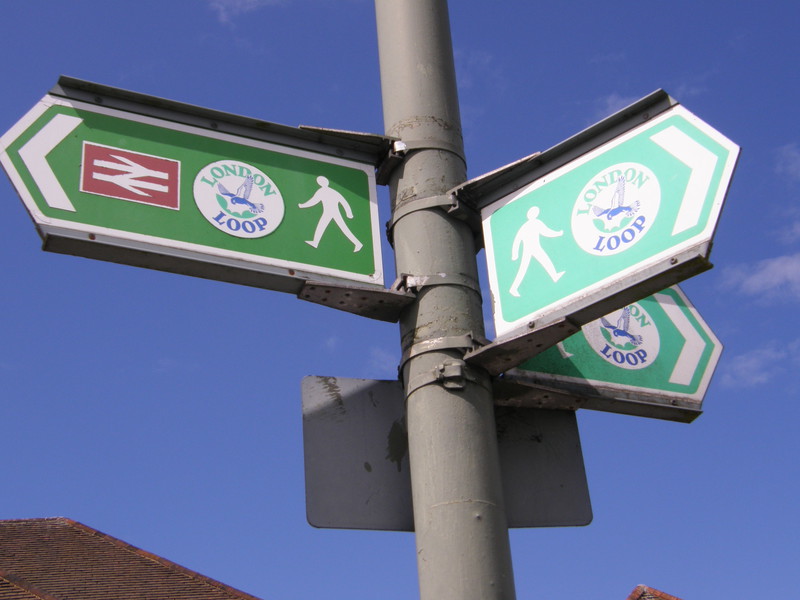
At the northern end of the meadows, the path meets Western Way and spills into a huge park, with the suburbs of Barnet visible on the hill to the northwest. The London Loop runs through here on day 11, and it's worth following it all the way to the station. There's a fascinating little collection of dark brick cottages on the eastern edge of the park, which have great views over the greenery towards a row of tall trees, and at the northern end of the park is the stadium of Barnet Football Club, locally known as the Bees.
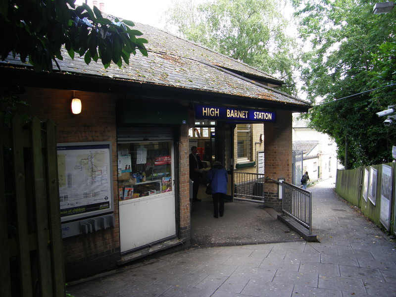
The most direct route to the station is to turn left at the top of Fairfield Way and walk along the main road, but a much more scenic approach is to follow the Loop north along Potter's Lane, and across a lovely little meadow to the east of the station, from where you can peek at the Tube trains sitting at this northernmost terminus of the Northern line. High Barnet station is just along Meadway, back on the main road, down a sloping walkway that passes the entrance to the station before continuing down to the car park and main station buildings. It's a quiet and pleasant end to this section of the line, and is miles away from Morden station, both geographically and physically. I know where I'd rather live, anyway...