
Today's walk seemed to go on a lot longer than I thought it would, but it was only when I got home that I realised why. Last night, after writing up my Heathrow walk, I sleepily looked at the mileage for today's walk, and figured it would be an easy day at just 7.6 miles and that I'd probably be home around lunchtime, as I live just two stops from Boston Manor along the pretty nippy Piccadilly line.
Of course, in my sleepy state I'd looked at the wrong day, because this walk isn't 7.6 miles long – that's the next leg – so by the time I got to Osterley, I couldn't work out why my legs were aching more than they should, and why on earth I wasn't at Boston Manor yet, downing an ice-cold bottle of Lucozade while waiting for the Tube home. I thought perhaps the high humidity was affecting me more than usual, or that I'd stayed up a little too late to finish off the account of my Heathrow walk, but it never dawned on me that today's walk was three miles longer than my head thought it should be. It's not a mistake I recommend... but at least the next walk will be a nice short hop, and that's always welcome.
Hatton Cross to Hounslow West
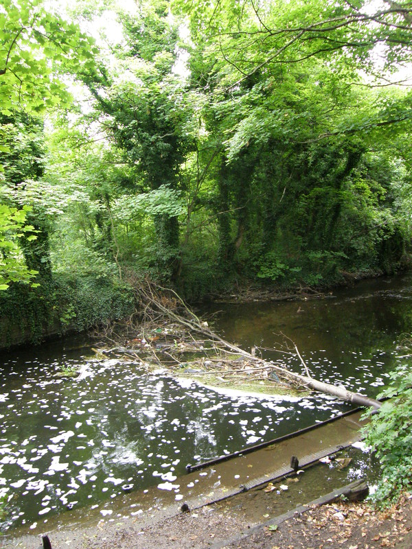
Day 7 of the London Loop ends at Hatton Cross, having come from Kingston, so I thought I'd follow it south for a while, as the Loop is a pretty good arbiter of taste. It's a fairly long walk from the Tube station to the River Crane, past a farm just to the side of the A30, complete with horses and some extremely fragrant piles of hay, but soon enough the Loop turns right off the road to follow the river. After yesterday's rain, the woods lining the Crane were humid, slippery and full of biting mosquitoes, and the overgrown theme set by the section of the Loop I followed round the eastern edge of Heathrow yesterday continued with a vengeance, with the river hardly visible for most of the way. There is one difference between yesterday's walk along the Crane and this section, though: here in the south there is way more rubbish, and whenever you come across a hole in the bushes and peer through at the river, it's like a modern version of a beaver dam, with the detritus of 21st century life spread out in a big arc across the river, snagged on branches and tree roots. I remember being unimpressed with the amount of litter when I walked this part of the Loop back in 2003; in over five years nothing has changed, which is a pity.
The Loop continues along the banks of the Crane, crossing over the A312 and on to the northwest corner of Hampstead Heath. On the way the path passes the site of an old 16th century gunpowder works, which today looks more like a mountain bike training course; the huge mounds of earth by the river were built to shield the rest of the world from the inevitable explosions that would rock the gunpowder works from time to time. There are the remains of other gunpowder works along the Crane on the other side of Hounslow Heath, but they're a bit far away for the Piccadilly line, so you'll have to walk the Loop to discover them.
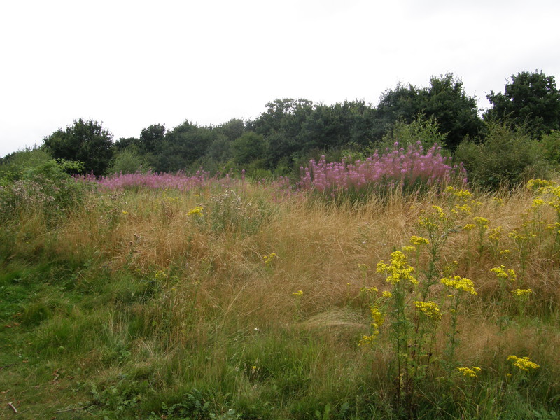
On the other side of the A315, the Crane flows into Hounslow Heath, though any signs of heath are well hidden for quite a while, as the path continues to follow the river south through thick woods that cut out any signs of daylight. Every now and then you catch glimpses of tees and fairways to the east, until eventually you reach a bridge over the Crane and the Loop turns east into Hounslow Heath Golf Course. Luckily there's a path that follows a cutting, protecting you from stray golf balls, and then the Loop pops out into the heath proper and the fun really begins. Hounslow Heath is a fairly wild place, with scrubland stretching as far as the eye can see, which is not very far in some of the more overgrown parts. The heath is criss-crossed by plenty of wide walking paths, though luckily the Loop is well signposted and it's easy to follow it into the centre of the heath. This part of the world was famous for its highwaymen in the 17th and 18th century, and it's easy to see why they found it such a good place to hang out; even today, as you wander along the paths in the company of dog walkers and park wardens, it's easy to imagine a highwayman charging down a London-bound stagecoach, or jumping out of the bushes with a shout of 'Stand and deliver!'
The Loop heads southeast to the other side of the heath, but the Piccadilly line is some way north of here, so when you come across a crossroads with a major walking route (signed with yellow boot-prints), turn north and follow the path all the way to the northern entrance to the heath, coming out opposite the Hussar pub. From here to the station it's a fairly long and not terribly thrilling exercise in pebbledash suburbs, past the Duke of York pub and Hounslow Heath School to Bath Road, while the planes fly lower and lower the closer to Hounslow you get.
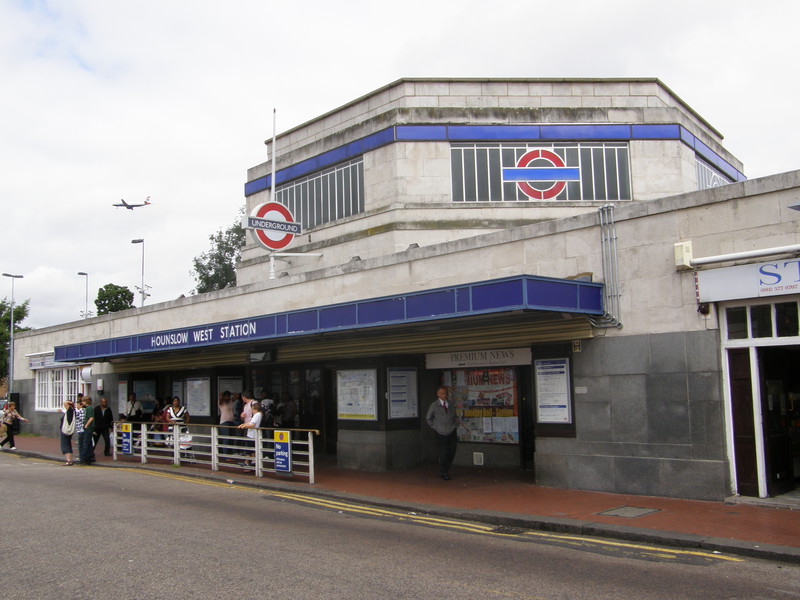
Left along the main road is Hounslow West station, a Charles Holden creation from the early 1930s that is very similar to his station at Ealing Common, with a tall heptagonal ticket hall fronted by slatted windows carrying the Underground logo on the sides. The first station on this part of the line was opened way back in 1884 by the Metropolitan District Railway, under the name Hounslow Central, and District line services ran along this branch until 1964, when they were withdrawn in favour of the Piccadilly line (which only started running here in 1933).
Hounslow West to Hounslow Central

Walking east along Bath Road is not one of life's great pleasures, as the traffic is busy and the architecture is fairly standard for a busy A-road through zones 4 and 5. There is a large stone church on the north side of the road which is worth a look, but it's fairly average walking to the junction with the A3063, a theme that continues left along Sutton Lane. The planes are even lower here, and it's just not a great place to explore on foot.
On the other side of the Tube tracks, which you have to cross via a pedestrian bridge on the western side of the road, is New Brentford Cemetery, which is worth popping into. Dating from 1902, it's quite small and has a quaint little chapel in the centre, and some of the graves are worth a look. Just past the cemetery is Harte Road, and at the end is an entrance into Lampton Park, the largest park in Hounslow. It's not a terrible place, but even though it has a pleasant enough circular flower bed in the centre and plenty of space for football to the west, it's a slightly tired-looking place, and the constant thrum of low-flying planes, one every minute or so, is enough to dampen even the most relaxed spirit. The park is also home to Hounslow Civic Centre, and Lampton Road is just the other side of the centre, where a right turn takes you to the station.
Hounslow Central station, like the other stations on this part of the line, was originally opened as part of the District line; it first served trains way back in 1886, when it was known as Heston & Hounslow. The current station buildings date from 1912, and look more like a small Edwardian suburban house rather than a train station, which is no bad thing, really.
Hounslow Central to Hounslow East
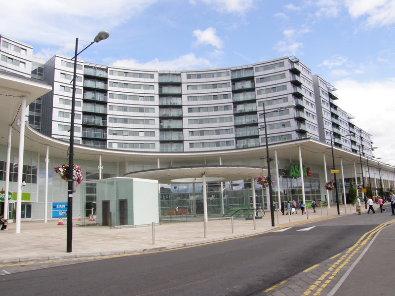
It isn't far from Hounslow Central to Hounslow East, particularly if you take the direct route. There's quite a bit to see, though, not least the houses along Lansdowne Road, where finally the pebbledash gets pushed aside and some decent Edwardian terraces shine out. Enjoy it while it lasts, though, because just round the corner is the Blenheim Centre, a massive and very modern development that dwarfs everything around it. The complex consists of a huge Asda superstore, a health and fitness centre, five retail units, a Post Office, 336 apartments and a car park for over 400 cars in the basement, and there's apparently going to be a second phase of development that will add 38 shops, a ten-screen cinema, a restaurant, 150 apartments and office space. It's an impressive place, but lining the eastern edge of the car park out front is a row of terraced houses, half of them with their windows covered with metal grilles, a reminder perhaps that development has its price.
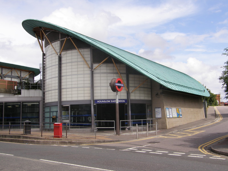
Round the back of the centre are the terraced houses of Myrtle Road, which leads to Kingsley Road and Hounslow East station. Although the original station was opened in 1909, replacing the nearby Hounslow Town station, the current station is ultra-modern and an absolute delight to behold. It has a sloping green roof curving off a round ticket hall with cream glass walls, and inside the roof is made of wood and the feeling of space is impressive; after walking through the less-than-thrilling suburbs of Hounslow, the Blenheim Centre was enough of a shock, but to follow it up with such a beautiful Tube station is a double-whammy that indicates Hounslow is on the up. If this is the future of the area, I'll watch future developments with interest; if only they could shut the bloody planes up, things would be perfectly placed.
Hounslow East to Osterley
Almost the entire walk from Hounslow East to Osterley is along a right of way that slips past Hounslow Bus Garage and continues between scraggly trees and fencing. The initial section is clearly where people come to dump their Stella and Tyskie cans, and it's a sorry little walk north to Spring Grove Road, where things start to improve a little. The path crosses the Tube line over an enclosed bridge and comes out in Spencer Road, where the houses are pleasant enough but nothing special, and a little further on is the rumbling A4, with the Tube station on the other side of a subway under the dual carriageway.
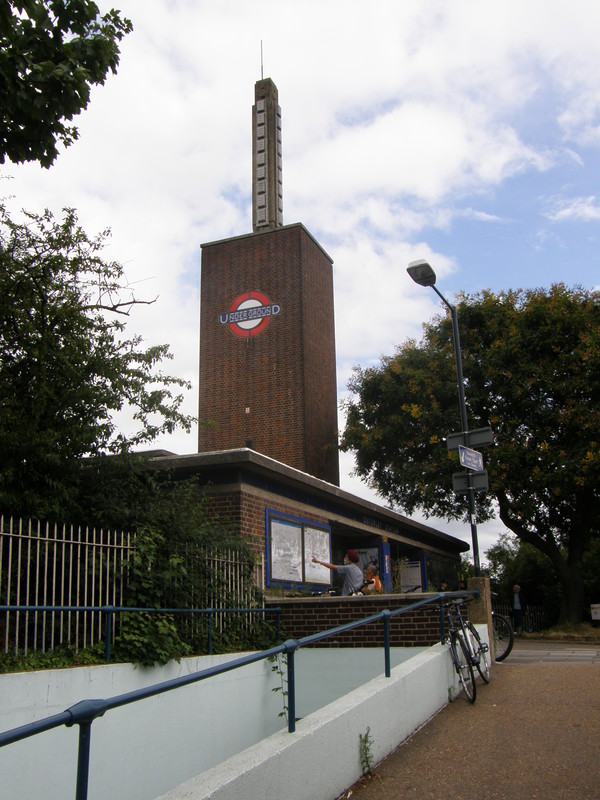
Osterley station is an interesting Charles Holden building from 1934, when this new station was opened to replace the old Osterley & Spring Grove station a few hundred yards to the east. It is dominated by a huge brick tower topped with an obelisk made from concrete, which itself is crowned by a spike (though I think this might be a radio antenna, as it doesn't seem to appear in period photographs of the station opening). The station building is fairly low key and without the tower it would be pretty hard to identify as a Tube station, but the tower and obelisk, complete with the Underground roundel, are really distinctive and instantly cry out 'Tube station'... which, I guess, is the point.
Osterley to Boston Manor
You don't have to weave around quite as much as I did when walking from Osterley to Boston Manor, but I've got a soft spot for canals, and day 8 of the Capital Ring starts at Boston Manor and follows the Grand Union Canal to the locks at Hanwell Flight, so I thought I'd include this section in my tubewalk. Besides, when I walked this part of the Ring back in 2006, I remember spotting a footpath that headed west from Hanwell Flight, and I wondered at the time where it went to, so here was my chance to find out.
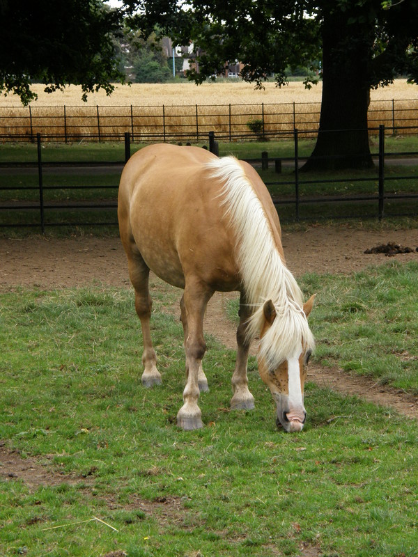
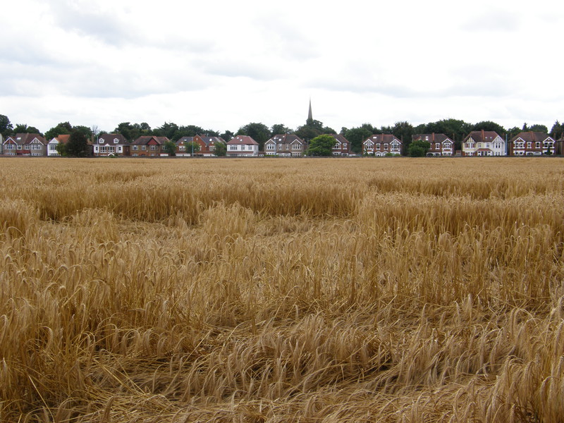
Before all this canal excitement, though, it's a short walk from Osterley station to Osterley Park, a huge green space that surrounds a National Trust property of the same name. The park itself is still mainly off-limits to Joe Public, as it is farmed and is home to horses, cows and fields of wheat, but there's a handy right of way that cuts across the park from west to east, and although it's a fairly thin path at times, it's an enjoyable stroll. It doesn't go near the house, but if you're interested in taking a detour to visit the property, the right of way cuts across the main driveway, or the Avenue as it's known, and the house is a short stroll north along the tree-lined drive.
Boston Manor station isn't that far from here, but there's a golf course, a motorway, a railway line and a canal in the way, so I chose to head north from the eastern edge of Osterley Park, along Windmill Lane. There's a nice-looking Fuller's pub here, the Hare and Hounds, that's a good place to stock up on calories, because it's a bit of a slog to the canal. The road goes under the M4, and a footpath turns off to the right just after Long Wood, heading along the thinnest path I've ever seen, stuck between a fence on the left and bushes to the right. After a long slog along the edge of playing fields, the path turns to the left, while just ahead is a crossing across the train tracks. This used to be a stop on the Brentford line called Trumpers Crossing Halt, but now it's just a pedestrian crossing into the industrial estate beyond.
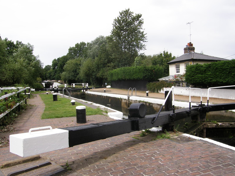
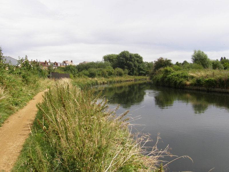
The footpath squeezes between yet more fencing and yet more undergrowth, and at this time of year it's a bit of a struggle to avoid the brambles and nettles that grow across the path at head height. It's a long and pretty boring walk along the railway, but eventually it crosses the tracks and pops out at Hanwell Flight, a set of six locks on the canal that were built in 1794, raising the canal by 53 feet in 600 yards. This is the Grand Union Canal, which starts in Brentford, not that far to the south. The Capital Ring and the Brent River Walk share the towpath at this point, and the walking is easy, as canal walking always is. On the left, just after a bridge to the industrial estate on the west bank, is Elthorne Waterside, a nature conservation area that is actually a grassed-over refuse tip, and after a large weir where the River Brent splits from the canal, a noisy bridge carrying the M4 comes into view and the Ring link path turns left towards the Tube station.
Boston Manor station is a short walk through the suburbs and along the main road. The original station was opened here in 1883 as part of the Metropolitan District Railway, but the current station is another 1930s Charles Holden building, and as with Osterley station, it has a large brick tower sticking out of the top, carrying the Underground logo into the sky. However, Boston Manor has a trick up its sleeve, because instead of a concrete obelisk, its tower is lined with a glass fin that lights up at night; given that the station is on top of a bridge, this means the Underground symbol is visible for miles around. The ticket hall is slightly spoiled by some ungainly handrails that weren't in the original design, but again this is a great-looking Holden design, and it makes for a fitting end to this long but enjoyable romp through the suburbs of southwest London.